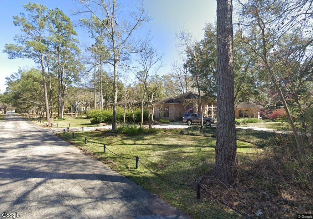
343 Bunker Hill Rd Houston, TX 77024
Estimated Value: $2,917,000 - $3,242,339
4
Beds
6
Baths
5,212
Sq Ft
$591/Sq Ft
Est. Value
About This Home
This home is located at 343 Bunker Hill Rd, Houston, TX 77024 and is currently estimated at $3,081,446, approximately $591 per square foot. 343 Bunker Hill Rd is a home located in Harris County with nearby schools including Bunker Hill Elementary School, Memorial Middle, and Memorial High School.
Ownership History
Date
Name
Owned For
Owner Type
Purchase Details
Closed on
Dec 19, 1994
Sold by
Carpenter F Edwin and Carpenter Elizabeth M
Bought by
Henkel Thomas R
Current Estimated Value
Home Financials for this Owner
Home Financials are based on the most recent Mortgage that was taken out on this home.
Original Mortgage
$588,000
Interest Rate
6%
Create a Home Valuation Report for This Property
The Home Valuation Report is an in-depth analysis detailing your home's value as well as a comparison with similar homes in the area
Home Values in the Area
Average Home Value in this Area
Purchase History
| Date | Buyer | Sale Price | Title Company |
|---|---|---|---|
| Henkel Thomas R | -- | -- |
Source: Public Records
Mortgage History
| Date | Status | Borrower | Loan Amount |
|---|---|---|---|
| Closed | Henkel Thomas R | $588,000 |
Source: Public Records
Tax History Compared to Growth
Tax History
| Year | Tax Paid | Tax Assessment Tax Assessment Total Assessment is a certain percentage of the fair market value that is determined by local assessors to be the total taxable value of land and additions on the property. | Land | Improvement |
|---|---|---|---|---|
| 2025 | $33,236 | $3,188,700 | $1,991,440 | $1,197,260 |
| 2024 | $33,236 | $2,860,385 | $1,991,440 | $868,945 |
| 2023 | $33,236 | $2,889,801 | $1,991,440 | $898,361 |
| 2022 | $56,508 | $2,785,563 | $1,991,440 | $794,123 |
| 2021 | $53,505 | $2,492,466 | $1,842,082 | $650,384 |
| 2020 | $49,742 | $2,246,009 | $1,842,082 | $403,927 |
| 2019 | $51,785 | $2,245,000 | $1,842,082 | $402,918 |
| 2018 | $10,725 | $2,310,600 | $1,842,082 | $468,518 |
| 2017 | $56,066 | $2,430,600 | $1,842,082 | $588,518 |
| 2016 | $55,822 | $2,442,924 | $1,842,082 | $600,842 |
| 2015 | $36,438 | $2,408,210 | $1,842,082 | $566,128 |
| 2014 | $36,438 | $2,000,000 | $1,842,082 | $157,918 |
Source: Public Records
Map
Nearby Homes
- 345 Knipp Rd
- 318 Knipp Rd
- 307 Chapel Belle Ln
- 11640 Greenbay St
- 11722 Claywood St
- 12003 Tall Oaks St
- 517 Flintdale Rd
- 11607 Shady Grove Ln
- 11910 Heritage Ln
- 11706 Flintwood Dr
- 11718 Broken Bough Cir
- 234 Plantation Rd
- 601 Strey Ln
- 11607 Barazi Oaks Ct
- 11606 Blalock Ln
- 9 Leisure Ln
- 11711 Memorial Dr Unit 570
- 11711 Memorial Dr Unit 55
- 11711 Memorial Dr Unit 21
- 11711 Memorial Dr Unit 565
- 11830 Bayhurst Dr
- 351 Bunker Hill Rd
- 11826 Bayhurst Dr
- 11834 Bayhurst Dr
- 341 Bunker Hill Rd
- 333 Bunker Hill Rd
- 11818 Bayhurst Dr
- 11838 Bayhurst Dr
- 355 Bunker Hill Rd
- 347 Bunker Hill Rd
- 329 Bunker Hill Rd
- 329 Bunker Hill Rd
- 11842 Bayhurst Dr
- 388 Folwell Ln
- 327 Bunker Hill Rd
- 405 Bunker Hill Rd
- 338 Folwell Ln
- 334 Chapel Belle Ln
- 337 Folwell Ln
- 338 Chapel Belle Ln