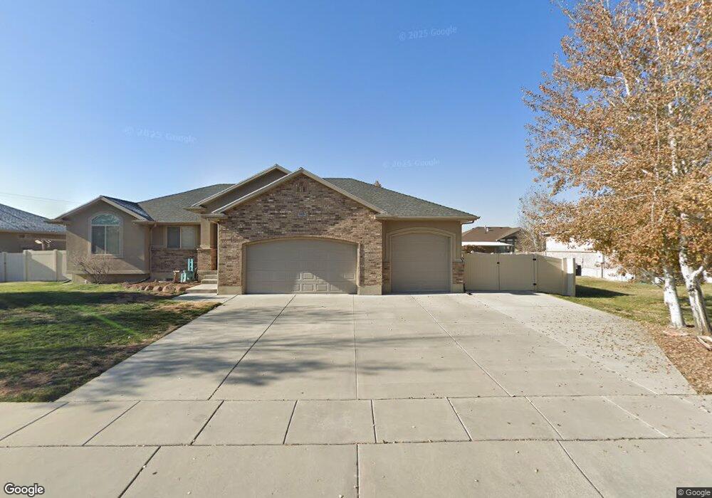
343 N 4920 W West Point, UT 84015
Estimated Value: $620,000 - $668,000
5
Beds
3
Baths
2,990
Sq Ft
$217/Sq Ft
Est. Value
About This Home
This home is located at 343 N 4920 W, West Point, UT 84015 and is currently estimated at $647,849, approximately $216 per square foot. 343 N 4920 W is a home located in Davis County with nearby schools including West Point School, West Point Junior High School, and Syracuse High School.
Ownership History
Date
Name
Owned For
Owner Type
Purchase Details
Closed on
Oct 7, 2019
Sold by
Carter Jeffrey S and Carter Tracey K
Bought by
Carter Jeffrey S and Carter Tracey K
Current Estimated Value
Purchase Details
Closed on
Oct 25, 2016
Sold by
Barton Austin and Barton Melissa B
Bought by
Carter Jeffrey S and Carter Tracey K
Purchase Details
Closed on
Feb 26, 2014
Sold by
Barton Austin
Bought by
Barton Austin and Barton Melissa B
Home Financials for this Owner
Home Financials are based on the most recent Mortgage that was taken out on this home.
Original Mortgage
$298,493
Interest Rate
4.4%
Mortgage Type
FHA
Purchase Details
Closed on
Nov 9, 2007
Sold by
Lemmons Douglas M
Bought by
Lemmons Douglas M and Lemmons Jennifer L
Home Financials for this Owner
Home Financials are based on the most recent Mortgage that was taken out on this home.
Original Mortgage
$273,000
Interest Rate
6.35%
Mortgage Type
New Conventional
Purchase Details
Closed on
Nov 22, 2006
Sold by
Scott Shepherd Construction Llc
Bought by
Lemmons Douglas M
Home Financials for this Owner
Home Financials are based on the most recent Mortgage that was taken out on this home.
Original Mortgage
$210,400
Interest Rate
6.37%
Mortgage Type
Purchase Money Mortgage
Purchase Details
Closed on
Jun 22, 2006
Sold by
Shepherd Scott R and Shepherd Cindy L
Bought by
Scott Shephered Construction Llc
Home Financials for this Owner
Home Financials are based on the most recent Mortgage that was taken out on this home.
Original Mortgage
$160,000
Interest Rate
6.55%
Mortgage Type
Purchase Money Mortgage
Purchase Details
Closed on
Jan 3, 2006
Sold by
Shepherd Scott R
Bought by
Shepherd Scott R and Shepherd Cindy L
Purchase Details
Closed on
Sep 22, 2005
Sold by
Abrams Doyle Dahl and Abrams Florence K
Bought by
Shepherd Scott R
Create a Home Valuation Report for This Property
The Home Valuation Report is an in-depth analysis detailing your home's value as well as a comparison with similar homes in the area
Home Values in the Area
Average Home Value in this Area
Purchase History
| Date | Buyer | Sale Price | Title Company |
|---|---|---|---|
| Carter Jeffrey S | -- | None Available | |
| Carter Jeffrey S | -- | Founders Title | |
| Barton Austin | -- | Mountain View Title & E | |
| Barton Austin | -- | Inwest Title Service | |
| Lemmons Douglas M | -- | Bonneville Superior Title Co | |
| Lemmons Douglas M | -- | Bonneville Superior Title Co | |
| Scott Shephered Construction Llc | -- | Bonneville Superior Title Co | |
| Shepherd Scott R | -- | Bonneville Title Company | |
| Shepherd Scott R | -- | Bonneville Title Company |
Source: Public Records
Mortgage History
| Date | Status | Borrower | Loan Amount |
|---|---|---|---|
| Previous Owner | Barton Austin | $298,493 | |
| Previous Owner | Lemmons Douglas M | $273,000 | |
| Previous Owner | Lemmons Douglas M | $210,400 | |
| Previous Owner | Scott Shephered Construction Llc | $160,000 |
Source: Public Records
Tax History Compared to Growth
Tax History
| Year | Tax Paid | Tax Assessment Tax Assessment Total Assessment is a certain percentage of the fair market value that is determined by local assessors to be the total taxable value of land and additions on the property. | Land | Improvement |
|---|---|---|---|---|
| 2025 | $2,673 | $350,350 | $112,687 | $237,663 |
| 2024 | $2,625 | $343,750 | $101,452 | $242,298 |
| 2023 | $2,381 | $579,000 | $126,380 | $452,620 |
| 2022 | $3,149 | $349,800 | $65,716 | $284,084 |
| 2021 | $2,665 | $471,000 | $102,765 | $368,235 |
| 2020 | $2,242 | $406,000 | $86,316 | $319,684 |
| 2019 | $2,060 | $375,000 | $83,748 | $291,252 |
| 2018 | $1,921 | $350,000 | $83,784 | $266,216 |
| 2016 | $2,285 | $159,280 | $32,416 | $126,864 |
| 2015 | $2,271 | $150,040 | $32,416 | $117,624 |
| 2014 | $1,983 | $132,537 | $32,416 | $100,121 |
| 2013 | -- | $127,846 | $35,495 | $92,351 |
Source: Public Records
Map
Nearby Homes
- 4669 W 75 N
- 4719 W 650 N
- 4594 W 75 N Unit 405
- 477 N 4500 W
- 128 N 4500 W
- 4352 W 300 N
- 4366 W 200 N
- 4325 W 75 N
- 120 N 4325 W
- 4362 West St Unit 106
- 4358 West St Unit 105
- 357 N 4000 W
- 356 S 4300 W Unit 611
- 364 S 4300 W Unit 610
- 3949 W 250 N
- 4469 W 1000 N Unit 120
- Charleston Plan at Bluff View
- 696 S 4500 W
- 3932 W 825 N Unit WF5
- 114 3830 W