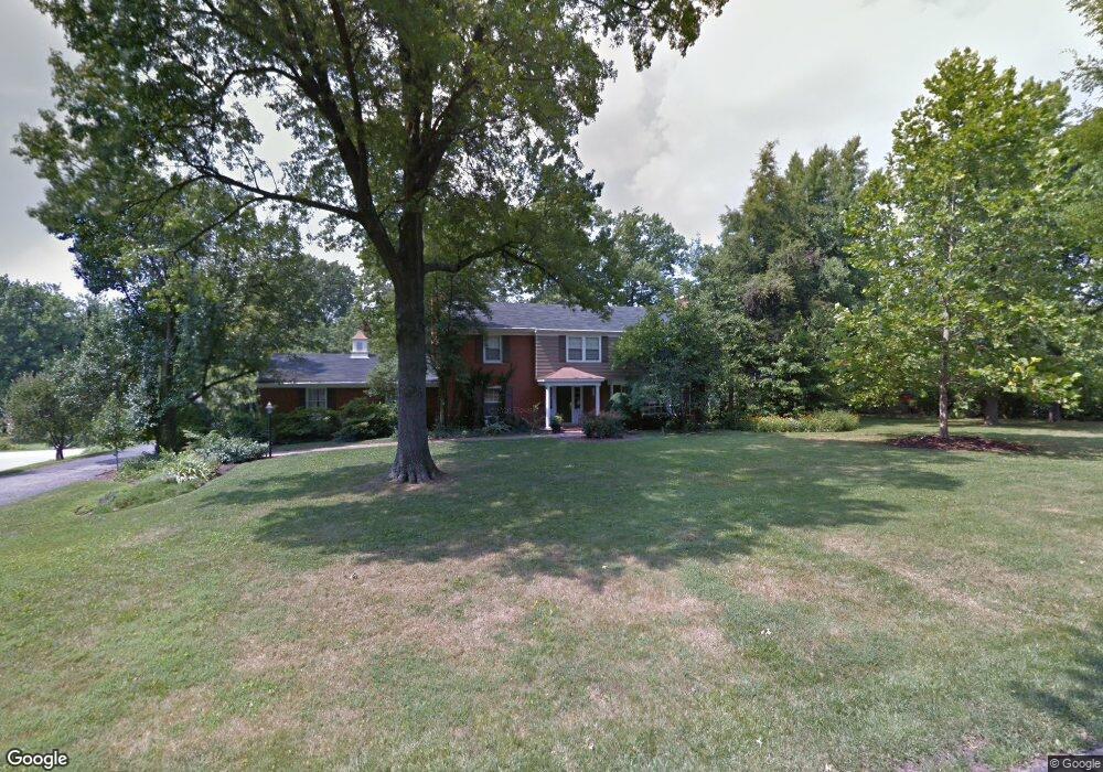
343 Poage Farm Rd Cincinnati, OH 45215
Estimated Value: $719,366 - $834,000
4
Beds
4
Baths
3,460
Sq Ft
$225/Sq Ft
Est. Value
About This Home
This home is located at 343 Poage Farm Rd, Cincinnati, OH 45215 and is currently estimated at $777,092, approximately $224 per square foot. 343 Poage Farm Rd is a home located in Hamilton County with nearby schools including Wyoming High School and John Paul II Catholic School.
Ownership History
Date
Name
Owned For
Owner Type
Purchase Details
Closed on
Jun 10, 1999
Sold by
Wu Frances N
Bought by
Skidmore Mary Susan
Current Estimated Value
Home Financials for this Owner
Home Financials are based on the most recent Mortgage that was taken out on this home.
Original Mortgage
$175,000
Outstanding Balance
$45,925
Interest Rate
6.99%
Estimated Equity
$731,167
Create a Home Valuation Report for This Property
The Home Valuation Report is an in-depth analysis detailing your home's value as well as a comparison with similar homes in the area
Home Values in the Area
Average Home Value in this Area
Purchase History
| Date | Buyer | Sale Price | Title Company |
|---|---|---|---|
| Skidmore Mary Susan | $289,500 | L & D Title Agency Inc |
Source: Public Records
Mortgage History
| Date | Status | Borrower | Loan Amount |
|---|---|---|---|
| Open | Skidmore Mary Susan | $175,000 |
Source: Public Records
Tax History Compared to Growth
Tax History
| Year | Tax Paid | Tax Assessment Tax Assessment Total Assessment is a certain percentage of the fair market value that is determined by local assessors to be the total taxable value of land and additions on the property. | Land | Improvement |
|---|---|---|---|---|
| 2024 | $11,321 | $190,597 | $35,564 | $155,033 |
| 2023 | $10,438 | $190,597 | $35,564 | $155,033 |
| 2022 | $9,183 | $139,157 | $37,699 | $101,458 |
| 2021 | $9,394 | $139,157 | $37,699 | $101,458 |
| 2020 | $9,394 | $139,157 | $37,699 | $101,458 |
| 2019 | $9,587 | $131,279 | $35,564 | $95,715 |
| 2018 | $9,591 | $131,279 | $35,564 | $95,715 |
| 2017 | $9,183 | $131,279 | $35,564 | $95,715 |
| 2016 | $7,299 | $120,565 | $33,835 | $86,730 |
| 2015 | $7,385 | $120,565 | $33,835 | $86,730 |
| 2014 | $7,404 | $120,565 | $33,835 | $86,730 |
| 2013 | $6,968 | $108,616 | $30,482 | $78,134 |
Source: Public Records
Map
Nearby Homes
- 377 Compton Rd
- 271 Poage Farm Rd
- 305 Compton Hills Dr
- 513 Chisholm Trail
- 525 Chisholm Trail
- 204 Brocdorf Dr
- 281 Compton Rd
- 158 Congress Run Rd
- 239 Compton Ridge Dr
- 216 Hilltop Ln
- 8816 Falmouth Dr
- 8932 Hollyhock Dr
- 253 Compton Rd
- 8608 Long Ln
- 9197 Long Ln
- 254 Compton Rd
- 926 Reily Rd
- 500 Laramie Trail
- 194 Mount Pleasant Ave
- 9458 Long Ln
- 476 Compton Rd
- 335 Poage Farm Rd
- 487 Compton Rd
- 464 Compton Rd
- 480 Compton Rd
- 354 Compton Hills Dr
- 349 Compton Hills Dr
- 495 Compton Rd
- 488 Compton Rd
- 454 Compton Rd
- 327 Poage Farm Rd
- 320 Poage Farm Rd
- 496 Compton Rd
- 346 Compton Hills Dr
- 503 Compton Rd
- 439 Compton Rd
- 343 Compton Hills Dr
- 310 Poage Farm Rd
- 504 Compton Rd
- 509 Compton Rd