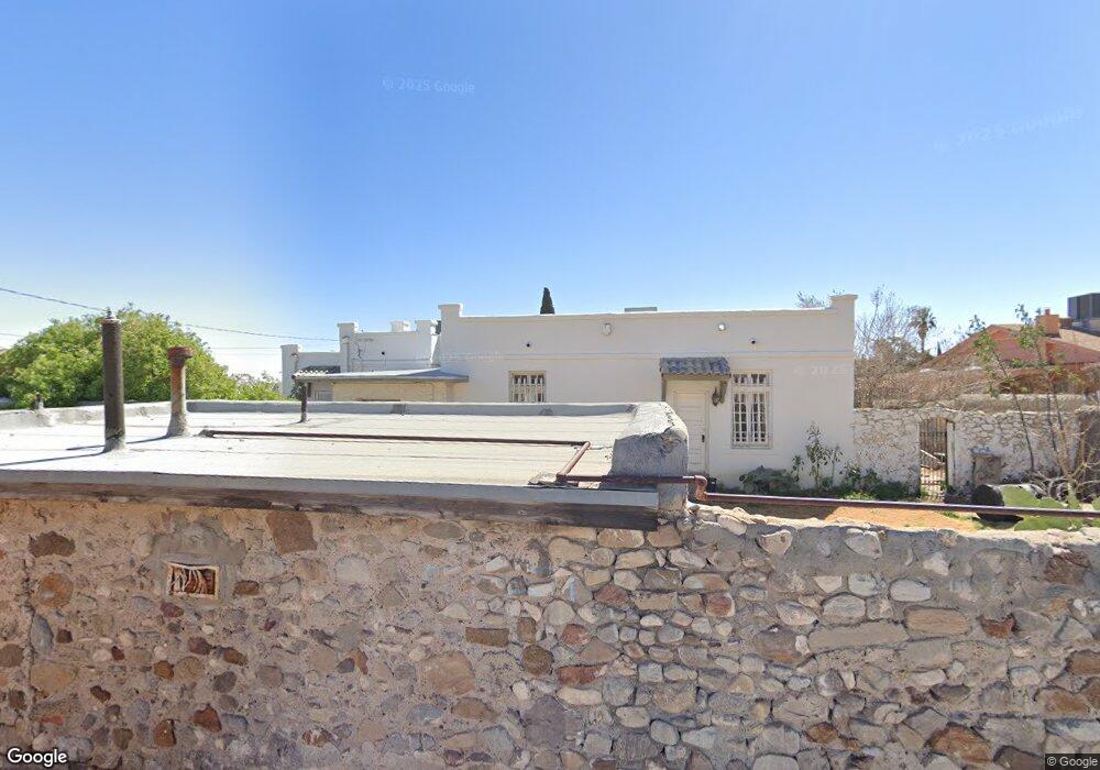
3431 Fort Blvd El Paso, TX 79930
Central NeighborhoodEstimated Value: $265,000 - $371,921
3
Beds
2
Baths
3,059
Sq Ft
$104/Sq Ft
Est. Value
About This Home
This home is located at 3431 Fort Blvd, El Paso, TX 79930 and is currently estimated at $316,730, approximately $103 per square foot. 3431 Fort Blvd is a home located in El Paso County with nearby schools including Rusk Elementary School, Middle School-5 NW Middle, and Austin High School.
Ownership History
Date
Name
Owned For
Owner Type
Purchase Details
Closed on
Aug 25, 2008
Sold by
The Jean F Schweidel Revocable Trust
Bought by
Salazar Luis Ignacio and Aleman Ana Isabel
Current Estimated Value
Home Financials for this Owner
Home Financials are based on the most recent Mortgage that was taken out on this home.
Original Mortgage
$175,000
Outstanding Balance
$115,110
Interest Rate
6.29%
Mortgage Type
Purchase Money Mortgage
Estimated Equity
$201,620
Purchase Details
Closed on
Sep 22, 2005
Sold by
Schweidel Jean F
Bought by
The Jean F Schweidel Revocable Trust
Create a Home Valuation Report for This Property
The Home Valuation Report is an in-depth analysis detailing your home's value as well as a comparison with similar homes in the area
Home Values in the Area
Average Home Value in this Area
Purchase History
| Date | Buyer | Sale Price | Title Company |
|---|---|---|---|
| Salazar Luis Ignacio | -- | None Available | |
| The Jean F Schweidel Revocable Trust | -- | -- |
Source: Public Records
Mortgage History
| Date | Status | Borrower | Loan Amount |
|---|---|---|---|
| Open | Salazar Luis Ignacio | $175,000 |
Source: Public Records
Tax History Compared to Growth
Tax History
| Year | Tax Paid | Tax Assessment Tax Assessment Total Assessment is a certain percentage of the fair market value that is determined by local assessors to be the total taxable value of land and additions on the property. | Land | Improvement |
|---|---|---|---|---|
| 2025 | $5,415 | $277,770 | -- | -- |
| 2024 | $5,415 | $252,518 | -- | -- |
| 2023 | $5,149 | $229,562 | $0 | $0 |
| 2022 | $6,178 | $208,693 | $0 | $0 |
| 2021 | $5,924 | $219,642 | $19,562 | $200,080 |
| 2020 | $5,301 | $172,474 | $17,861 | $154,613 |
| 2018 | $4,729 | $159,767 | $17,861 | $141,906 |
| 2017 | $4,648 | $165,000 | $17,861 | $147,139 |
| 2016 | $4,648 | $165,000 | $17,861 | $147,139 |
| 2015 | $4,515 | $165,000 | $17,861 | $147,139 |
| 2014 | $4,515 | $165,000 | $17,861 | $147,139 |
Source: Public Records
Map
Nearby Homes
- 3510 Porter Ave
- 3427 Hamilton Ave
- 3606 Morehead Ave
- 3327 Mobile Ave
- 3125 Hamilton Ave
- 3524 Mobile Ave
- 3215 Mobile Ave
- 3031 Fort Blvd
- 3704 Mckinley Ave
- 3027 Morehead Ave
- 3827 Idalia Ave
- 3806 Mountain Ave
- 3018 Sacramento Ave
- 3831 Mountain Ave
- 3413 Monroe Ave
- 3921 Nations Ave
- 3204 Memphis Ave
- 3901 Mckinley Ave
- 3921 Mobile Ave
- 2917 Mobile Ave
- 3425 Fort Blvd
- 3421 Fort Blvd
- 3501 Fort Blvd
- 3424 Morehead Ave
- 3432 Morehead Ave
- 3432 Morehead Ave
- 3432 Morehead Ave Unit 2
- 3432 Morehead Ave Unit 1
- 3422 Morehead Ave
- 3415 Fort Blvd
- 3505 Fort Blvd
- 3420 Morehead Ave
- 3420 Morehead Ave Unit Back Unit
- 3420 Morehead Ave Unit Front Unit
- 3500 Morehead Ave
- 3414 Morehead Ave
- 3509 Fort Blvd
- 3405 Fort Blvd
- 3430 Fort Blvd
- 3424 Fort Blvd