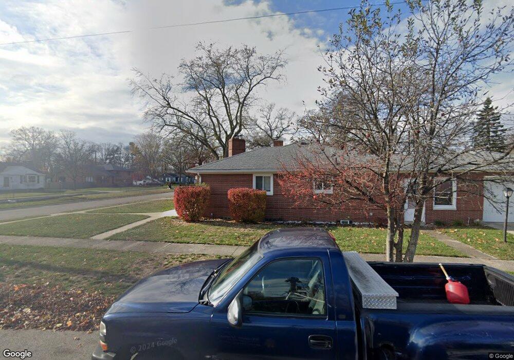
3431 Maple St Port Huron, MI 48060
Estimated Value: $156,000 - $226,000
Studio
--
Bath
952
Sq Ft
$187/Sq Ft
Est. Value
About This Home
This home is located at 3431 Maple St, Port Huron, MI 48060 and is currently estimated at $178,250, approximately $187 per square foot. 3431 Maple St is a home located in St. Clair County with nearby schools including Garfield Elementary School, Holland Woods Middle School, and Port Huron Northern High School.
Ownership History
Date
Name
Owned For
Owner Type
Purchase Details
Closed on
Jul 31, 2024
Sold by
Stoldt Investments Llc
Bought by
Stoldt Properties Llc
Current Estimated Value
Purchase Details
Closed on
May 11, 2018
Sold by
Stoldt Properties Llc
Bought by
Stoldt Investments Llc
Purchase Details
Closed on
Jan 12, 2018
Sold by
Johnson Amy L
Bought by
Stoldt Gary V and Stoldt Karen P
Purchase Details
Closed on
Jan 12, 2017
Sold by
Stoldt Gary V and Stoldt Karen P
Bought by
Stoldt Properties Llc
Create a Home Valuation Report for This Property
The Home Valuation Report is an in-depth analysis detailing your home's value as well as a comparison with similar homes in the area
Home Values in the Area
Average Home Value in this Area
Purchase History
| Date | Buyer | Sale Price | Title Company |
|---|---|---|---|
| Stoldt Properties Llc | -- | None Listed On Document | |
| Stoldt Investments Llc | -- | None Available | |
| Stoldt Gary V | $83,000 | Liberty Title | |
| Stoldt Properties Llc | -- | -- |
Source: Public Records
Tax History
| Year | Tax Paid | Tax Assessment Tax Assessment Total Assessment is a certain percentage of the fair market value that is determined by local assessors to be the total taxable value of land and additions on the property. | Land | Improvement |
|---|---|---|---|---|
| 2025 | $3,044 | $73,900 | $0 | $0 |
| 2024 | $2,963 | $67,600 | $0 | $0 |
| 2023 | $2,806 | $59,800 | $0 | $0 |
| 2022 | $2,874 | $53,800 | $0 | $0 |
| 2020 | $2,755 | $44,500 | $44,500 | $0 |
| 2019 | $2,705 | $44,800 | $0 | $0 |
| 2018 | $2,212 | $44,800 | $0 | $0 |
| 2017 | $2,030 | $40,400 | $0 | $0 |
| 2016 | $1,812 | $40,400 | $0 | $0 |
| 2015 | $1,825 | $36,000 | $36,000 | $0 |
| 2014 | $1,825 | $33,100 | $33,100 | $0 |
| 2013 | -- | $32,500 | $0 | $0 |
Source: Public Records
Map
Nearby Homes
- 3455 Gratiot Ave
- 810 Holland Ave Unit 8
- 3321 Stone St
- 1020 Sanborn St
- 817 Florida Ave
- 3142 Wright St
- 3165 10th Ave
- 1813 N Woodland Dr
- 2925 Linda Ct
- 1828 Kennelworth Dr
- 3444 Riverside Dr
- 3316 Hickory Ln
- 2431 Armour St
- 2400 Stone St Unit 2414
- 2224 Garfield St
- 3947 Butternut Ct
- 3945 Butternut Ct
- 2215 Hancock St
- 4177 Gratiot Ave
- 2525 19th Ave
- 3433 Maple St
- 3439 Maple St
- 905 Edison Blvd
- 3430 Maple St
- 3443 Maple St
- 901 Edison Blvd
- 819 Edison Blvd
- 3432 Walnut St
- 3436 Walnut St
- 915 Edison Blvd
- 3434 Maple St
- 3449 Maple St
- 3460 Walnut St
- 3444 Maple St Unit Bldg-Unit
- 3448 Maple St
- 910 La Salle Blvd
- 902 Edison Blvd
- 906 Edison Blvd
- 3464 Walnut St
- 3443 Cherry St
Your Personal Tour Guide
Ask me questions while you tour the home.