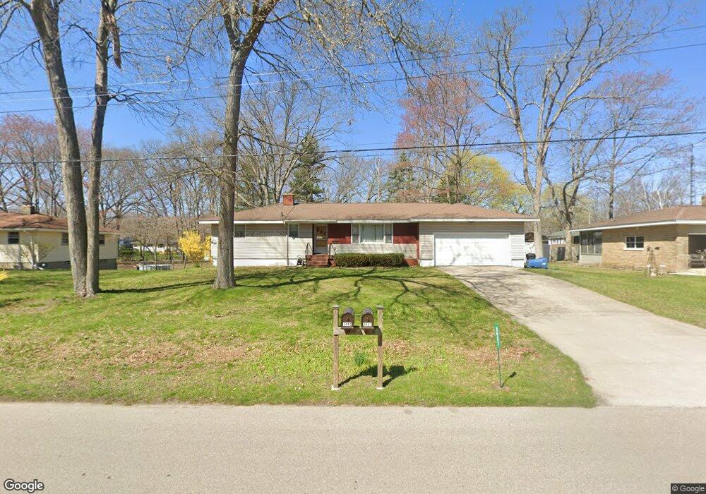
3431 Rood Rd Norton Shores, MI 49441
Roosevelt Park NeighborhoodEstimated Value: $112,000 - $273,000
--
Bed
1
Bath
1,240
Sq Ft
$180/Sq Ft
Est. Value
About This Home
This home is located at 3431 Rood Rd, Norton Shores, MI 49441 and is currently estimated at $223,642, approximately $180 per square foot. 3431 Rood Rd is a home located in Muskegon County with nearby schools including Mona Shores High School, Edgewood Elementary Academy, and West Shore Lutheran School.
Ownership History
Date
Name
Owned For
Owner Type
Purchase Details
Closed on
May 2, 2025
Sold by
Stegink Julie E and Bozeman-Stegink Julie
Bought by
Bustin Jill A
Current Estimated Value
Purchase Details
Closed on
Dec 23, 2024
Sold by
James R Bozeman Trust and Bustin Jill A
Bought by
Stegink Julie E and Bozeman Jeffrey A
Purchase Details
Closed on
Aug 28, 2019
Sold by
Bozeman James A and Bozeman Adele
Bought by
Bozeman James A and The James A Bozeman Trust
Create a Home Valuation Report for This Property
The Home Valuation Report is an in-depth analysis detailing your home's value as well as a comparison with similar homes in the area
Home Values in the Area
Average Home Value in this Area
Purchase History
| Date | Buyer | Sale Price | Title Company |
|---|---|---|---|
| Bustin Jill A | $108,578 | None Listed On Document | |
| Bustin Jill A | $108,578 | None Listed On Document | |
| Stegink Julie E | -- | None Listed On Document | |
| Stegink Julie E | -- | None Listed On Document | |
| Stegink Julie E | -- | None Listed On Document | |
| Bozeman James A | -- | None Available |
Source: Public Records
Tax History Compared to Growth
Tax History
| Year | Tax Paid | Tax Assessment Tax Assessment Total Assessment is a certain percentage of the fair market value that is determined by local assessors to be the total taxable value of land and additions on the property. | Land | Improvement |
|---|---|---|---|---|
| 2025 | $3,467 | $112,000 | $0 | $0 |
| 2024 | $2,409 | $102,100 | $0 | $0 |
| 2023 | $2,300 | $89,300 | $0 | $0 |
| 2022 | $3,158 | $76,800 | $0 | $0 |
| 2021 | $3,065 | $70,500 | $0 | $0 |
| 2020 | $3,028 | $66,300 | $0 | $0 |
| 2019 | $2,049 | $60,000 | $0 | $0 |
| 2018 | $2,001 | $59,200 | $0 | $0 |
| 2017 | $1,954 | $57,300 | $0 | $0 |
| 2016 | $1,513 | $53,200 | $0 | $0 |
| 2015 | -- | $50,800 | $0 | $0 |
| 2014 | $1,816 | $50,600 | $0 | $0 |
| 2013 | -- | $47,100 | $0 | $0 |
Source: Public Records
Map
Nearby Homes
- 1243 Crandall Ave
- 3246 Royal Oak Rd
- 3684 Harris Dr
- 3320 Davis Rd
- 3681 Brentwood St Unit 24
- 1448 Marlboro Rd
- 1480 Marlboro Rd
- 1744 W Norton Ave
- 1045 Le Roux Rd Unit 178
- 1582 Haverhill Rd
- 1733 Woodside Rd
- 1012 Beechtree Ct
- 3658 Lake Harbor Rd
- 1377 Princeton Rd
- 3920 Braeburn Dr
- 3854 Greuling Rd
- 1689 Bonneville Dr
- 3891 Wickham Dr
- 1650 Bonneville Dr
- 1059 W Summit Ave
- 3415 Rood Rd
- 3447 Rood Rd
- 3440 Rood Rd
- 3448 Rood Rd
- 3465 Rood Rd
- 3464 Rood Rd
- 1385 W Norton Ave
- 3450 Norlock St
- 3432 Brentwood St
- 3446 Brentwood St
- 3487 Rood Rd
- 3482 Rood Rd
- 1354 Clayton Ave
- 3466 Norlock St
- 3462 Brentwood St
- 1367 W Norton Ave
- 1441 W Norton Ave
- 1378 W Norton Ave
- 1376 W Norton Ave
- 3497 Rood Rd