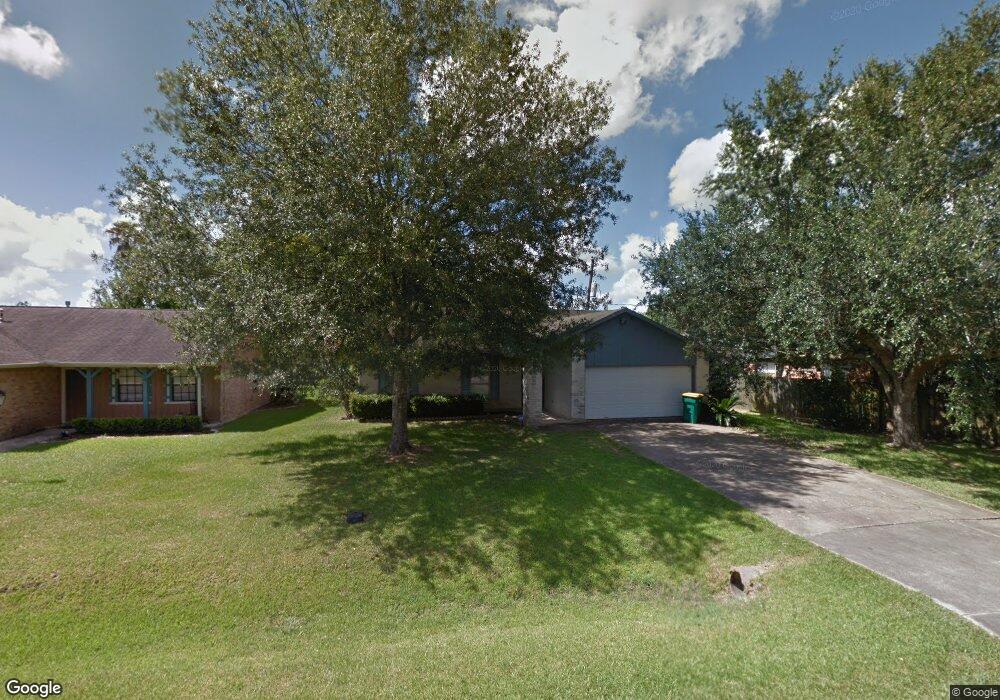
3432 Robinson Dr Pearland, TX 77581
Outlying Friendswood City NeighborhoodEstimated Value: $238,399 - $296,000
--
Bed
2
Baths
1,401
Sq Ft
$194/Sq Ft
Est. Value
About This Home
This home is located at 3432 Robinson Dr, Pearland, TX 77581 and is currently estimated at $271,850, approximately $194 per square foot. 3432 Robinson Dr is a home located in Brazoria County with nearby schools including Barbara Cockrell Elementary School, Leon H. Sablatura Middle School, and Pearland Junior High School West.
Ownership History
Date
Name
Owned For
Owner Type
Purchase Details
Closed on
Dec 10, 2007
Sold by
Corralez Rosie Estrada and Corralez Martin L
Bought by
Amezcua Virginia
Current Estimated Value
Home Financials for this Owner
Home Financials are based on the most recent Mortgage that was taken out on this home.
Original Mortgage
$117,000
Outstanding Balance
$74,056
Interest Rate
6.3%
Mortgage Type
Purchase Money Mortgage
Estimated Equity
$197,794
Purchase Details
Closed on
Oct 5, 1999
Sold by
Hughes James R and Hughes Shirley L
Bought by
Corralez Rocio E and Corralez Martin L
Home Financials for this Owner
Home Financials are based on the most recent Mortgage that was taken out on this home.
Original Mortgage
$80,510
Interest Rate
7.83%
Create a Home Valuation Report for This Property
The Home Valuation Report is an in-depth analysis detailing your home's value as well as a comparison with similar homes in the area
Home Values in the Area
Average Home Value in this Area
Purchase History
| Date | Buyer | Sale Price | Title Company |
|---|---|---|---|
| Amezcua Virginia | -- | Stewart Title | |
| Corralez Rocio E | -- | Texas American Title Company |
Source: Public Records
Mortgage History
| Date | Status | Borrower | Loan Amount |
|---|---|---|---|
| Open | Amezcua Virginia | $117,000 | |
| Previous Owner | Corralez Rocio E | $80,510 |
Source: Public Records
Tax History Compared to Growth
Tax History
| Year | Tax Paid | Tax Assessment Tax Assessment Total Assessment is a certain percentage of the fair market value that is determined by local assessors to be the total taxable value of land and additions on the property. | Land | Improvement |
|---|---|---|---|---|
| 2025 | $1,830 | $156,776 | $35,600 | $165,340 |
| 2023 | $1,830 | $129,567 | $35,600 | $167,490 |
| 2022 | $2,833 | $117,788 | $35,600 | $144,770 |
| 2021 | $2,759 | $158,780 | $35,600 | $123,180 |
| 2020 | $2,626 | $148,210 | $32,870 | $115,340 |
| 2019 | $2,388 | $127,720 | $30,130 | $97,590 |
| 2018 | $2,162 | $80,450 | $21,910 | $58,540 |
| 2017 | $3,047 | $132,460 | $31,500 | $100,960 |
| 2016 | $2,770 | $116,040 | $31,500 | $84,540 |
| 2015 | $2,268 | $93,270 | $18,130 | $75,140 |
| 2014 | $2,268 | $94,960 | $18,130 | $76,830 |
Source: Public Records
Map
Nearby Homes
- 3406 Robinson Dr
- 1006 Union Valley Dr
- 1106 Glenda St
- 3411 Glastonbury Dr
- 1107 Barkly Ct
- 1219 Lazy Springs Ln
- 1112 Breckonridge Cir
- 11222 Hall Meadows Ct
- 3759 Knapp Rd
- 11203 Hall Ridge Ct
- 1417 Silver Rings Ct
- 8323 Lettie St
- 3433 Monarch Meadow Ln
- 3611 Bosc Dr
- 3815 Alice St
- 8119 Springtime Ln
- 1604 Spring Glen Ln
- 3631 Bosc Dr
- 1605 Spring Glen Ln
- 8434 Gulfwood Ln
- 3430 Robinson Dr
- 1107 Union Valley Dr
- 1109 Union Valley Dr
- 1105 Union Valley Dr
- 1111 Union Valley Dr
- 3529 Robinson Dr
- 3428 Robinson Dr
- 3427 Meadowville Dr
- 1113 Union Valley Dr
- 3433 Robinson Dr
- 3429 Robinson Dr
- 3425 Meadowville Dr
- 1108 Union Valley Dr
- 1104 Union Valley Dr
- 3424 Robinson Dr
- 1112 Union Valley Dr
- 1102 Union Valley Dr
- 3423 Meadowville Dr
- 1003 Union Valley Dr
- 1003 Union Valley