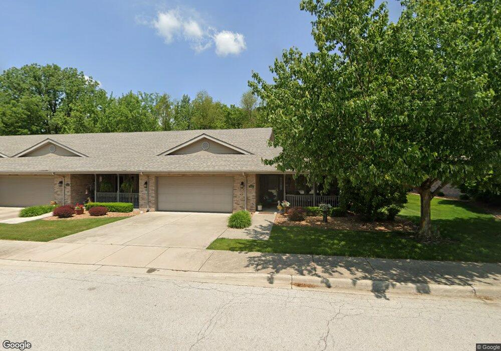
3432 Station Dr Matteson, IL 60443
Estimated Value: $236,000 - $253,000
2
Beds
2
Baths
1,744
Sq Ft
$139/Sq Ft
Est. Value
About This Home
This home is located at 3432 Station Dr, Matteson, IL 60443 and is currently estimated at $242,934, approximately $139 per square foot. 3432 Station Dr is a home located in Cook County with nearby schools including Illinois School, Indiana Elementary School, and Arcadia Elementary School.
Ownership History
Date
Name
Owned For
Owner Type
Purchase Details
Closed on
Aug 3, 2016
Sold by
Davis Evelyn M
Bought by
Cook Evelyn M and Evelyn M David Living Trust
Current Estimated Value
Purchase Details
Closed on
May 14, 2016
Sold by
Grossman James W and Grossman Carol T
Bought by
Davis Evelyn M
Purchase Details
Closed on
May 14, 2004
Sold by
Grossman Carol T and Grossman James W
Bought by
Grossman James W and Grossman Carol T
Home Financials for this Owner
Home Financials are based on the most recent Mortgage that was taken out on this home.
Original Mortgage
$163,000
Interest Rate
6.8%
Mortgage Type
New Conventional
Purchase Details
Closed on
Apr 18, 2000
Sold by
Lincoln Way Builders Inc
Bought by
Grossman James W and Luzi Carol T
Home Financials for this Owner
Home Financials are based on the most recent Mortgage that was taken out on this home.
Original Mortgage
$133,200
Interest Rate
8.22%
Create a Home Valuation Report for This Property
The Home Valuation Report is an in-depth analysis detailing your home's value as well as a comparison with similar homes in the area
Home Values in the Area
Average Home Value in this Area
Purchase History
| Date | Buyer | Sale Price | Title Company |
|---|---|---|---|
| Cook Evelyn M | -- | Greater Illinois Title | |
| Davis Evelyn M | $132,500 | Fidelity National Title | |
| Grossman James W | -- | Stewart Title Of Illinois | |
| Grossman James W | $144,000 | -- |
Source: Public Records
Mortgage History
| Date | Status | Borrower | Loan Amount |
|---|---|---|---|
| Previous Owner | Grossman James W | $163,000 | |
| Previous Owner | Grossman James W | $133,200 |
Source: Public Records
Tax History Compared to Growth
Tax History
| Year | Tax Paid | Tax Assessment Tax Assessment Total Assessment is a certain percentage of the fair market value that is determined by local assessors to be the total taxable value of land and additions on the property. | Land | Improvement |
|---|---|---|---|---|
| 2024 | $2,346 | $18,000 | $2,398 | $15,602 |
| 2023 | $2,805 | $18,000 | $2,398 | $15,602 |
| 2022 | $2,805 | $12,013 | $2,098 | $9,915 |
| 2021 | $2,943 | $12,012 | $2,098 | $9,914 |
| 2020 | $2,958 | $12,012 | $2,098 | $9,914 |
| 2019 | $3,333 | $13,299 | $1,948 | $11,351 |
| 2018 | $3,326 | $13,299 | $1,948 | $11,351 |
| 2017 | $3,589 | $13,299 | $1,948 | $11,351 |
| 2016 | $2,766 | $9,907 | $1,798 | $8,109 |
| 2015 | $3,551 | $9,907 | $1,798 | $8,109 |
| 2014 | $3,465 | $9,907 | $1,798 | $8,109 |
| 2013 | $3,206 | $10,057 | $1,798 | $8,259 |
Source: Public Records
Map
Nearby Homes
- 549 Homan Ave
- 313 Jackson St
- 21607 Main St
- 21635 Dogwood Rd Unit 1165
- 508 Davis St
- 3704 215th St Unit 205
- 500 Antietam St
- 3712 214th St
- 21209 Oak St
- 3727 214th Place Unit 2
- 3133 Heritage Blvd
- 338 Waldmann Dr
- 120 Indiana St
- 21142 Locust St
- 3809 215th St
- 315 Sheridan St
- 3817 216th Place
- 3718 211th Pl
- 3844 214th Place
- 3135 Nottingham Ct
- 3438 Station Dr
- 3444 Station Dr
- 3416 Station Dr
- 3416 Station Dr Unit 5-B
- 3450 Station Dr
- 3410 Station Dr
- 3431 Station Dr
- 3437 Station Dr
- 3421 Station Dr
- 3443 Station Dr
- 3415 Station Dr
- 3404 Station Dr
- 3409 Station Dr
- 3449 Station Dr
- 3403 Station Dr
- 3430 Front St
- 3436 Front St
- 3420 Front St
- 3442 Front St
- 3414 Front St