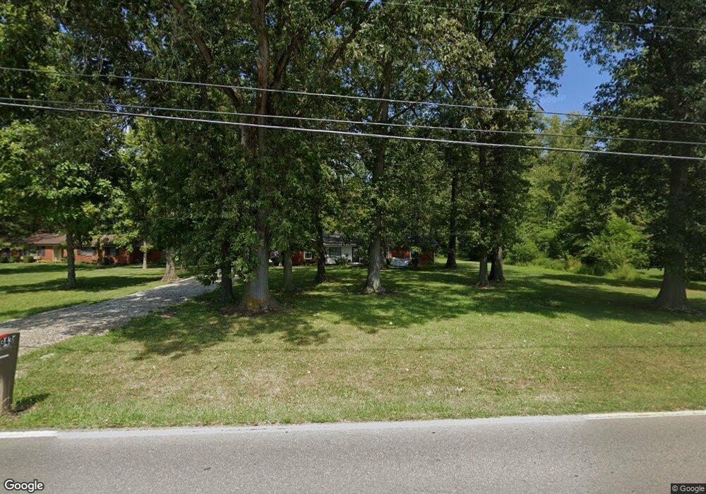
3434 E 100 N Greenfield, IN 46140
Estimated Value: $309,000 - $342,000
4
Beds
2
Baths
1,827
Sq Ft
$180/Sq Ft
Est. Value
About This Home
This home is located at 3434 E 100 N, Greenfield, IN 46140 and is currently estimated at $328,000, approximately $179 per square foot. 3434 E 100 N is a home located in Hancock County with nearby schools including J.B. Stephens Elementary School, Maxwell Intermediate School, and Greenfield Central Junior High School.
Ownership History
Date
Name
Owned For
Owner Type
Purchase Details
Closed on
Dec 15, 2015
Sold by
Grinstead Ryan L
Bought by
Huff Michael S
Current Estimated Value
Home Financials for this Owner
Home Financials are based on the most recent Mortgage that was taken out on this home.
Original Mortgage
$186,558
Outstanding Balance
$146,942
Interest Rate
3.75%
Mortgage Type
FHA
Estimated Equity
$181,058
Purchase Details
Closed on
Jun 19, 2008
Sold by
Mcbride Real Estate Investments Llc
Bought by
Grinstead Ryan L and Grinstead Summer R
Home Financials for this Owner
Home Financials are based on the most recent Mortgage that was taken out on this home.
Original Mortgage
$179,465
Interest Rate
6.05%
Mortgage Type
FHA
Purchase Details
Closed on
Nov 20, 2006
Sold by
Olsen James R
Bought by
Mcbride Real Estate Investments Llc
Create a Home Valuation Report for This Property
The Home Valuation Report is an in-depth analysis detailing your home's value as well as a comparison with similar homes in the area
Home Values in the Area
Average Home Value in this Area
Purchase History
| Date | Buyer | Sale Price | Title Company |
|---|---|---|---|
| Huff Michael S | -- | None Available | |
| Grinstead Ryan L | -- | -- | |
| Mcbride Real Estate Investments Llc | -- | -- |
Source: Public Records
Mortgage History
| Date | Status | Borrower | Loan Amount |
|---|---|---|---|
| Open | Huff Michael S | $186,558 | |
| Previous Owner | Grinstead Ryan L | $179,465 |
Source: Public Records
Tax History Compared to Growth
Tax History
| Year | Tax Paid | Tax Assessment Tax Assessment Total Assessment is a certain percentage of the fair market value that is determined by local assessors to be the total taxable value of land and additions on the property. | Land | Improvement |
|---|---|---|---|---|
| 2024 | $2,092 | $295,300 | $59,300 | $236,000 |
| 2023 | $2,107 | $270,000 | $59,300 | $210,700 |
| 2022 | $1,640 | $224,900 | $33,900 | $191,000 |
| 2021 | $1,390 | $199,300 | $33,900 | $165,400 |
| 2020 | $1,362 | $193,300 | $33,900 | $159,400 |
| 2019 | $1,309 | $188,800 | $33,900 | $154,900 |
| 2018 | $1,343 | $189,500 | $33,900 | $155,600 |
| 2017 | $1,349 | $183,000 | $33,900 | $149,100 |
| 2016 | $1,477 | $181,500 | $33,200 | $148,300 |
| 2014 | $1,134 | $156,500 | $32,600 | $123,900 |
| 2013 | $1,134 | $157,400 | $32,600 | $124,800 |
Source: Public Records
Map
Nearby Homes
- 1089 Summerwood Blvd
- 1620 Westfield Ct
- 1069 Forest Glen Dr
- 1569 Tupelo Dr
- 980 Blossom Ct
- 1439 E Mckenzie Rd
- 1369 Mulberry Ct
- 1781 Stonewall Cir
- 1271 Magnolia Dr
- 2202 Silver Spoon Dr
- 658 Bobtail Dr
- 477 Woodstream Dr
- 1664 Sweetwater Ln
- 1521 Tupelo Dr
- 1461 Eucalyptus Cir
- 1647 Sweetwater Ln
- 1252 Jasmine Dr
- 1668 Willowview Ln
- 1226 Arlington Dr
- 1192 Jasmine Dr
- 3404 E 100 N
- 3464 E 100 N
- 1984 Breakwater Dr
- 1976 Breakwater Dr
- 3492 E 100 N
- 3492 E Cr 100 N
- 973 Springside Ct
- 1968 Breakwater Dr
- 1960 Breakwater Dr
- 1952 Breakwater Dr
- 967 Springside Ct
- 1944 Breakwater Dr
- 961 Springside Ct
- 1981 Breakwater Dr
- 1993 Breakwater Dr
- 1975 Breakwater Dr
- 1936 Breakwater Dr
- 955 Springside Ct
- 1928 Breakwater Dr
- 1945 Breakwater Dr
