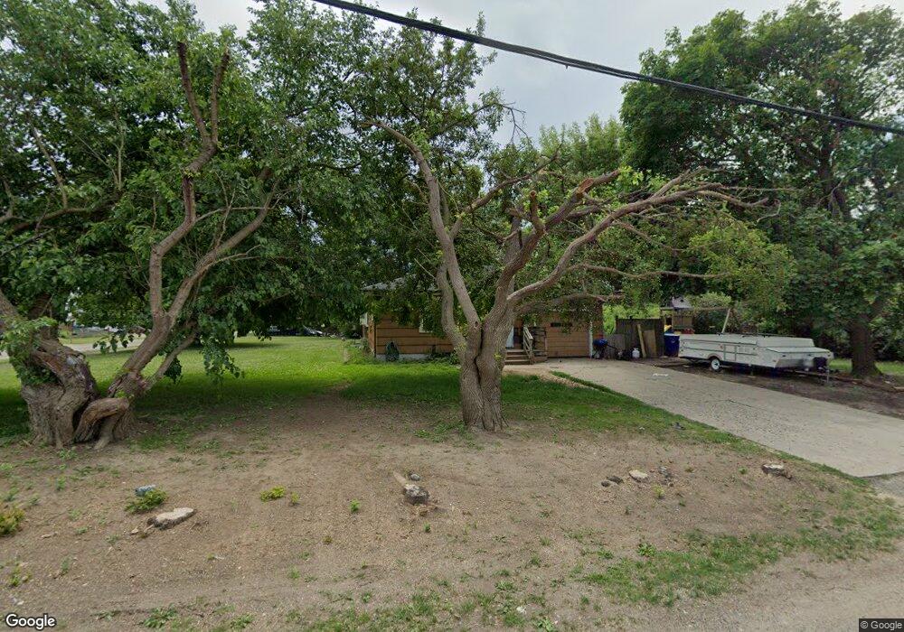
3435 Airport Rd Waterford, MI 48329
Waterford Township NeighborhoodEstimated Value: $244,000 - $268,000
3
Beds
1
Bath
1,386
Sq Ft
$182/Sq Ft
Est. Value
About This Home
This home is located at 3435 Airport Rd, Waterford, MI 48329 and is currently estimated at $252,044, approximately $181 per square foot. 3435 Airport Rd is a home located in Oakland County with nearby schools including Schoolcraft Elementary School, Waterford Kettering High School, and Mason Middle School.
Ownership History
Date
Name
Owned For
Owner Type
Purchase Details
Closed on
Mar 16, 2010
Sold by
Milka Evan G
Bought by
Federal National Mortgage Association
Current Estimated Value
Purchase Details
Closed on
Dec 12, 2006
Sold by
Stewart Jay E and Gilford Deborah J
Bought by
Milka Evan G
Home Financials for this Owner
Home Financials are based on the most recent Mortgage that was taken out on this home.
Original Mortgage
$154,500
Interest Rate
6.27%
Mortgage Type
Purchase Money Mortgage
Create a Home Valuation Report for This Property
The Home Valuation Report is an in-depth analysis detailing your home's value as well as a comparison with similar homes in the area
Home Values in the Area
Average Home Value in this Area
Purchase History
| Date | Buyer | Sale Price | Title Company |
|---|---|---|---|
| Federal National Mortgage Association | $128,880 | None Available | |
| Milka Evan G | $154,500 | Capital Title Ins Agency |
Source: Public Records
Mortgage History
| Date | Status | Borrower | Loan Amount |
|---|---|---|---|
| Previous Owner | Milka Evan G | $154,500 |
Source: Public Records
Tax History Compared to Growth
Tax History
| Year | Tax Paid | Tax Assessment Tax Assessment Total Assessment is a certain percentage of the fair market value that is determined by local assessors to be the total taxable value of land and additions on the property. | Land | Improvement |
|---|---|---|---|---|
| 2024 | $1,168 | $99,950 | $0 | $0 |
| 2023 | $1,114 | $89,250 | $0 | $0 |
| 2022 | $3,276 | $75,650 | $0 | $0 |
| 2021 | $3,723 | $70,340 | $0 | $0 |
| 2020 | $1,020 | $67,150 | $0 | $0 |
| 2019 | $2,901 | $63,670 | $0 | $0 |
| 2018 | $2,730 | $52,710 | $0 | $0 |
| 2017 | $2,636 | $52,710 | $0 | $0 |
| 2016 | $2,736 | $51,660 | $0 | $0 |
| 2015 | -- | $45,400 | $0 | $0 |
| 2014 | -- | $43,560 | $0 | $0 |
| 2011 | -- | $41,960 | $0 | $0 |
Source: Public Records
Map
Nearby Homes
- 6015 Rowley Blvd
- 6275 Williams Lake Rd
- 6376 Lanman Dr
- 6391 Rowley Blvd
- 3077 Nanwich Dr
- 3867 Percy King Rd
- 5502 Rowley Blvd
- 6625 Lanman Dr
- 6031 Southward Ave
- 3229 Homestead Dr
- 6441 Crest Dr
- 3880 Lotus Dr
- 3912 Cambrook Ln
- 3194 Whitfield Dr
- 4083 Ledgestone Dr
- 6350 Elmwood Dr
- 2610 Airport Rd
- 5754 Lockwood Dr Unit 39
- 2615 Compton Dr
- 6533 Cloverton Dr
- 6145 Lindsay Dr
- 3425 Airport Rd
- 3421 Airport Rd
- 3444 Airport Rd
- 3434 Airport Rd Unit Bldg-Unit
- 3434 Airport Rd
- 6161 Lindsay Dr
- 3424 Airport Rd
- 3460 Airport Rd
- 6162 Lindsay Dr
- 3470 Airport Rd
- 6170 Jameson Dr
- 6180 Lindsay Dr
- 3451 Oakbeach Ave
- 6181 Lindsay Dr
- 3461 Oakbeach Ave
- 3423 Oakbeach Ave
- 6041 Williams Lake Rd
- 6011 Williams Lake Rd
- 3418 Airport Rd