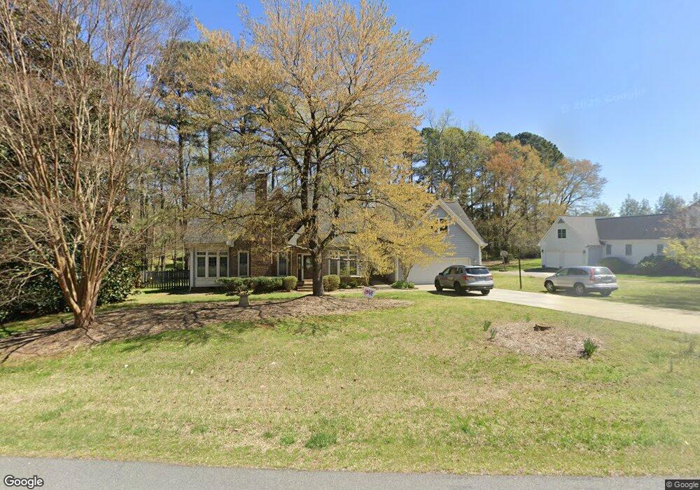
3437 Corsham Dr Apex, NC 27539
Middle Creek NeighborhoodEstimated Value: $903,267 - $1,018,000
--
Bed
--
Bath
4,682
Sq Ft
$202/Sq Ft
Est. Value
About This Home
This home is located at 3437 Corsham Dr, Apex, NC 27539 and is currently estimated at $947,817, approximately $202 per square foot. 3437 Corsham Dr is a home located in Wake County with nearby schools including Yates Mill Elementary School, Dillard Drive Magnet Middle School, and Middle Creek High.
Ownership History
Date
Name
Owned For
Owner Type
Purchase Details
Closed on
Dec 8, 1993
Bought by
Wallace Robert L and Wallace Norma C
Current Estimated Value
Create a Home Valuation Report for This Property
The Home Valuation Report is an in-depth analysis detailing your home's value as well as a comparison with similar homes in the area
Home Values in the Area
Average Home Value in this Area
Purchase History
| Date | Buyer | Sale Price | Title Company |
|---|---|---|---|
| Wallace Robert L | $175,500 | -- |
Source: Public Records
Tax History Compared to Growth
Tax History
| Year | Tax Paid | Tax Assessment Tax Assessment Total Assessment is a certain percentage of the fair market value that is determined by local assessors to be the total taxable value of land and additions on the property. | Land | Improvement |
|---|---|---|---|---|
| 2025 | $4,816 | $749,805 | $142,500 | $607,305 |
| 2024 | $4,676 | $749,805 | $142,500 | $607,305 |
| 2023 | $3,625 | $462,322 | $78,375 | $383,947 |
| 2022 | $3,359 | $462,322 | $78,375 | $383,947 |
| 2021 | $3,269 | $462,322 | $78,375 | $383,947 |
| 2020 | $3,215 | $462,322 | $78,375 | $383,947 |
| 2019 | $3,357 | $408,551 | $91,960 | $316,591 |
| 2018 | $3,086 | $408,551 | $91,960 | $316,591 |
| 2017 | $2,925 | $408,551 | $91,960 | $316,591 |
| 2016 | $2,866 | $408,551 | $91,960 | $316,591 |
| 2015 | $3,092 | $442,261 | $99,000 | $343,261 |
| 2014 | $2,930 | $442,261 | $99,000 | $343,261 |
Source: Public Records
Map
Nearby Homes
- 7513 Orchard Crest Ct
- 1305 Commons Ford Place
- 8844 Forester Ln
- 3645 S Pointe Dr
- 4012 Graham Newton Rd
- 8004 Deer Meadow Dr
- 3909 Langston Cir
- 7825 Penny Rd
- 3920 Rustic Mill Dr
- 3628 Jamison Park Dr
- 212 Sea Biscuit Ln Unit 25
- 8008 Deer Meadow Dr
- 8012 Penny Rd
- 8201 Rhodes Rd
- 8016 Penny Rd Unit Nc
- 2901 Hunters Bluff Dr
- 8014 Penny Rd
- 6512 Ten-Ten Rd
- 6512 Ten Rd
- 102 Jamison Woods Ln
- 3449 Corsham Dr
- 3488 Corsham Dr
- 3516 Foy Glen Ct
- 5601 Ten Ten Rd
- 3444 Corsham Dr
- 3512 Foy Glen Ct
- 3448 Corsham Dr
- 3436 Corsham Dr
- 3508 Foy Glen Ct
- 3520 Foy Glen Ct
- 3517 Foy Glen Ct
- 5501 Ten Ten Rd
- 1904 Englewood Dr
- 3521 Foy Glen Ct
- 3513 Foy Glen Ct
- 5600 Ten Ten Rd
- 3509 Foy Glen Ct
- 1906 Englewood Dr
- 3504 Foy Glen Ct
- 1908 Englewood Dr