Estimated Value: $321,000 - $357,000
4
Beds
3
Baths
1,833
Sq Ft
$183/Sq Ft
Est. Value
About This Home
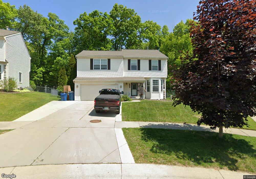
This home is located at 3439 Hilltop Dr Unit 11, Holly, MI 48442 and is currently estimated at $335,882, approximately $183 per square foot. 3439 Hilltop Dr Unit 11 is a home located in Oakland County with nearby schools including Holly High School, Holly Academy, and Adelphian Junior Academy.
Ownership History
Date
Name
Owned For
Owner Type
Purchase Details
Closed on
Aug 1, 2007
Sold by
Billette Mark and Billette April
Bought by
The Bank Of New York Trust Co Na and Jpmorgan Chase Bank Na
Current Estimated Value
Purchase Details
Closed on
Jul 21, 2005
Sold by
Nitoski Michael A and Nitoski Anne C
Bought by
Billette Mark and Billette April
Home Financials for this Owner
Home Financials are based on the most recent Mortgage that was taken out on this home.
Original Mortgage
$197,000
Interest Rate
7.5%
Mortgage Type
Fannie Mae Freddie Mac
Create a Home Valuation Report for This Property
The Home Valuation Report is an in-depth analysis detailing your home's value as well as a comparison with similar homes in the area
Home Values in the Area
Average Home Value in this Area
Purchase History
| Date | Buyer | Sale Price | Title Company |
|---|---|---|---|
| The Bank Of New York Trust Co Na | $146,200 | None Available | |
| Billette Mark | $197,000 | Capital Title Ins Agency |
Source: Public Records
Mortgage History
| Date | Status | Borrower | Loan Amount |
|---|---|---|---|
| Previous Owner | Billette Mark | $197,000 |
Source: Public Records
Tax History Compared to Growth
Tax History
| Year | Tax Paid | Tax Assessment Tax Assessment Total Assessment is a certain percentage of the fair market value that is determined by local assessors to be the total taxable value of land and additions on the property. | Land | Improvement |
|---|---|---|---|---|
| 2024 | $2,489 | $135,320 | $0 | $0 |
| 2023 | $2,352 | $120,980 | $0 | $0 |
| 2022 | $2,499 | $108,500 | $0 | $0 |
| 2021 | $2,370 | $99,800 | $0 | $0 |
| 2020 | $2,174 | $96,270 | $0 | $0 |
| 2019 | $1,464 | $89,340 | $0 | $0 |
| 2018 | $2,297 | $81,470 | $0 | $0 |
| 2017 | $2,273 | $80,420 | $0 | $0 |
| 2016 | $2,269 | $75,140 | $0 | $0 |
| 2015 | -- | $66,210 | $0 | $0 |
| 2014 | -- | $55,660 | $0 | $0 |
| 2011 | -- | $53,950 | $0 | $0 |
Source: Public Records
Map
Nearby Homes
- 3307 Pond Ridge Dr Unit 114
- 15105 N Holly Rd
- 3233 Herrington Dr Unit 145
- 4022 Stonebridge
- 3806 Rolling Hills Dr
- 4083 Stonebridge Unit 28
- 4034 Stonebridge
- 1119 Lambert Dr
- 1107 Odessa Dr
- 00 Grange Hall Rd
- 4041 Deer Run Trail Unit 2
- VL Delphine Dr
- 3175 Grange Hall Rd
- 107 Oakwood St
- 744 Hartner Dr
- 572 Dockside Cir Unit 54
- 519 Dockside Cir Unit 21
- 1039 Old Leake Ct Unit 200
- 109 Oakwood St
- 205 Lakeview St
- 3429 Hilltop Dr Unit 12
- 15013 Burrows Dr
- 3419 Hilltop Dr
- 3420 Quick Rd
- 3418 Quick Rd
- 15023 Burrows Dr
- 3409 Hilltop Dr
- 3428 Hilltop Dr Unit 27
- 3386 Quick Rd
- 3418 Hilltop Dr Unit 26
- 15033 Burrows Dr Unit 8
- 3399 Hilltop Dr
- 15043 Burrows Dr
- 3380 Quick Rd
- 15044 Burrows Dr Unit 28
- 3422 Quick Rd
- 3389 Hilltop Dr
- 3398 Hilltop Dr
- 15053 Burrows Dr Unit 6
- 3440 Quick Rd