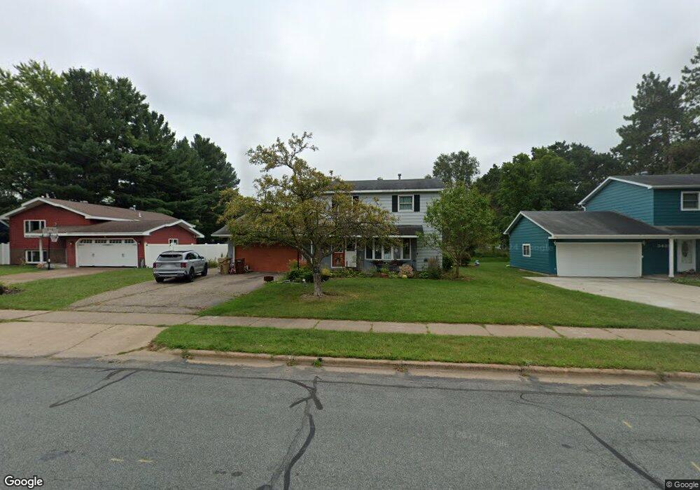
3439 Locust Ln Eau Claire, WI 54703
Pinehurst NeighborhoodEstimated Value: $294,995 - $314,000
3
Beds
3
Baths
1,520
Sq Ft
$202/Sq Ft
Est. Value
About This Home
This home is located at 3439 Locust Ln, Eau Claire, WI 54703 and is currently estimated at $307,499, approximately $202 per square foot. 3439 Locust Ln is a home located in Eau Claire County with nearby schools including Locust Lane Elementary School, Northstar Middle School, and North High School.
Ownership History
Date
Name
Owned For
Owner Type
Purchase Details
Closed on
Jun 27, 2022
Sold by
Otto Robert J and Otto Audrey Ann
Bought by
Oertel-Otto Megan
Current Estimated Value
Purchase Details
Closed on
May 6, 2005
Sold by
Bushbeck Gary R and Bushbeck Christine M
Bought by
Otto Robert J and Otto Audrey Ann
Home Financials for this Owner
Home Financials are based on the most recent Mortgage that was taken out on this home.
Original Mortgage
$137,250
Interest Rate
6.05%
Mortgage Type
New Conventional
Create a Home Valuation Report for This Property
The Home Valuation Report is an in-depth analysis detailing your home's value as well as a comparison with similar homes in the area
Home Values in the Area
Average Home Value in this Area
Purchase History
| Date | Buyer | Sale Price | Title Company |
|---|---|---|---|
| Oertel-Otto Megan | $218,000 | -- | |
| Otto Robert J | $152,500 | None Available |
Source: Public Records
Mortgage History
| Date | Status | Borrower | Loan Amount |
|---|---|---|---|
| Previous Owner | Otto Robert J | $137,250 |
Source: Public Records
Tax History Compared to Growth
Tax History
| Year | Tax Paid | Tax Assessment Tax Assessment Total Assessment is a certain percentage of the fair market value that is determined by local assessors to be the total taxable value of land and additions on the property. | Land | Improvement |
|---|---|---|---|---|
| 2024 | $4,426 | $213,000 | $23,700 | $189,300 |
| 2023 | $4,398 | $213,000 | $23,700 | $189,300 |
| 2022 | $3,740 | $213,000 | $23,700 | $189,300 |
| 2021 | $3,671 | $213,000 | $23,700 | $189,300 |
| 2020 | $3,566 | $180,900 | $22,200 | $158,700 |
| 2019 | $3,583 | $180,900 | $22,200 | $158,700 |
| 2018 | $3,512 | $180,900 | $22,200 | $158,700 |
| 2017 | $3,420 | $152,200 | $19,100 | $133,100 |
| 2016 | $4,310 | $152,200 | $19,100 | $133,100 |
| 2014 | -- | $152,200 | $19,100 | $133,100 |
| 2013 | -- | $152,200 | $19,100 | $133,100 |
Source: Public Records
Map
Nearby Homes
- 3354 Midway St
- 3233 Potter Rd
- 3019 Dale Rd
- 3313 Jeffrey Ln
- 3205 Lilac St
- 3244 Fern Ct
- 3350 Anderson Dr
- 3521 Leslie Ln
- 2964 W Princeton Ave
- 3904 Lark Ave
- 2903 E Princeton Ave
- 4226 Bennington Ct
- 2827 E Princeton Ave
- 2839 E Princeton Ave
- 2833 E Princeton Ave
- 4232 Bennington Ct
- 3440 Nelson Ct
- 4216 Heritage Dr
- 2548 Woodhaven Rd
- 4337 Heritage Dr