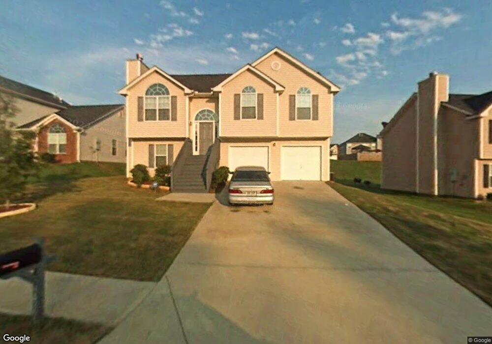
3439 Newgold Trace Union City, GA 30291
Estimated Value: $242,000 - $277,000
3
Beds
3
Baths
1,115
Sq Ft
$225/Sq Ft
Est. Value
About This Home
This home is located at 3439 Newgold Trace, Union City, GA 30291 and is currently estimated at $250,855, approximately $224 per square foot. 3439 Newgold Trace is a home located in Fulton County with nearby schools including Liberty Point Elementary School, Camp Creek Middle School, and Langston Hughes High School.
Ownership History
Date
Name
Owned For
Owner Type
Purchase Details
Closed on
Aug 23, 2017
Sold by
Not Provided
Bought by
Tah 2017 1 Borrower Llc and C/O Tricon American Homes Llc
Current Estimated Value
Purchase Details
Closed on
Sep 29, 2016
Sold by
Mcf Sfr Holdings 1 Llc
Bought by
2016A Property Owner Llc
Purchase Details
Closed on
Jan 14, 2016
Sold by
Mcf Asset Holdings Lp
Bought by
Mcf Sfr Holdings 1 Llc
Purchase Details
Closed on
Nov 3, 2015
Sold by
Harper Ruth Ann
Bought by
Mcf Asset Holdings Lp
Purchase Details
Closed on
Jun 11, 2004
Sold by
Scenic Homes Inc
Bought by
Mckenzie Maverick
Home Financials for this Owner
Home Financials are based on the most recent Mortgage that was taken out on this home.
Original Mortgage
$131,696
Interest Rate
6.25%
Mortgage Type
VA
Create a Home Valuation Report for This Property
The Home Valuation Report is an in-depth analysis detailing your home's value as well as a comparison with similar homes in the area
Home Values in the Area
Average Home Value in this Area
Purchase History
| Date | Buyer | Sale Price | Title Company |
|---|---|---|---|
| Tah 2017 1 Borrower Llc | -- | -- | |
| 2016A Property Owner Llc | $4,250,687 | -- | |
| Mcf Sfr Holdings 1 Llc | -- | -- | |
| Mcf Asset Holdings Lp | $57,201 | -- | |
| Mckenzie Maverick | $132,800 | -- |
Source: Public Records
Mortgage History
| Date | Status | Borrower | Loan Amount |
|---|---|---|---|
| Previous Owner | Mckenzie Maverick | $131,696 |
Source: Public Records
Tax History Compared to Growth
Tax History
| Year | Tax Paid | Tax Assessment Tax Assessment Total Assessment is a certain percentage of the fair market value that is determined by local assessors to be the total taxable value of land and additions on the property. | Land | Improvement |
|---|---|---|---|---|
| 2025 | $1,124 | $103,000 | $22,400 | $80,600 |
| 2023 | $2,912 | $103,160 | $25,280 | $77,880 |
| 2022 | $1,466 | $55,720 | $13,240 | $42,480 |
| 2021 | $1,512 | $55,720 | $13,240 | $42,480 |
| 2020 | $1,256 | $55,720 | $13,240 | $42,480 |
| 2019 | $1,909 | $45,200 | $8,880 | $36,320 |
| 2018 | $1,123 | $39,800 | $8,840 | $30,960 |
| 2017 | $668 | $22,880 | $3,560 | $19,320 |
| 2016 | $668 | $22,880 | $3,560 | $19,320 |
| 2015 | $920 | $27,760 | $4,360 | $23,400 |
| 2014 | $487 | $27,760 | $4,360 | $23,400 |
Source: Public Records
Map
Nearby Homes
- 3227 Diamond Bluff
- 000 Highpoint Rd
- 99 Highpoint Rd
- 6024 Diamond Ln
- 6000 Diamond Ln
- 4605 Ravenwood Loop
- 4611 Ravenwood Loop
- 9515 Lakeview Rd
- 4615 Ravenwood Loop
- 4111 Ravenwood Ct Unit 6
- 9562 Lakeview Cir
- 9562 Lakeview Cir Unit 71
- 4695 Ravenwood Loop
- 0 Highpoint Rd Unit 10553938
- 5856 Rock Rd
- 9585 Lakeview Cir
- 9899 Vista Cir
- 5910 Rock Rd
- 3437 Newgold Trace
- 3441 Newgold Trace
- 3435 Newgold Trace
- 3122 Far Emerald Land
- 3120 Far Emerald Land
- 3128 Far Emerald Land
- 3433 Newgold Trace
- 3118 Far Emerald Land
- 3127 Far Emerald Land
- 3125 Far Emerald Land
- 3405 Newgold Trace
- 3438 Newgold Trace
- 3123 Far Emerald Land
- 3403 Newgold Trace Unit 117
- 3403 Newgold Trace
- 3403 Newgold Trace
- 3130 Far Emerald Land
- 3407 Newgold Trace
- 3121 Far Emerald Land