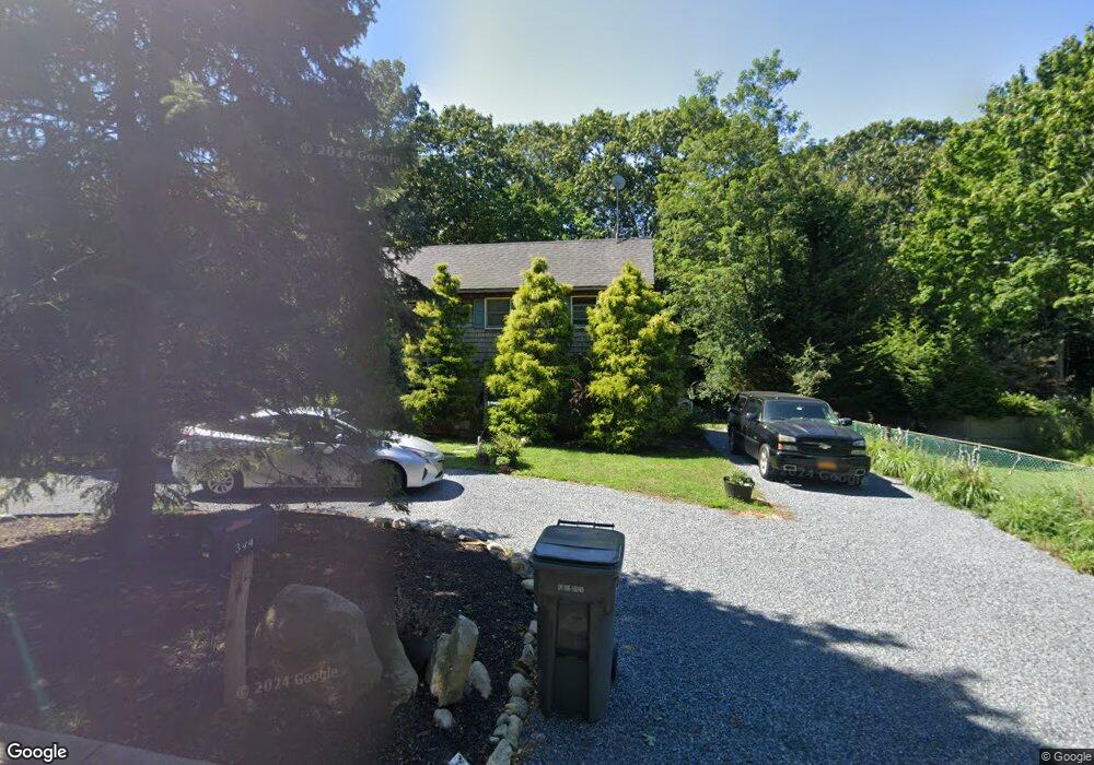
344 Division St Sag Harbor, NY 11963
Estimated Value: $1,427,431 - $2,817,000
3
Beds
2
Baths
1,248
Sq Ft
$1,543/Sq Ft
Est. Value
About This Home
This home is located at 344 Division St, Sag Harbor, NY 11963 and is currently estimated at $1,925,108, approximately $1,542 per square foot. 344 Division St is a home located in Suffolk County with nearby schools including Sag Harbor Elementary School, Pierson Middle/High School, and Ross School.
Ownership History
Date
Name
Owned For
Owner Type
Purchase Details
Closed on
Aug 20, 2024
Sold by
Broggi Steven E and Broggi Linda G
Bought by
Broggi Family Irt and Broggi
Current Estimated Value
Purchase Details
Closed on
Feb 20, 2004
Sold by
Broggi Steven C and Broggi Linda G
Bought by
Broggi Steven E and Broggi Linda G
Home Financials for this Owner
Home Financials are based on the most recent Mortgage that was taken out on this home.
Original Mortgage
$20,000
Interest Rate
6.12%
Mortgage Type
Credit Line Revolving
Create a Home Valuation Report for This Property
The Home Valuation Report is an in-depth analysis detailing your home's value as well as a comparison with similar homes in the area
Home Values in the Area
Average Home Value in this Area
Purchase History
| Date | Buyer | Sale Price | Title Company |
|---|---|---|---|
| Broggi Family Irt | -- | None Available | |
| Broggi Family Irt | -- | None Available | |
| Broggi Steven E | -- | -- | |
| Broggi Steven E | -- | -- |
Source: Public Records
Mortgage History
| Date | Status | Borrower | Loan Amount |
|---|---|---|---|
| Previous Owner | Broggi Steven E | $15,972 | |
| Previous Owner | Broggi Steven E | $20,000 | |
| Previous Owner | Broggi Steven E | $15,972 |
Source: Public Records
Tax History Compared to Growth
Tax History
| Year | Tax Paid | Tax Assessment Tax Assessment Total Assessment is a certain percentage of the fair market value that is determined by local assessors to be the total taxable value of land and additions on the property. | Land | Improvement |
|---|---|---|---|---|
| 2024 | $1,982 | $713,600 | $545,800 | $167,800 |
| 2023 | $5,891 | $713,600 | $545,800 | $167,800 |
| 2022 | $1,938 | $713,600 | $545,800 | $167,800 |
| 2021 | $1,950 | $713,600 | $545,800 | $167,800 |
| 2020 | $3,824 | $713,600 | $545,800 | $167,800 |
| 2019 | $5,818 | $0 | $0 | $0 |
| 2018 | -- | $746,200 | $595,400 | $150,800 |
| 2017 | $4,287 | $746,200 | $595,400 | $150,800 |
| 2016 | $3,236 | $541,500 | $390,700 | $150,800 |
| 2015 | -- | $385,200 | $234,400 | $150,800 |
| 2014 | -- | $385,200 | $234,400 | $150,800 |
Source: Public Records
Map
Nearby Homes
- 36 Denison Rd
- 1206 Middle Line Hwy
- 11 Grand St
- 41 Montauk Ave
- 12 Marsden St
- 11 Carver St
- 233 Madison St
- 7 Carlisle Ln
- 25 Round Pond Ln
- 207 Madison St
- 1635 Sagg Rd
- 5 Washington Ave
- 159 Jermain Ave
- 14 Hamilton St
- 6 Ackerly St
- 278 Hampton St
- 57 Palmer Terrace
- 17 Elizabeth St
- 109 Franklin Ave
- 57 Jermain Ave