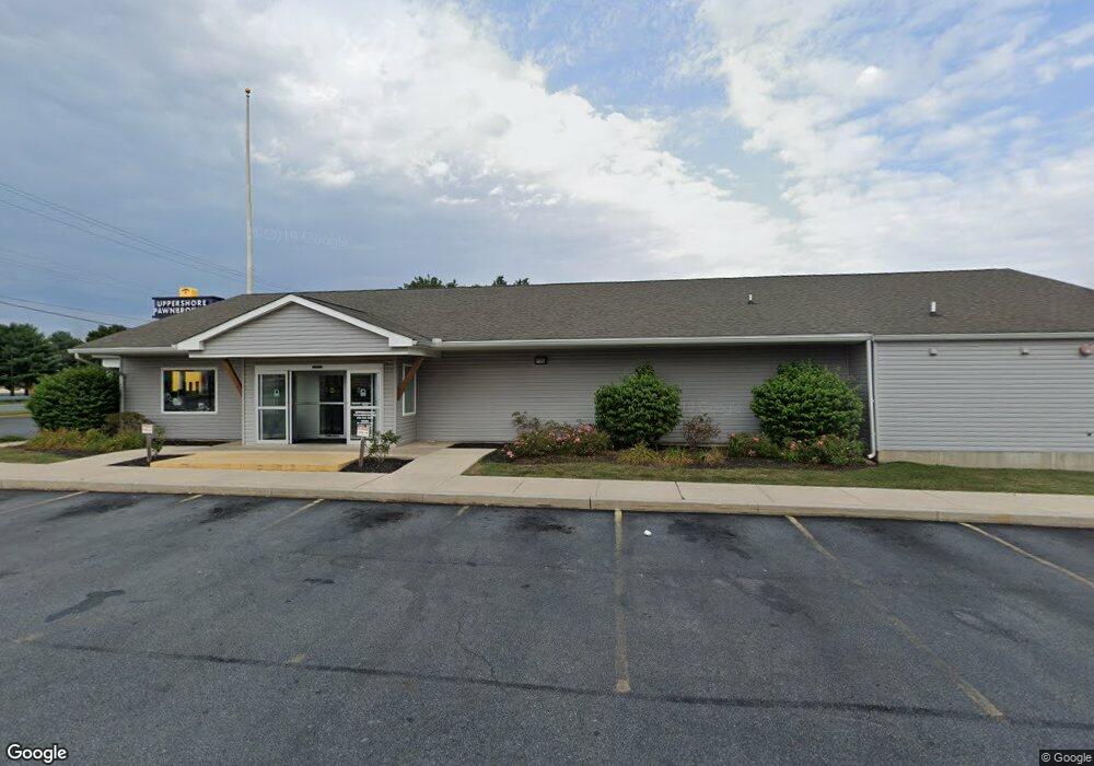
344 E Pulaski Hwy Elkton, MD 21921
Estimated Value: $1,521,492
--
Bed
--
Bath
11,682
Sq Ft
$130/Sq Ft
Est. Value
About This Home
This home is located at 344 E Pulaski Hwy, Elkton, MD 21921 and is currently estimated at $1,521,492, approximately $130 per square foot. 344 E Pulaski Hwy is a home located in Cecil County with nearby schools including Holly Hall Elementary School, Bohemia Manor Middle School, and Bohemia Manor High School.
Ownership History
Date
Name
Owned For
Owner Type
Purchase Details
Closed on
Jan 7, 2010
Sold by
Dunn Donald R and Apg Land Llc
Bought by
Dapco Realty Llc
Current Estimated Value
Purchase Details
Closed on
May 11, 2007
Sold by
Aberdeen Proving Ground
Bought by
Dunn Donald R & Apg Land Llc
Home Financials for this Owner
Home Financials are based on the most recent Mortgage that was taken out on this home.
Original Mortgage
$825,000
Interest Rate
6.23%
Purchase Details
Closed on
Apr 20, 2007
Sold by
Aberdeen Proving Ground
Bought by
Dunn Donald R & Apg Land Llc
Home Financials for this Owner
Home Financials are based on the most recent Mortgage that was taken out on this home.
Original Mortgage
$825,000
Interest Rate
6.23%
Purchase Details
Closed on
Oct 11, 1988
Sold by
Scolaro Dominick and Scolaro Mary A
Bought by
Aberdeen Proving Ground
Create a Home Valuation Report for This Property
The Home Valuation Report is an in-depth analysis detailing your home's value as well as a comparison with similar homes in the area
Home Values in the Area
Average Home Value in this Area
Purchase History
| Date | Buyer | Sale Price | Title Company |
|---|---|---|---|
| Dapco Realty Llc | $900,000 | -- | |
| Dunn Donald R & Apg Land Llc | $1,100,000 | -- | |
| Dunn Donald R & Apg Land Llc | $1,100,000 | -- | |
| Aberdeen Proving Ground | $430,000 | -- |
Source: Public Records
Mortgage History
| Date | Status | Borrower | Loan Amount |
|---|---|---|---|
| Previous Owner | Dunn Donald R & Apg Land Llc | $825,000 | |
| Previous Owner | Dunn Donald R & Apg Land Llc | $825,000 |
Source: Public Records
Tax History Compared to Growth
Tax History
| Year | Tax Paid | Tax Assessment Tax Assessment Total Assessment is a certain percentage of the fair market value that is determined by local assessors to be the total taxable value of land and additions on the property. | Land | Improvement |
|---|---|---|---|---|
| 2025 | $18,973 | $1,096,733 | $0 | $0 |
| 2024 | $18,091 | $1,045,700 | $536,300 | $509,400 |
| 2023 | $18,195 | $1,045,700 | $536,300 | $509,400 |
| 2022 | $18,424 | $1,045,700 | $536,300 | $509,400 |
| 2021 | $18,054 | $1,048,700 | $536,300 | $512,400 |
| 2020 | $18,253 | $1,020,300 | $0 | $0 |
| 2019 | $17,745 | $991,900 | $0 | $0 |
| 2018 | $17,237 | $963,500 | $429,800 | $533,700 |
| 2017 | $16,778 | $937,833 | $0 | $0 |
| 2016 | $14,967 | $912,167 | $0 | $0 |
| 2015 | $14,967 | $886,500 | $0 | $0 |
| 2014 | $14,119 | $886,500 | $0 | $0 |
Source: Public Records
Map
Nearby Homes
- 106 Normira Ave
- 206 Whitehall Rd
- 0 E Pulaski Hwy
- 114 Creswell Ave
- 4 Saint Pats Cir
- 103 State St
- 17 Kent Rd
- 0 Delaware Ave Unit MDCC2018992
- 114 Saint Louis Dr
- 5 Thyme St
- 110 Delaware Ave
- 0 W Main St Unit MDCC2016174
- 12 Heather Ct
- NEUVILLE Plan at The Preserve at Southfields
- GALEN Plan at The Preserve at Southfields
- LISMORE Plan at The Preserve at Southfields
- HENLEY Plan at The Preserve at Southfields
- ELM Plan at The Preserve at Southfields
- 434 Buttonwoods Rd
- 430 Buttonwoods Rd
- 4 Coachman Dr
- 338 E Pulaski Hwy
- 334 E Pulaski Hwy
- 350 E Pulaski Hwy
- 330 E Pulaski Hwy
- 330 E Pulaski Hwy
- 343 E Pulaski Hwy
- 349 E Pulaski Hwy
- 333 E Pulaski Hwy
- 399 E Pulaski Hwy
- 5 Coachman Dr
- 124 Hearth Stone Dr
- 312 E Pulaski Hwy
- 126 Hearth Stone Dr
- 122 Hearth Stone Dr
- 360 E Pulaski Hwy
- 128 Hearth Stone Dr
- 120 Hearth Stone Dr
- 130 Hearth Stone Dr
- 118 Hearth Stone Dr