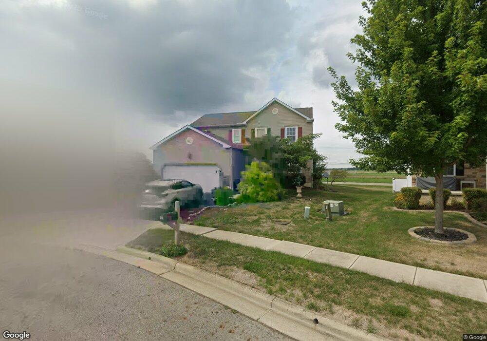
344 Karst Cir Ashville, OH 43103
Estimated Value: $362,000 - $380,000
3
Beds
4
Baths
2,256
Sq Ft
$166/Sq Ft
Est. Value
About This Home
This home is located at 344 Karst Cir, Ashville, OH 43103 and is currently estimated at $373,969, approximately $165 per square foot. 344 Karst Cir is a home located in Pickaway County.
Ownership History
Date
Name
Owned For
Owner Type
Purchase Details
Closed on
Dec 8, 2008
Sold by
Maronda Homes Inc Of Ohio
Bought by
Whitmer Mark A and Whitmer Brenda L
Current Estimated Value
Home Financials for this Owner
Home Financials are based on the most recent Mortgage that was taken out on this home.
Original Mortgage
$128,074
Outstanding Balance
$32,355
Interest Rate
5.96%
Mortgage Type
Purchase Money Mortgage
Estimated Equity
$341,614
Create a Home Valuation Report for This Property
The Home Valuation Report is an in-depth analysis detailing your home's value as well as a comparison with similar homes in the area
Home Values in the Area
Average Home Value in this Area
Purchase History
| Date | Buyer | Sale Price | Title Company |
|---|---|---|---|
| Whitmer Mark A | $160,100 | Stewart Title Of Columbus |
Source: Public Records
Mortgage History
| Date | Status | Borrower | Loan Amount |
|---|---|---|---|
| Open | Whitmer Mark A | $128,074 |
Source: Public Records
Tax History Compared to Growth
Tax History
| Year | Tax Paid | Tax Assessment Tax Assessment Total Assessment is a certain percentage of the fair market value that is determined by local assessors to be the total taxable value of land and additions on the property. | Land | Improvement |
|---|---|---|---|---|
| 2024 | -- | $114,620 | $11,550 | $103,070 |
| 2023 | $4,395 | $114,620 | $11,550 | $103,070 |
| 2022 | $3,493 | $83,930 | $9,690 | $74,240 |
| 2021 | $3,308 | $83,930 | $9,690 | $74,240 |
| 2020 | $3,316 | $83,930 | $9,690 | $74,240 |
| 2019 | $2,544 | $71,380 | $9,690 | $61,690 |
| 2018 | $2,943 | $71,380 | $9,690 | $61,690 |
| 2017 | $3,872 | $71,380 | $9,690 | $61,690 |
| 2016 | $2,192 | $51,600 | $9,650 | $41,950 |
| 2015 | $2,193 | $51,600 | $9,650 | $41,950 |
| 2014 | $2,194 | $51,600 | $9,650 | $41,950 |
| 2013 | $2,380 | $54,070 | $9,650 | $44,420 |
Source: Public Records
Map
Nearby Homes
- 5332 Karst Cir
- Longwood Plan at Walker Pointe
- Birmingham Plan at Walker Pointe
- Sanibel Plan at Walker Pointe
- Carlisle Plan at Walker Pointe
- Somerset Plan at Walker Pointe
- Chattanooga Plan at Walker Pointe
- Rockford Plan at Walker Pointe
- Hoover Plan at Walker Pointe
- Sedona Plan at Walker Pointe
- Truman Plan at Walker Pointe
- Miramar Plan at Walker Pointe
- 52 River Bend Dr
- Beacon Plan at Day Farm - Maple Street Collection
- Greenbriar Plan at Day Farm - Maple Street Collection
- Jensen Plan at Day Farm - Maple Street Collection
- Breckenridge Plan at Day Farm - Maple Street Collection
- Yosemite Plan at Day Farm - Maple Street Collection
- Danville Plan at Day Farm - Maple Street Collection
- Fairfax Plan at Day Farm - Maple Street Collection
- 342 Karst Cir
- 346 Karst Cir
- 340 Karst Cir
- 343 Karst Cir
- 341 Karst Cir
- 330 Karst Cir
- 339 Karst Cir
- 337 Karst Cir
- 100 Scioto Landing Blvd
- 102 Scioto Landing Blvd
- 16070 North St
- 2293 North St
- 106 Scioto Landing Blvd
- 104 Scioto Landing Blvd
- 108 Scioto Landing Blvd
- 336 Karst Cir
- 110 Scioto Landing Blvd
- 91 Henderson Ln
- 335 Karst Cir
- 112 Scioto Landing Blvd