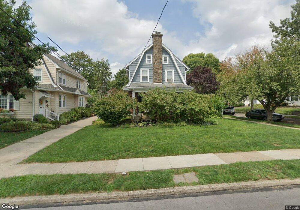
344 Lenox Rd Havertown, PA 19083
Estimated Value: $495,640 - $587,000
4
Beds
2
Baths
1,593
Sq Ft
$334/Sq Ft
Est. Value
About This Home
This home is located at 344 Lenox Rd, Havertown, PA 19083 and is currently estimated at $531,410, approximately $333 per square foot. 344 Lenox Rd is a home located in Delaware County with nearby schools including Chatham Park Elementary School, Haverford Middle School, and Haverford Senior High School.
Ownership History
Date
Name
Owned For
Owner Type
Purchase Details
Closed on
Jan 21, 2004
Sold by
Deangelis Thomas P and Estate Of George Caleix
Bought by
Cummings Michael and Cummings Karen
Current Estimated Value
Home Financials for this Owner
Home Financials are based on the most recent Mortgage that was taken out on this home.
Original Mortgage
$153,000
Outstanding Balance
$71,502
Interest Rate
5.89%
Mortgage Type
Purchase Money Mortgage
Estimated Equity
$459,908
Create a Home Valuation Report for This Property
The Home Valuation Report is an in-depth analysis detailing your home's value as well as a comparison with similar homes in the area
Home Values in the Area
Average Home Value in this Area
Purchase History
| Date | Buyer | Sale Price | Title Company |
|---|---|---|---|
| Cummings Michael | $243,900 | Fidelity National Title Insu |
Source: Public Records
Mortgage History
| Date | Status | Borrower | Loan Amount |
|---|---|---|---|
| Open | Cummings Michael | $153,000 |
Source: Public Records
Tax History
| Year | Tax Paid | Tax Assessment Tax Assessment Total Assessment is a certain percentage of the fair market value that is determined by local assessors to be the total taxable value of land and additions on the property. | Land | Improvement |
|---|---|---|---|---|
| 2025 | $7,062 | $274,660 | $98,420 | $176,240 |
| 2024 | $7,062 | $274,660 | $98,420 | $176,240 |
| 2023 | $6,862 | $274,660 | $98,420 | $176,240 |
| 2022 | $6,701 | $274,660 | $98,420 | $176,240 |
| 2021 | $10,917 | $274,660 | $98,420 | $176,240 |
| 2020 | $6,023 | $129,590 | $49,840 | $79,750 |
| 2019 | $5,912 | $129,590 | $49,840 | $79,750 |
| 2018 | $5,811 | $129,590 | $0 | $0 |
| 2017 | $5,688 | $129,590 | $0 | $0 |
| 2016 | $711 | $129,590 | $0 | $0 |
| 2015 | $726 | $129,590 | $0 | $0 |
| 2014 | $711 | $129,590 | $0 | $0 |
Source: Public Records
Map
Nearby Homes
- 224 Farnham Rd
- 210 Farnham Rd
- 249 Brookline Blvd
- 222 Wickford Rd
- 216 Brentwood Rd
- 608 Hirst Ave
- 137 Strathmore Rd
- 1604 Earlington Rd
- 114 Earlington Rd
- 42 Brookline Blvd
- 917 Darby Rd
- 1622 Winton Ave
- 1628 Surrey Ln
- 19 Juniper Rd
- 1232 Darby Rd
- 40 Fulmer Ave
- 128 E Marthart Ave
- 221 E Park Rd
- 8 Myrtle Ave
- 110 E Township Line Rd
Your Personal Tour Guide
Ask me questions while you tour the home.