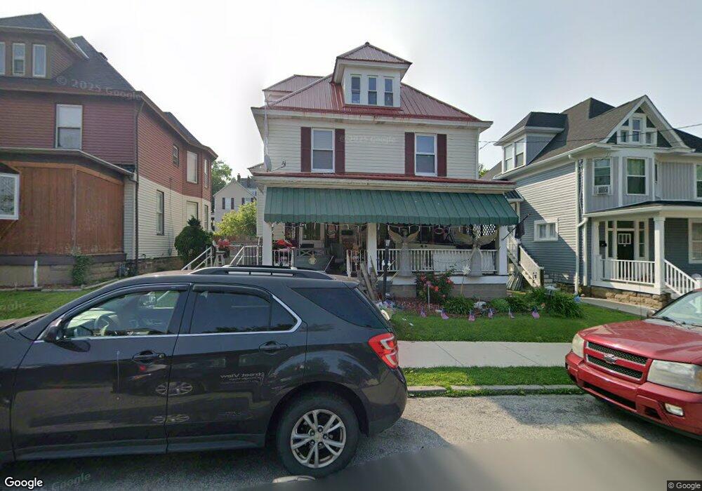
344 Ridge Ave New Kensington, PA 15068
Estimated Value: $74,198 - $143,000
--
Bed
--
Bath
1,666
Sq Ft
$69/Sq Ft
Est. Value
About This Home
This home is located at 344 Ridge Ave, New Kensington, PA 15068 and is currently estimated at $115,550, approximately $69 per square foot. 344 Ridge Ave is a home located in Westmoreland County with nearby schools including Mary Queen of Apostles School.
Ownership History
Date
Name
Owned For
Owner Type
Purchase Details
Closed on
May 15, 2015
Sold by
Bombalski David J
Bought by
Sadowski Edward M and Sadowski Terri L
Current Estimated Value
Purchase Details
Closed on
Jul 23, 2007
Sold by
Wells Fargo Bank Na
Bought by
Bombalski David J
Purchase Details
Closed on
Feb 1, 2007
Sold by
Gregurich John S and Gregurich Susan R
Bought by
Wells Fargo Bank Na and Wells Fargo Bank Minnesota Na
Create a Home Valuation Report for This Property
The Home Valuation Report is an in-depth analysis detailing your home's value as well as a comparison with similar homes in the area
Home Values in the Area
Average Home Value in this Area
Purchase History
| Date | Buyer | Sale Price | Title Company |
|---|---|---|---|
| Sadowski Edward M | $18,000 | None Available | |
| Bombalski David J | $18,000 | Service Link | |
| Wells Fargo Bank Na | $3,535 | None Available |
Source: Public Records
Tax History Compared to Growth
Tax History
| Year | Tax Paid | Tax Assessment Tax Assessment Total Assessment is a certain percentage of the fair market value that is determined by local assessors to be the total taxable value of land and additions on the property. | Land | Improvement |
|---|---|---|---|---|
| 2025 | $2,313 | $14,490 | $2,800 | $11,690 |
| 2024 | $2,292 | $14,490 | $2,800 | $11,690 |
| 2023 | $2,169 | $14,490 | $2,800 | $11,690 |
| 2022 | $2,102 | $14,490 | $2,800 | $11,690 |
| 2021 | $2,055 | $14,490 | $2,800 | $11,690 |
| 2020 | $2,011 | $14,490 | $2,800 | $11,690 |
| 2019 | $1,960 | $14,490 | $2,800 | $11,690 |
| 2018 | $1,931 | $14,490 | $2,800 | $11,690 |
| 2017 | $1,902 | $14,490 | $2,800 | $11,690 |
| 2016 | $1,902 | $14,490 | $2,800 | $11,690 |
| 2015 | $1,902 | $14,490 | $2,800 | $11,690 |
| 2014 | $1,828 | $14,490 | $2,800 | $11,690 |
Source: Public Records
Map
Nearby Homes
- 318 Ridge Ave
- 327 Charles Ave
- 486 McCargo St
- 254 Ridge Ave
- 225 Highland Ave
- 1134 Leishman Ave
- 1025 Kenneth Ave
- 1218 Woodmont Ave
- 168 Short St
- 159 Freeport Rd
- 201 Locust St
- 533 Freeport Rd
- 1240 Victoria Ave
- 105 Locust St
- 1233 Kenneth Ave
- 1312 Woodmont Ave
- 1308 Taylor Ave
- 1506 Victoria Ave
- Lots 12-14 Ross Ave
- 125 North St
- 348 Ridge Ave
- 340 Ridge Ave
- 336 Ridge Ave
- 352 Ridge Ave
- 332 Ridge Ave
- 345 Ridge Ave
- 333 Freeport Rd
- 335 Freeport Rd
- 328 Ridge Ave
- 331 Freeport Rd
- 337 Freeport Rd
- 329 Freeport Rd
- 339 Freeport Rd
- 347 Ridge Ave
- 325 Freeport Rd
- 1042 Victoria Ave
- 324 Ridge Ave
- 323 Freeport Rd
- 1030 Victoria Ave
- 320 Ridge Ave