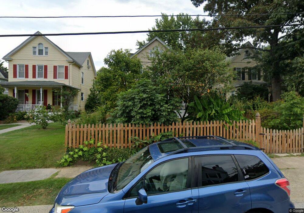
344 Rosebank Ave Baltimore, MD 21212
Homeland NeighborhoodEstimated Value: $332,611 - $415,000
--
Bed
2
Baths
1,630
Sq Ft
$229/Sq Ft
Est. Value
About This Home
This home is located at 344 Rosebank Ave, Baltimore, MD 21212 and is currently estimated at $373,806, approximately $229 per square foot. 344 Rosebank Ave is a home located in Baltimore City with nearby schools including Booker T. Washington Middle School, Forest Park High School, and Paul Laurence Dunbar Community High School.
Ownership History
Date
Name
Owned For
Owner Type
Purchase Details
Closed on
Dec 30, 1994
Sold by
Kusner Edward J
Bought by
Okeefe William P
Current Estimated Value
Home Financials for this Owner
Home Financials are based on the most recent Mortgage that was taken out on this home.
Original Mortgage
$96,800
Interest Rate
9.2%
Create a Home Valuation Report for This Property
The Home Valuation Report is an in-depth analysis detailing your home's value as well as a comparison with similar homes in the area
Home Values in the Area
Average Home Value in this Area
Purchase History
| Date | Buyer | Sale Price | Title Company |
|---|---|---|---|
| Okeefe William P | $124,000 | -- |
Source: Public Records
Mortgage History
| Date | Status | Borrower | Loan Amount |
|---|---|---|---|
| Closed | Okeefe William P | $96,800 |
Source: Public Records
Tax History Compared to Growth
Tax History
| Year | Tax Paid | Tax Assessment Tax Assessment Total Assessment is a certain percentage of the fair market value that is determined by local assessors to be the total taxable value of land and additions on the property. | Land | Improvement |
|---|---|---|---|---|
| 2025 | $4,733 | $248,433 | -- | -- |
| 2024 | $4,733 | $243,500 | $102,200 | $141,300 |
| 2023 | $4,921 | $229,400 | $0 | $0 |
| 2022 | $4,334 | $215,300 | $0 | $0 |
| 2021 | $4,748 | $201,200 | $102,200 | $99,000 |
| 2020 | $4,091 | $201,200 | $102,200 | $99,000 |
| 2019 | $3,912 | $201,200 | $102,200 | $99,000 |
| 2018 | $3,772 | $229,600 | $102,200 | $127,400 |
| 2017 | $3,659 | $224,300 | $0 | $0 |
| 2016 | $3,152 | $219,000 | $0 | $0 |
| 2015 | $3,152 | $213,700 | $0 | $0 |
| 2014 | $3,152 | $213,700 | $0 | $0 |
Source: Public Records
Map
Nearby Homes
- 308 Broxton Rd
- 212 Saint Dunstans Rd
- 6013 Pinehurst Rd
- 405 Lyman Ave
- 117 E Northern Pkwy
- 437,439,441,443,&445 Kenneth Square
- 313 E Lake Ave
- 425 E Lake Ave
- 302 Tunbridge Rd
- 305 Tunbridge Rd
- 5802 Clearspring Rd
- 409 Cedarcroft Rd
- 508 Harwood Ave
- 310 Paddington Rd
- 516 Harwood Ave
- 5600 Govane Ave
- 705 E Lake Ave
- 324 Woodbourne Ave
- 528 Tunbridge Rd
- 116 Enfield Rd
- 342 Rosebank Ave
- 346 Rosebank Ave
- 340 Rosebank Ave
- 348 Rosebank Ave
- 4 Brackenridge Ct
- 3 Brackenridge Ct
- 338 Rosebank Ave
- 350 Rosebank Ave
- 5 Brackenridge Ct
- 2 Brackenridge Ct
- 336 Rosebank Ave
- 352 Rosebank Ave
- 5907 Brackenridge Ave
- 6 Brackenridge Ct
- 1 Brackenridge Ct
- 343 Rosebank Ave
- 345 Rosebank Ave
- 341 Rosebank Ave
- 347 Rosebank Ave
- 5909 Brackenridge Ave