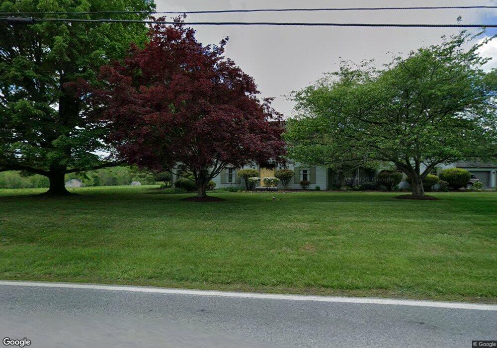
344 S Guernsey Rd West Grove, PA 19390
Estimated Value: $590,000 - $676,000
4
Beds
2
Baths
2,884
Sq Ft
$215/Sq Ft
Est. Value
About This Home
This home is located at 344 S Guernsey Rd, West Grove, PA 19390 and is currently estimated at $618,625, approximately $214 per square foot. 344 S Guernsey Rd is a home located in Chester County with nearby schools including Penn London Elementary School, Avon Grove Intermediate School, and Fred S Engle Middle School.
Ownership History
Date
Name
Owned For
Owner Type
Purchase Details
Closed on
Jul 12, 2022
Sold by
Regester Gary W
Bought by
Regester Gary W
Current Estimated Value
Home Financials for this Owner
Home Financials are based on the most recent Mortgage that was taken out on this home.
Original Mortgage
$1,000,000
Outstanding Balance
$956,824
Interest Rate
5.78%
Mortgage Type
New Conventional
Estimated Equity
-$338,199
Create a Home Valuation Report for This Property
The Home Valuation Report is an in-depth analysis detailing your home's value as well as a comparison with similar homes in the area
Home Values in the Area
Average Home Value in this Area
Purchase History
| Date | Buyer | Sale Price | Title Company |
|---|---|---|---|
| Regester Gary W | -- | -- |
Source: Public Records
Mortgage History
| Date | Status | Borrower | Loan Amount |
|---|---|---|---|
| Open | Regester Gary W | $1,000,000 |
Source: Public Records
Tax History Compared to Growth
Tax History
| Year | Tax Paid | Tax Assessment Tax Assessment Total Assessment is a certain percentage of the fair market value that is determined by local assessors to be the total taxable value of land and additions on the property. | Land | Improvement |
|---|---|---|---|---|
| 2025 | $6,374 | $207,770 | $52,900 | $154,870 |
| 2024 | $6,374 | $207,770 | $52,900 | $154,870 |
| 2023 | $6,241 | $207,770 | $52,900 | $154,870 |
| 2022 | $6,151 | $207,770 | $52,900 | $154,870 |
| 2021 | $6,024 | $207,770 | $52,900 | $154,870 |
| 2020 | $5,823 | $207,770 | $52,900 | $154,870 |
| 2019 | $5,679 | $207,770 | $52,900 | $154,870 |
| 2018 | $5,536 | $207,770 | $52,900 | $154,870 |
| 2017 | $5,421 | $207,770 | $52,900 | $154,870 |
| 2016 | $4,375 | $207,770 | $52,900 | $154,870 |
| 2015 | $4,375 | $207,770 | $52,900 | $154,870 |
| 2014 | $4,375 | $207,770 | $52,900 | $154,870 |
Source: Public Records
Map
Nearby Homes
- 603 Lamborn Ridge Dr
- 653 State Rd
- 2 Radence Ln
- 17 Nottingham Dr
- 24 Caversham Dr
- 504 Prospect Ave
- 135 Jackson Ave
- 9 Morningside Ct
- 274 Schoolhouse Rd
- 403 E Glenview Dr
- 263 Schoolhouse Rd
- 136 Janine Way
- 8 Prospect Ave
- 117 Railroad Ave Unit 10
- Kipling Plan at Lexington Point
- Magnolia Plan at Lexington Point
- Ethan Plan at Lexington Point
- Parker Plan at Lexington Point
- Covington Plan at Lexington Point
- Harrison Plan at Lexington Point