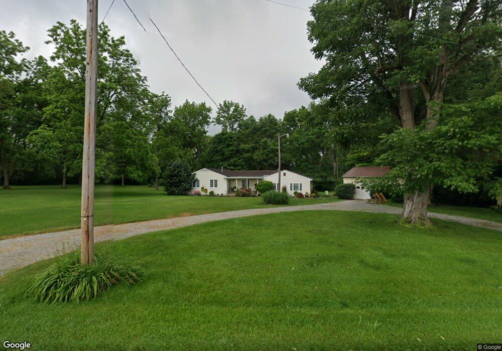
3444 Clark Rd New Vienna, OH 45159
Estimated Value: $190,000 - $229,000
2
Beds
2
Baths
1,680
Sq Ft
$124/Sq Ft
Est. Value
About This Home
This home is located at 3444 Clark Rd, New Vienna, OH 45159 and is currently estimated at $207,831, approximately $123 per square foot. 3444 Clark Rd is a home located in Clinton County with nearby schools including East Clinton High School.
Ownership History
Date
Name
Owned For
Owner Type
Purchase Details
Closed on
Aug 29, 2013
Sold by
Snow Bradley D and Snow Sandra K
Bought by
Snow Harold Dean and Snow Jo Ann
Current Estimated Value
Home Financials for this Owner
Home Financials are based on the most recent Mortgage that was taken out on this home.
Original Mortgage
$93,120
Outstanding Balance
$60,551
Interest Rate
4.38%
Mortgage Type
New Conventional
Estimated Equity
$147,280
Purchase Details
Closed on
Jun 20, 2003
Sold by
Wade Kenneth L and Wade Orpha B
Bought by
Wade Orpha B
Purchase Details
Closed on
Jan 1, 1990
Bought by
Wade Orpha and Wade Kenneth
Create a Home Valuation Report for This Property
The Home Valuation Report is an in-depth analysis detailing your home's value as well as a comparison with similar homes in the area
Home Values in the Area
Average Home Value in this Area
Purchase History
| Date | Buyer | Sale Price | Title Company |
|---|---|---|---|
| Snow Harold Dean | -- | -- | |
| Wade Orpha B | -- | -- | |
| Wade Orpha | -- | -- |
Source: Public Records
Mortgage History
| Date | Status | Borrower | Loan Amount |
|---|---|---|---|
| Open | Snow Harold Dean | $93,120 |
Source: Public Records
Tax History Compared to Growth
Tax History
| Year | Tax Paid | Tax Assessment Tax Assessment Total Assessment is a certain percentage of the fair market value that is determined by local assessors to be the total taxable value of land and additions on the property. | Land | Improvement |
|---|---|---|---|---|
| 2024 | $1,435 | $46,030 | $6,830 | $39,200 |
| 2023 | $1,435 | $46,030 | $6,830 | $39,200 |
| 2022 | $1,463 | $40,700 | $4,600 | $36,100 |
| 2021 | $1,476 | $40,700 | $4,600 | $36,100 |
| 2020 | $1,458 | $40,700 | $4,600 | $36,100 |
| 2019 | $1,079 | $31,740 | $4,600 | $27,140 |
| 2018 | $1,021 | $31,740 | $4,600 | $27,140 |
| 2017 | $854 | $31,740 | $4,600 | $27,140 |
| 2016 | $773 | $29,610 | $4,090 | $25,520 |
| 2015 | $743 | $29,610 | $4,090 | $25,520 |
| 2013 | $814 | $30,630 | $5,110 | $25,520 |
Source: Public Records
Map
Nearby Homes
- 208 Dorothy Ln
- 0 E Fork Rd Unit 1842519
- 0 E Fork Rd Unit 1829555
- 13287 State Route 729
- 57 Kings Ct
- 822 Bernard Rd
- 62 Kings Ct
- 392 Romans Rd
- 1529 Hildebrant Rd
- 0 Hildebrant Rd Unit 1856809
- 5891 Farmers Rd
- 288 Clark Rd
- 10035 Wolfe Rd
- 1056 West Rd
- 429 Cumberland Rd
- 6081 Panhandle Rd
- 3657 Farmers Rd
- 13279 Ohio 729
- 2593 Terrell Rd
- 89 E Main St
- 3564 Clark Rd
- 11219 State Route 28
- 11241 State Route 28
- 11103 State Route 28
- 11081 State Route 28
- 11081 St Rt 28
- 11411 State Route 28
- 10999 State Route 28
- 11103 Ohio 28
- 10895 E St Rt 28
- 10895 Ohio 28
- 28 Sr
- 11587 State Route 28
- 10821 State Route 28
- 10821 State Route 28
- 631 West St
- 10795 State Route 28
- 296 Dorothy Ln
- 273 Dorothy Ln
- 619 West St