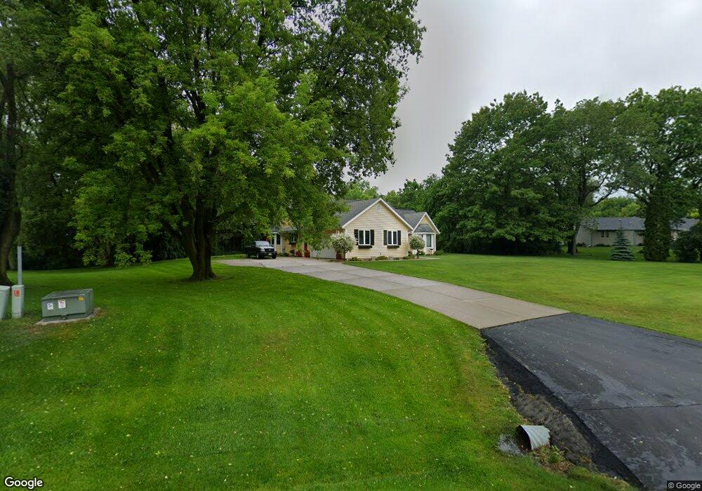
3445 Cumberland Trail Slinger, WI 53086
Estimated Value: $482,000 - $587,000
--
Bed
--
Bath
--
Sq Ft
1.59
Acres
About This Home
This home is located at 3445 Cumberland Trail, Slinger, WI 53086 and is currently estimated at $546,826. 3445 Cumberland Trail is a home located in Washington County with nearby schools including Slinger High School and St Peter Elementary School.
Ownership History
Date
Name
Owned For
Owner Type
Purchase Details
Closed on
Mar 6, 2015
Sold by
Hoeft Steven R and Hoeft Sandra J
Bought by
Heinzen Dane W and Heinzen Vicki L
Current Estimated Value
Home Financials for this Owner
Home Financials are based on the most recent Mortgage that was taken out on this home.
Original Mortgage
$251,000
Outstanding Balance
$191,386
Interest Rate
3.56%
Mortgage Type
New Conventional
Estimated Equity
$355,440
Create a Home Valuation Report for This Property
The Home Valuation Report is an in-depth analysis detailing your home's value as well as a comparison with similar homes in the area
Home Values in the Area
Average Home Value in this Area
Purchase History
| Date | Buyer | Sale Price | Title Company |
|---|---|---|---|
| Heinzen Dane W | $270,000 | None Available |
Source: Public Records
Mortgage History
| Date | Status | Borrower | Loan Amount |
|---|---|---|---|
| Open | Heinzen Dane W | $251,000 |
Source: Public Records
Tax History Compared to Growth
Tax History
| Year | Tax Paid | Tax Assessment Tax Assessment Total Assessment is a certain percentage of the fair market value that is determined by local assessors to be the total taxable value of land and additions on the property. | Land | Improvement |
|---|---|---|---|---|
| 2024 | $3,921 | $501,700 | $100,200 | $401,500 |
| 2023 | $3,562 | $501,700 | $100,200 | $401,500 |
| 2022 | $3,155 | $320,500 | $79,900 | $240,600 |
| 2021 | $3,146 | $320,500 | $79,900 | $240,600 |
| 2020 | $3,197 | $320,500 | $79,900 | $240,600 |
| 2019 | $3,128 | $320,500 | $79,900 | $240,600 |
| 2018 | $3,104 | $294,700 | $77,900 | $216,800 |
| 2017 | $3,200 | $294,700 | $77,900 | $216,800 |
| 2016 | $3,184 | $294,700 | $77,900 | $216,800 |
| 2015 | $3,305 | $301,700 | $77,900 | $223,800 |
| 2014 | $3,305 | $300,500 | $82,000 | $218,500 |
| 2013 | $3,506 | $302,900 | $82,000 | $220,900 |
Source: Public Records
Map
Nearby Homes
- 2300 Sherman Rd
- 3555 Hillside Rd
- 4229 Sherman Rd
- 1900 Hillside Rd
- 3790 Sherman Rd
- Madison II Plan at Cedar Creek Estates
- Prairiefield II Plan at Cedar Creek Estates
- McKinley I Plan at Cedar Creek Estates
- The Walnut Plan at Cedar Creek Estates
- The Juneberry Plan at Cedar Creek Estates
- Savannah Plan at Cedar Creek Estates
- Hampton Ridge Plan at Cedar Creek Estates
- Jefferson I Plan at Cedar Creek Estates
- Wakefield Plan at Cedar Creek Estates
- 497 Limestone Ln
- Breckenridge I Plan at Cedar Creek Estates
- Hampton Bay Plan at Cedar Creek Estates
- Madison IV Plan at Cedar Creek Estates
- Rivershire Plan at Cedar Creek Estates
- Princeton Plan at Cedar Creek Estates
- 3435 Cumberland Trail
- 3438 Cumberland Trail
- 3446 Cumberland Trail
- 3463 Cumberland Trail
- 3460 Cumberland Trail
- 3479 Cumberland Trail
- 3997 Fairfield Rd
- 4002 Fairfield Rd
- 3491 Cumberland Trail
- 2280 N Hollow Cir
- 2280 N Hollow Cir Unit Lt5
- 3503 Cumberland Trail
- 3985 Fairfield Rd
- 3971 Fairfield Rd
- 3511 Cumberland Trail
- 3521 Colony Ct
- 3520 Colony Ct
- 2270 N Hollow Cir
- 3512 Cumberland Trail
- 1250 Hillside Rd