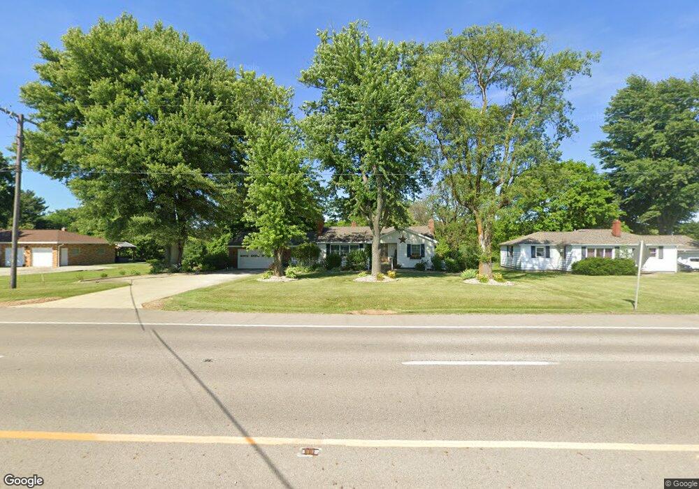
3448 State Route 39 Shelby, OH 44875
Estimated Value: $154,000 - $257,000
2
Beds
2
Baths
1,006
Sq Ft
$192/Sq Ft
Est. Value
About This Home
This home is located at 3448 State Route 39, Shelby, OH 44875 and is currently estimated at $193,304, approximately $192 per square foot. 3448 State Route 39 is a home located in Richland County with nearby schools including St. Mary's School.
Ownership History
Date
Name
Owned For
Owner Type
Purchase Details
Closed on
May 21, 1997
Sold by
Brady Michael
Bought by
Stover Janet
Current Estimated Value
Home Financials for this Owner
Home Financials are based on the most recent Mortgage that was taken out on this home.
Original Mortgage
$72,000
Outstanding Balance
$10,067
Interest Rate
8.24%
Mortgage Type
New Conventional
Estimated Equity
$183,237
Purchase Details
Closed on
Jun 14, 1993
Sold by
Guill Richard A
Bought by
Brady Michael
Purchase Details
Closed on
May 14, 1991
Purchase Details
Closed on
Jan 2, 1990
Create a Home Valuation Report for This Property
The Home Valuation Report is an in-depth analysis detailing your home's value as well as a comparison with similar homes in the area
Home Values in the Area
Average Home Value in this Area
Purchase History
| Date | Buyer | Sale Price | Title Company |
|---|---|---|---|
| Stover Janet | $93,000 | -- | |
| Brady Michael | $62,000 | -- | |
| -- | $59,000 | -- | |
| -- | $55,000 | -- |
Source: Public Records
Mortgage History
| Date | Status | Borrower | Loan Amount |
|---|---|---|---|
| Open | Stover Janet | $72,000 |
Source: Public Records
Tax History Compared to Growth
Tax History
| Year | Tax Paid | Tax Assessment Tax Assessment Total Assessment is a certain percentage of the fair market value that is determined by local assessors to be the total taxable value of land and additions on the property. | Land | Improvement |
|---|---|---|---|---|
| 2024 | $1,498 | $39,530 | $5,280 | $34,250 |
| 2023 | $1,498 | $39,530 | $5,280 | $34,250 |
| 2022 | $1,364 | $32,080 | $5,100 | $26,980 |
| 2021 | $1,364 | $32,080 | $5,100 | $26,980 |
| 2020 | $1,366 | $32,080 | $5,100 | $26,980 |
| 2019 | $1,259 | $27,230 | $4,330 | $22,900 |
| 2018 | $1,233 | $27,230 | $4,330 | $22,900 |
| 2017 | $1,223 | $27,230 | $4,330 | $22,900 |
| 2016 | $1,224 | $27,550 | $4,330 | $23,220 |
| 2015 | $1,217 | $27,550 | $4,330 | $23,220 |
| 2014 | $1,175 | $27,550 | $4,330 | $23,220 |
| 2012 | $581 | $27,550 | $4,330 | $23,220 |
Source: Public Records
Map
Nearby Homes
- 3400 Rock Rd
- 3596 Ohio 39
- 3763 State Route 39
- 3619 Springmill Rd N
- 3389 Wareham Rd
- 0 Technology Pkwy
- 1845 Taylortown Rd
- 2674 Stiving Rd
- 38 Woodland Rd
- 31 Sherwood Dr
- 116 Mansfield Ave
- 228 E Main St
- 671 Bendle Ave
- 226 E Main St
- 1717 Myers Rd
- 624 Bendle Ave
- 2392 E Smiley Rd
- 70 Mansfield Ave
- 2484 E Smiley Rd
- 221 S Gamble St
- 3438 State Route 39
- 3454 State Route 39
- 3430 State Route 39
- 3470 State Route 39
- 3422 State Route 39
- 3422 Ohio 39
- 3476 State Route 39
- 3479 State Route 39
- 3484 State Route 39
- 3485 State Route 39
- 3389 State Route 39
- 3494 State Route 39
- 2953 Dale Rd
- 3491 State Route 39
- 3385 State Route 39
- 3520 State Route 39
- 2939 Dale Rd
- 3606 Alvin Rd
- 3517 State Route 39
- 2935 Dale Rd