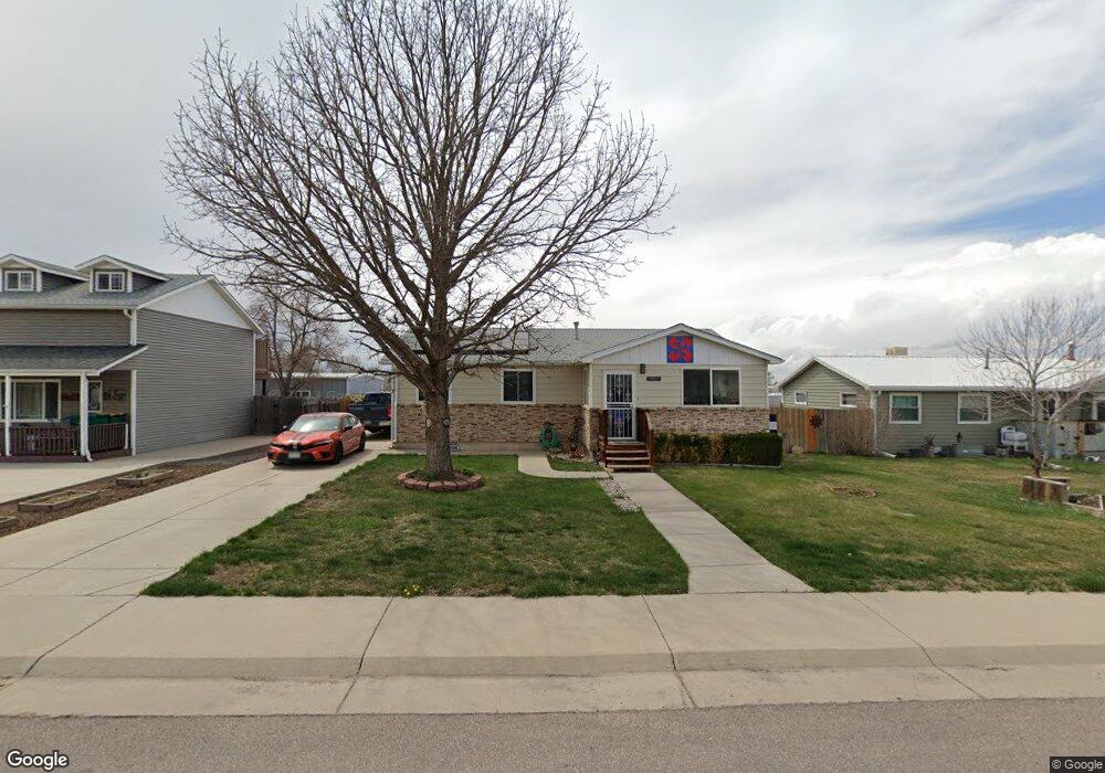
345 Cedar St Hudson, CO 80642
Estimated Value: $363,000 - $434,000
3
Beds
3
Baths
1,400
Sq Ft
$276/Sq Ft
Est. Value
About This Home
This home is located at 345 Cedar St, Hudson, CO 80642 and is currently estimated at $387,061, approximately $276 per square foot. 345 Cedar St is a home located in Weld County with nearby schools including Weld Central Senior High School.
Ownership History
Date
Name
Owned For
Owner Type
Purchase Details
Closed on
Sep 16, 2005
Sold by
Deutsche Bank National Trust Co
Bought by
Floyd Robert Dale
Current Estimated Value
Home Financials for this Owner
Home Financials are based on the most recent Mortgage that was taken out on this home.
Original Mortgage
$113,400
Outstanding Balance
$59,838
Interest Rate
5.73%
Mortgage Type
Fannie Mae Freddie Mac
Estimated Equity
$327,223
Purchase Details
Closed on
Jun 1, 2005
Sold by
Jolley Charles H
Bought by
Deutsche Bank National Trust Co
Purchase Details
Closed on
Dec 30, 1998
Sold by
Wilson Arlette M
Bought by
Jolley Charles H
Home Financials for this Owner
Home Financials are based on the most recent Mortgage that was taken out on this home.
Original Mortgage
$104,500
Interest Rate
6.85%
Mortgage Type
Purchase Money Mortgage
Purchase Details
Closed on
Apr 22, 1996
Sold by
Roskop Leonard
Bought by
Wilson Arlette M
Create a Home Valuation Report for This Property
The Home Valuation Report is an in-depth analysis detailing your home's value as well as a comparison with similar homes in the area
Purchase History
| Date | Buyer | Sale Price | Title Company |
|---|---|---|---|
| Floyd Robert Dale | $141,750 | Security Title | |
| Deutsche Bank National Trust Co | -- | -- | |
| Jolley Charles H | $110,000 | -- | |
| Wilson Arlette M | $95,000 | -- |
Source: Public Records
Mortgage History
| Date | Status | Borrower | Loan Amount |
|---|---|---|---|
| Open | Floyd Robert Dale | $113,400 | |
| Previous Owner | Jolley Charles H | $104,500 |
Source: Public Records
Tax History
| Year | Tax Paid | Tax Assessment Tax Assessment Total Assessment is a certain percentage of the fair market value that is determined by local assessors to be the total taxable value of land and additions on the property. | Land | Improvement |
|---|---|---|---|---|
| 2025 | $1,323 | $24,290 | $5,320 | $18,970 |
| 2024 | $1,323 | $24,290 | $5,320 | $18,970 |
| 2023 | $1,272 | $26,290 | $4,740 | $21,550 |
| 2022 | $1,022 | $19,020 | $3,480 | $15,540 |
| 2021 | $1,090 | $19,570 | $3,580 | $15,990 |
| 2020 | $778 | $16,320 | $2,500 | $13,820 |
| 2019 | $803 | $16,320 | $2,500 | $13,820 |
| 2018 | $640 | $14,330 | $2,740 | $11,590 |
| 2017 | $1,232 | $14,330 | $2,740 | $11,590 |
| 2016 | $952 | $10,990 | $2,790 | $8,200 |
| 2015 | $842 | $10,990 | $2,790 | $8,200 |
| 2014 | $515 | $6,650 | $1,190 | $5,460 |
Source: Public Records
Map
Nearby Homes
- 218 Grape St Unit 28
- 218 Grape St Unit 29
- 218 Grape St Unit 30
- 218 St Unit 29
- 608 Cedar St
- 508 Hickory St
- 240 Buckboard Dr
- 230 Buckboard Dr
- 250 Buckboard Dr
- 210 Dawn Dr
- 220 Dawn Dr
- 450 Buckboard Dr
- 22385 Highway 52
- 450 Lexi Ln
- 3849 Kenai St
- 505 Gavin Ct
- 510 Gavin Ct
- 500 Lexi Ln
- 500 Gavin Ct
- 21350 County Road 10
- 365 Cedar St
- 335 Cedar St
- 374 Cedar St
- 12 Fox Tail Dr
- 16 Remington Dr
- 0 Fox Tail Dr Unit 646386
- 3 Fox Tail Dr
- 0 Remington Dr Unit 646358
- 0 Remington Dr Unit 496818
- 0 Remington Dr Unit 567164
- 0 Fox Tail Dr Unit 592794
- 325 Cedar St
- 354 Cedar St
- 334 N Cedar St
- 314 Cedar St
- 301 Cedar St
- 305 3rd
- 329 Beech St
- 333 Birch St
- 405 Birch St
Your Personal Tour Guide
Ask me questions while you tour the home.