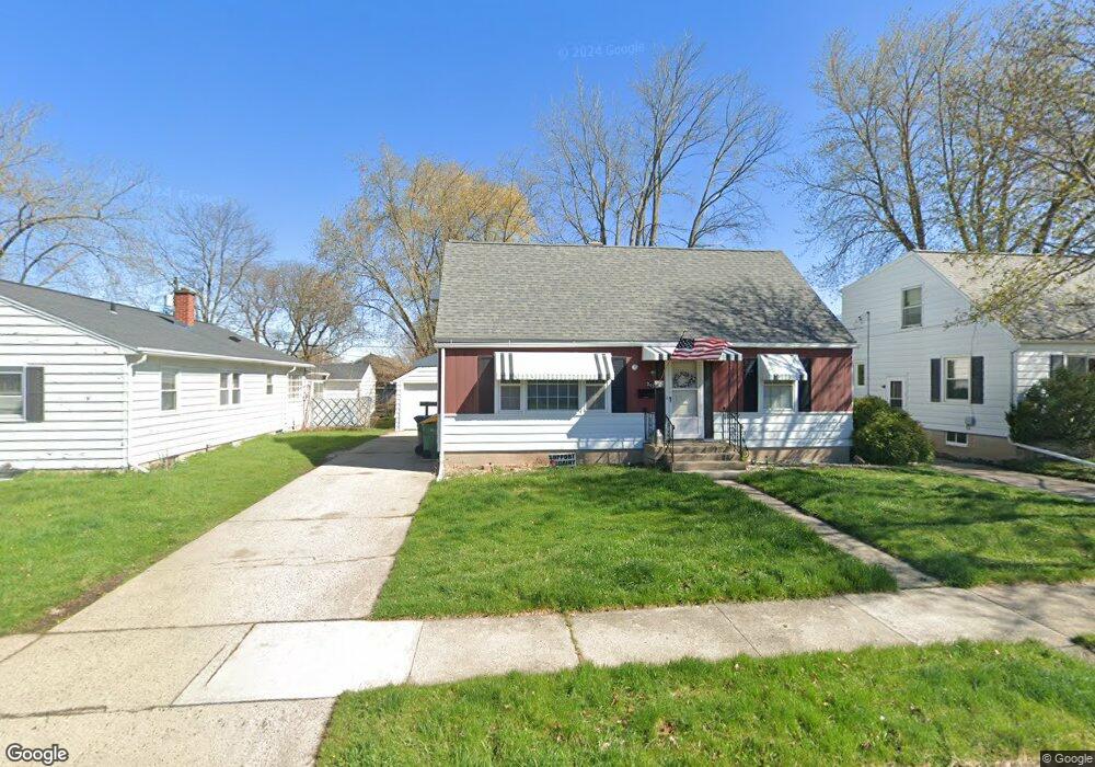
345 E 12th St Fond Du Lac, WI 54935
Estimated Value: $202,010 - $226,000
3
Beds
2
Baths
1,260
Sq Ft
$169/Sq Ft
Est. Value
About This Home
This home is located at 345 E 12th St, Fond Du Lac, WI 54935 and is currently estimated at $212,753, approximately $168 per square foot. 345 E 12th St is a home located in Fond du Lac County with nearby schools including Waters Elementary School, Theisen Middle School, and Fond du Lac High School.
Ownership History
Date
Name
Owned For
Owner Type
Purchase Details
Closed on
Sep 24, 2019
Sold by
Guell Charles D and Guell Colleen S
Bought by
Guell Charles D
Current Estimated Value
Home Financials for this Owner
Home Financials are based on the most recent Mortgage that was taken out on this home.
Original Mortgage
$137,087
Outstanding Balance
$126,386
Interest Rate
6.6%
Mortgage Type
FHA
Estimated Equity
$86,367
Purchase Details
Closed on
Nov 2, 2005
Sold by
Winter Tella
Bought by
Guell Charles D and Guell Colleen G
Create a Home Valuation Report for This Property
The Home Valuation Report is an in-depth analysis detailing your home's value as well as a comparison with similar homes in the area
Home Values in the Area
Average Home Value in this Area
Purchase History
| Date | Buyer | Sale Price | Title Company |
|---|---|---|---|
| Guell Charles D | $130,000 | Wisconsin Title Group | |
| Guell Charles D | $92,000 | None Available |
Source: Public Records
Mortgage History
| Date | Status | Borrower | Loan Amount |
|---|---|---|---|
| Open | Guell Charles D | $137,087 |
Source: Public Records
Tax History Compared to Growth
Tax History
| Year | Tax Paid | Tax Assessment Tax Assessment Total Assessment is a certain percentage of the fair market value that is determined by local assessors to be the total taxable value of land and additions on the property. | Land | Improvement |
|---|---|---|---|---|
| 2024 | $2,452 | $104,100 | $16,300 | $87,800 |
| 2023 | $2,572 | $104,100 | $16,300 | $87,800 |
| 2022 | $2,420 | $104,100 | $16,300 | $87,800 |
| 2021 | $2,428 | $104,100 | $16,300 | $87,800 |
| 2020 | $2,421 | $104,100 | $16,300 | $87,800 |
| 2019 | $2,420 | $104,100 | $16,300 | $87,800 |
| 2018 | $2,409 | $97,700 | $15,500 | $82,200 |
| 2017 | $2,376 | $97,700 | $15,500 | $82,200 |
| 2016 | $2,383 | $97,700 | $15,500 | $82,200 |
| 2015 | $2,825 | $97,700 | $15,500 | $82,200 |
| 2014 | $2,336 | $97,700 | $15,500 | $82,200 |
| 2013 | $2,613 | $108,400 | $17,200 | $91,200 |
Source: Public Records
Map
Nearby Homes