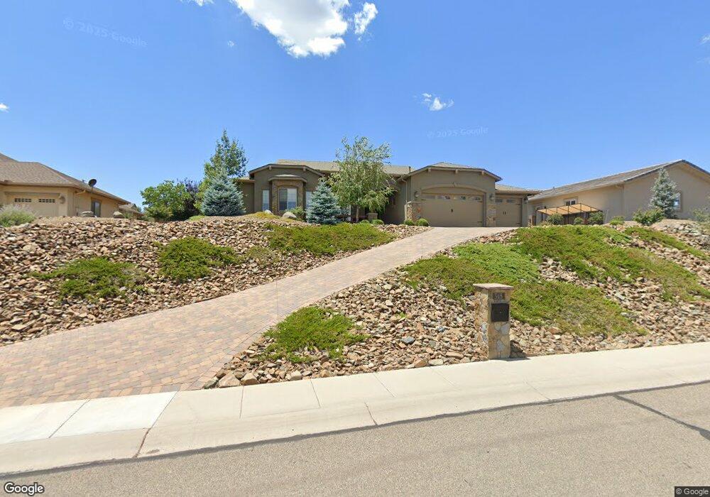
345 E Delano Ave Prescott, AZ 86301
Estimated Value: $825,000 - $908,000
--
Bed
--
Bath
2,381
Sq Ft
$370/Sq Ft
Est. Value
About This Home
This home is located at 345 E Delano Ave, Prescott, AZ 86301 and is currently estimated at $881,732, approximately $370 per square foot. 345 E Delano Ave is a home located in Yavapai County with nearby schools including Taylor Hicks School, Granite Mountain Middle School, and Prescott Mile High Middle School.
Ownership History
Date
Name
Owned For
Owner Type
Purchase Details
Closed on
Mar 30, 2017
Sold by
Giel Joan M and Giel Michael K
Bought by
Giel Michael Kenneth and Giel Joan Marie
Current Estimated Value
Home Financials for this Owner
Home Financials are based on the most recent Mortgage that was taken out on this home.
Original Mortgage
$248,000
Outstanding Balance
$127,681
Interest Rate
4.1%
Mortgage Type
New Conventional
Estimated Equity
$754,051
Purchase Details
Closed on
Nov 14, 2015
Sold by
Dusman Kenneth R and Dusman Karen E
Bought by
The Giel Family Trust
Purchase Details
Closed on
Nov 13, 2008
Sold by
Baseline 34 Development Llc
Bought by
Dusman Richard M
Purchase Details
Closed on
Sep 2, 2005
Sold by
Prescott Land Investors Llc
Bought by
Baseline 34 Development Llc
Create a Home Valuation Report for This Property
The Home Valuation Report is an in-depth analysis detailing your home's value as well as a comparison with similar homes in the area
Home Values in the Area
Average Home Value in this Area
Purchase History
| Date | Buyer | Sale Price | Title Company |
|---|---|---|---|
| Giel Michael Kenneth | -- | Yavapai Title | |
| Giel Joan M | -- | Yavapai Title | |
| The Giel Family Trust | $83,000 | Yavapai Title | |
| Dusman Richard M | $80,000 | Landamerica Title Agency | |
| Baseline 34 Development Llc | $2,100,000 | Capital Title Agency |
Source: Public Records
Mortgage History
| Date | Status | Borrower | Loan Amount |
|---|---|---|---|
| Open | Giel Joan M | $248,000 | |
| Closed | Giel Michael Kenneth | $248,000 |
Source: Public Records
Tax History Compared to Growth
Tax History
| Year | Tax Paid | Tax Assessment Tax Assessment Total Assessment is a certain percentage of the fair market value that is determined by local assessors to be the total taxable value of land and additions on the property. | Land | Improvement |
|---|---|---|---|---|
| 2026 | $3,005 | $74,064 | -- | -- |
| 2024 | $2,885 | $77,839 | -- | -- |
| 2023 | $2,944 | $62,107 | $9,632 | $52,475 |
| 2022 | $2,885 | $53,904 | $10,026 | $43,878 |
| 2021 | $3,008 | $52,618 | $8,181 | $44,437 |
| 2020 | $3,013 | $0 | $0 | $0 |
| 2019 | $2,975 | $0 | $0 | $0 |
| 2018 | $2,870 | $0 | $0 | $0 |
| 2017 | $536 | $0 | $0 | $0 |
| 2016 | $540 | $0 | $0 | $0 |
| 2015 | -- | $0 | $0 | $0 |
| 2014 | -- | $0 | $0 | $0 |
Source: Public Records
Map
Nearby Homes
- 1920 Megan Way
- 1100 E Rosser St
- 1161 Northridge Dr
- 1220 Pebble Springs
- 1222 Crown Ridge Dr
- 1226 Crown Ridge Dr
- 500/501 E Rosser St
- 1622 Dancing Star Way
- 2115 Colter Bay Ct
- 1899 Kensington Ct
- 422 Bloomingdale Dr
- 2117 Colter Bay Ct
- 10825 W Rd
- 450 Isabelle Ln
- 1748 Tatum Place
- 2121 Colter Bay Ct
- 462 Bloomingdale Dr
- 1715 Birdsong
- 1975 S Blooming Hills Dr Unit 220
- 330 Breezy Rd
- 345 E Delano Ave
- 333 E Delano Ave
- 353 E Delano Ave
- 0 Bloomingdale Dr Is Ln Unit PAR916736
- 0 Bloomingdale Dr Is Ln Unit 924621
- 0 Bloomingdale Dr Is Ln Unit 923423
- 0 Bloomingdale Dr Is Ln Unit 923424
- 305 Bloomingdale Dr
- 321 E Delano Ave
- 344 E Delano Ave
- 359 E Delano Ave
- 326 E Delano Ave
- 346 E Delano Ave Unit 22
- 346 E Delano Ave
- 1915 Riley Ln
- 315 E Delano Ave
- 363 E Delano Ave
- 363 E Delano Ave
- 320 E Delano Ave
- 1913 Riley Ln