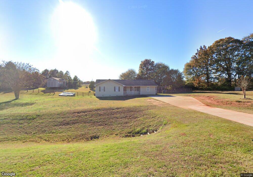
345 Harris Dr Locust Grove, GA 30248
Estimated Value: $259,978 - $291,000
3
Beds
2
Baths
1,628
Sq Ft
$166/Sq Ft
Est. Value
About This Home
This home is located at 345 Harris Dr, Locust Grove, GA 30248 and is currently estimated at $270,745, approximately $166 per square foot. 345 Harris Dr is a home located in Henry County with nearby schools including Unity Grove Elementary School, Locust Grove Middle School, and Locust Grove High School.
Ownership History
Date
Name
Owned For
Owner Type
Purchase Details
Closed on
Jun 18, 1999
Sold by
Hylock Kenneth R and Hylock Aundrea D
Bought by
Nunnaly Douglas R and Nunnaly Barbara M
Current Estimated Value
Home Financials for this Owner
Home Financials are based on the most recent Mortgage that was taken out on this home.
Original Mortgage
$92,900
Outstanding Balance
$24,662
Interest Rate
7.13%
Mortgage Type
FHA
Estimated Equity
$246,083
Create a Home Valuation Report for This Property
The Home Valuation Report is an in-depth analysis detailing your home's value as well as a comparison with similar homes in the area
Home Values in the Area
Average Home Value in this Area
Purchase History
| Date | Buyer | Sale Price | Title Company |
|---|---|---|---|
| Nunnaly Douglas R | $93,000 | -- |
Source: Public Records
Mortgage History
| Date | Status | Borrower | Loan Amount |
|---|---|---|---|
| Open | Nunnaly Douglas R | $92,900 |
Source: Public Records
Tax History Compared to Growth
Tax History
| Year | Tax Paid | Tax Assessment Tax Assessment Total Assessment is a certain percentage of the fair market value that is determined by local assessors to be the total taxable value of land and additions on the property. | Land | Improvement |
|---|---|---|---|---|
| 2025 | $3,740 | $101,884 | $16,440 | $85,444 |
| 2024 | $3,740 | $101,160 | $14,960 | $86,200 |
| 2023 | $3,735 | $96,320 | $14,400 | $81,920 |
| 2022 | $3,230 | $83,160 | $13,280 | $69,880 |
| 2021 | $2,492 | $63,920 | $11,400 | $52,520 |
| 2020 | $2,153 | $55,080 | $10,720 | $44,360 |
| 2019 | $1,984 | $50,680 | $10,200 | $40,480 |
| 2018 | $1,837 | $46,840 | $9,400 | $37,440 |
| 2016 | $1,653 | $42,040 | $7,640 | $34,400 |
| 2015 | $1,483 | $36,480 | $8,360 | $28,120 |
| 2014 | $1,377 | $33,400 | $8,160 | $25,240 |
Source: Public Records
Map
Nearby Homes
- 943 Colvin Dr
- 104 Waratah Dr
- 825 S Bethany Rd
- 75 Price Dr W
- 678 Seabolt Rd
- 735 Strawflower Ln
- 705 Seabolt Rd
- 340 Colvin Dr
- 328 Trulove Ln Unit 32
- 316 Trulove Ln Unit 35
- 560 Coan Dr
- 300 Leguin Mill Rd
- 551 Rosalind Terrace
- 390 Coan Dr
- 1579 S Bethany Rd
- 1404 Saddlebrook Ct
- 604 Onieda Dr
- 1145 Larkspur Dr
- 305 Annie Ln Unit 2
- 230 Leguin Mill Rd
- 335 Harris Dr
- 325 Harris Dr
- 230 Harris Dr Unit LOT 3
- 210 Harris Dr Unit LOT 1
- 220 Harris Dr Unit LOT 2
- 280 Harris Dr
- 315 Harris Dr
- 95 Seabolt Rd
- 270 Harris Dr
- 260 Harris Dr
- 555 Harris Dr
- 253 Seabolt Rd
- 849 Colvin Dr
- 305 Harris Dr
- 250 Harris Dr
- 65 Seabolt Rd
- 303 Harris Dr
- 512 Harris Dr
- 901 Colvin Dr
- 581 Harris Dr