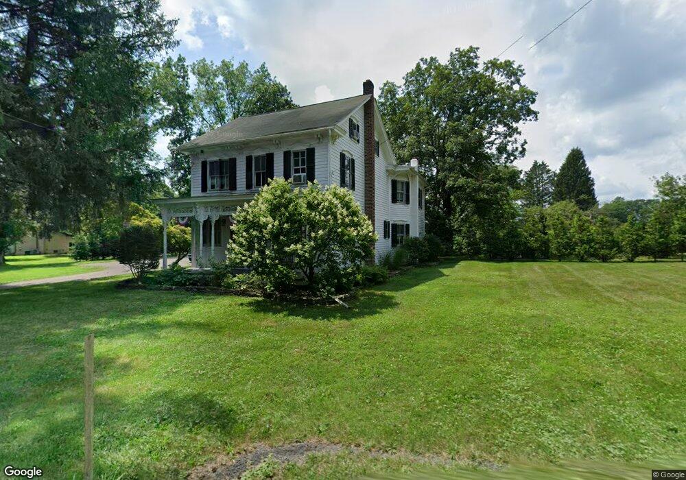
345 Mill Rd Lehighton, PA 18235
Estimated Value: $301,473 - $413,000
3
Beds
2
Baths
2,007
Sq Ft
$172/Sq Ft
Est. Value
About This Home
This home is located at 345 Mill Rd, Lehighton, PA 18235 and is currently estimated at $345,368, approximately $172 per square foot. 345 Mill Rd is a home located in Carbon County with nearby schools including Lehighton Area High School.
Ownership History
Date
Name
Owned For
Owner Type
Purchase Details
Closed on
Jan 15, 2025
Sold by
Steigerwalt Daniel W and Denege Elizabeth
Bought by
Steigerwalt Daniel W and Steigerwalt Denege Elizabeth
Current Estimated Value
Purchase Details
Closed on
Oct 24, 2022
Sold by
Steigerwalt Delroy C and Steigerwalt Carol A
Bought by
Steigerwalt Daniel W
Purchase Details
Closed on
Oct 24, 1975
Bought by
Steigerwalt Delroy C and Steigerwalt Carol A
Create a Home Valuation Report for This Property
The Home Valuation Report is an in-depth analysis detailing your home's value as well as a comparison with similar homes in the area
Home Values in the Area
Average Home Value in this Area
Purchase History
| Date | Buyer | Sale Price | Title Company |
|---|---|---|---|
| Steigerwalt Daniel W | -- | None Listed On Document | |
| Steigerwalt Daniel W | -- | None Listed On Document | |
| Steigerwalt Daniel W | -- | -- | |
| Steigerwalt Delroy C | $43,700 | -- |
Source: Public Records
Tax History Compared to Growth
Tax History
| Year | Tax Paid | Tax Assessment Tax Assessment Total Assessment is a certain percentage of the fair market value that is determined by local assessors to be the total taxable value of land and additions on the property. | Land | Improvement |
|---|---|---|---|---|
| 2025 | $3,772 | $49,300 | $9,850 | $39,450 |
| 2024 | $3,624 | $49,300 | $9,850 | $39,450 |
| 2023 | $3,587 | $49,300 | $9,850 | $39,450 |
| 2022 | $3,538 | $49,300 | $9,850 | $39,450 |
| 2021 | $3,433 | $49,300 | $9,850 | $39,450 |
| 2020 | $3,346 | $49,300 | $9,850 | $39,450 |
| 2019 | $3,174 | $49,300 | $9,850 | $39,450 |
| 2018 | $3,137 | $49,300 | $9,850 | $39,450 |
| 2017 | $3,137 | $49,300 | $9,850 | $39,450 |
| 2016 | -- | $49,300 | $9,850 | $39,450 |
| 2015 | -- | $49,300 | $9,850 | $39,450 |
| 2014 | -- | $49,300 | $9,850 | $39,450 |
Source: Public Records
Map
Nearby Homes
- 265 Mill Rd
- 1772 Mahoning Dr W
- 0 Beacon Pointe Plan at Summit Ridge
- 0 Blue Ridge Plan at Summit Ridge Unit PACC2005476
- 0 Georgia Mae Plan at Summit Ridge Unit PACC2005482
- Abbey Plan at Summit Ridge
- Beacon Pointe Plan at Summit Ridge
- White Oak Plan at Summit Ridge
- Black Cherry Plan at Summit Ridge
- Blue Ridge Plan at Summit Ridge
- Copper Beech Plan at Summit Ridge
- Sweet Birch Plan at Summit Ridge
- Georgia Mae Plan at Summit Ridge
- Emily Plan at Summit Ridge
- 134 Huron Dr
- 437 Chapel Dr
- 0 Abbey Plan at Summit Ridge Unit PACC2005470
- 0 Huron Ct Unit Lot 06
- TBD Heron Ct
- 93 Heartwood Ct