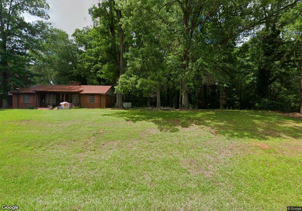
345 N Moore Rd Robbins, NC 27325
Estimated Value: $254,000 - $299,000
3
Beds
2
Baths
1,928
Sq Ft
$144/Sq Ft
Est. Value
About This Home
This home is located at 345 N Moore Rd, Robbins, NC 27325 and is currently estimated at $276,669, approximately $143 per square foot. 345 N Moore Rd is a home with nearby schools including Cameron Elementary School, New Century Middle School, and Union Pines High School.
Ownership History
Date
Name
Owned For
Owner Type
Purchase Details
Closed on
Jan 22, 2021
Sold by
Truesell Priscilla
Bought by
Locklear John R and Townsend Debbie A
Current Estimated Value
Home Financials for this Owner
Home Financials are based on the most recent Mortgage that was taken out on this home.
Original Mortgage
$173,992
Outstanding Balance
$155,288
Interest Rate
2.71%
Mortgage Type
New Conventional
Estimated Equity
$121,381
Purchase Details
Closed on
Jan 20, 2021
Sold by
Truesell Priscilla
Bought by
Locklear John R and Townsead Debbie A
Home Financials for this Owner
Home Financials are based on the most recent Mortgage that was taken out on this home.
Original Mortgage
$173,992
Outstanding Balance
$155,288
Interest Rate
2.71%
Mortgage Type
New Conventional
Estimated Equity
$121,381
Create a Home Valuation Report for This Property
The Home Valuation Report is an in-depth analysis detailing your home's value as well as a comparison with similar homes in the area
Home Values in the Area
Average Home Value in this Area
Purchase History
| Date | Buyer | Sale Price | Title Company |
|---|---|---|---|
| Locklear John R | $180,000 | None Available | |
| Locklear John R | $180,000 | None Listed On Document |
Source: Public Records
Mortgage History
| Date | Status | Borrower | Loan Amount |
|---|---|---|---|
| Open | Locklear John R | $173,992 | |
| Closed | Locklear John R | $173,992 |
Source: Public Records
Tax History Compared to Growth
Tax History
| Year | Tax Paid | Tax Assessment Tax Assessment Total Assessment is a certain percentage of the fair market value that is determined by local assessors to be the total taxable value of land and additions on the property. | Land | Improvement |
|---|---|---|---|---|
| 2024 | $915 | $210,420 | $34,960 | $175,460 |
| 2023 | $957 | $210,420 | $34,960 | $175,460 |
| 2022 | $952 | $151,140 | $17,850 | $133,290 |
| 2021 | $990 | $151,140 | $17,850 | $133,290 |
| 2020 | $975 | $151,140 | $17,850 | $133,290 |
| 2019 | $975 | $151,140 | $17,850 | $133,290 |
| 2018 | $922 | $153,600 | $17,640 | $135,960 |
| 2017 | $899 | $153,600 | $17,640 | $135,960 |
| 2015 | $868 | $153,600 | $17,640 | $135,960 |
| 2014 | $853 | $150,660 | $16,320 | $134,340 |
| 2013 | -- | $150,660 | $16,320 | $134,340 |
Source: Public Records
Map
Nearby Homes
- 312 T Johnson Rd
- 111 Bambi Ln
- 370 Bracken Hill Rd
- 230 Red Fox Ridge
- 115 Gilchrist Rd
- 5164 Nc-24
- 233 Rd
- 193 Jim Rd S
- 355 Shaw Rd
- 3759 Nc 24-27 Hwy
- 175 Almond Dr
- 285 Almond Dr
- 323 McCrimmon Rd
- 2068 Union Church Rd
- 150 Magnolia Hill Dr
- 305 Willow Oak Ct
- 274 Magnolia Hill Dr
- 0 Smith Hill Rd
- 125 Pressley Farm Ln
- 1840b Route 1
- 420 Monroe Rd
- 407 Manor Rd
- 0 Monroe Rd
- 430 Monroe Rd
- 441 Monroe Rd
- 1640 Red Hill Rd
- 461 Monroe Rd
- 1540 Red Hill Rd
- 1520 Red Hill Rd
- 1560 Red Hill Rd
- 1500 Red Hill Rd
- 1591 Red Hill Rd
- 1693 Red Hill Rd
- 471 T Johnson Rd
- 1592 Red Hill Rd
- 188 Monroe Rd
- 469 Monroe Rd
- 461 Monroe Rd
- 1695 Red Hill Rd
- 1633 Red Hill Rd