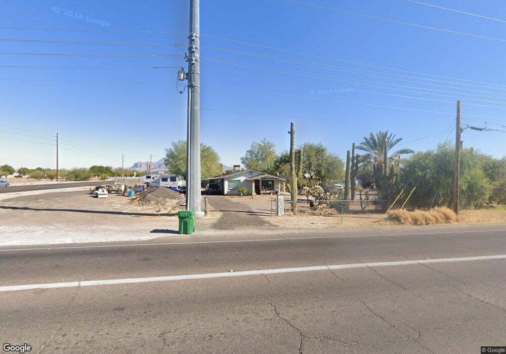
345 N Signal Butte Rd Apache Junction, AZ 85120
Northeast Mesa NeighborhoodEstimated Value: $287,000 - $373,000
--
Bed
2
Baths
1,141
Sq Ft
$290/Sq Ft
Est. Value
About This Home
This home is located at 345 N Signal Butte Rd, Apache Junction, AZ 85120 and is currently estimated at $330,966, approximately $290 per square foot. 345 N Signal Butte Rd is a home located in Maricopa County with nearby schools including Sousa Elementary School, Franklin at Brimhall Elementary School, and Franklin West Elementary School.
Ownership History
Date
Name
Owned For
Owner Type
Purchase Details
Closed on
Nov 9, 2007
Sold by
Dja Properties Inc
Bought by
Lewis Hillard R and Lewis Jacquelin
Current Estimated Value
Purchase Details
Closed on
Nov 19, 2003
Sold by
Ramsey Mark
Bought by
Dja Properties Inc
Home Financials for this Owner
Home Financials are based on the most recent Mortgage that was taken out on this home.
Original Mortgage
$66,000
Interest Rate
6%
Mortgage Type
Purchase Money Mortgage
Create a Home Valuation Report for This Property
The Home Valuation Report is an in-depth analysis detailing your home's value as well as a comparison with similar homes in the area
Home Values in the Area
Average Home Value in this Area
Purchase History
| Date | Buyer | Sale Price | Title Company |
|---|---|---|---|
| Lewis Hillard R | $45,000 | Security Title Agency Inc | |
| Dja Properties Inc | $40,000 | First American Title Ins Co |
Source: Public Records
Mortgage History
| Date | Status | Borrower | Loan Amount |
|---|---|---|---|
| Previous Owner | Dja Properties Inc | $66,000 |
Source: Public Records
Tax History Compared to Growth
Tax History
| Year | Tax Paid | Tax Assessment Tax Assessment Total Assessment is a certain percentage of the fair market value that is determined by local assessors to be the total taxable value of land and additions on the property. | Land | Improvement |
|---|---|---|---|---|
| 2025 | $537 | $7,206 | -- | -- |
| 2024 | $549 | $6,863 | -- | -- |
| 2023 | $549 | $25,560 | $5,110 | $20,450 |
| 2022 | $535 | $17,470 | $3,490 | $13,980 |
| 2021 | $541 | $15,900 | $3,180 | $12,720 |
| 2020 | $537 | $14,050 | $2,810 | $11,240 |
| 2019 | $493 | $11,970 | $2,390 | $9,580 |
| 2018 | $479 | $9,800 | $1,960 | $7,840 |
| 2017 | $461 | $8,730 | $1,740 | $6,990 |
| 2016 | $452 | $8,960 | $1,790 | $7,170 |
| 2015 | $424 | $6,760 | $1,350 | $5,410 |
Source: Public Records
Map
Nearby Homes
- 345 N Signal Butte Rd Unit 23
- 315 N Keith St
- 138 N Signal Butte Rd
- 11020 E University Dr
- 10530 E Baltimore St
- 11101 E University Dr Unit 214
- 11101 E University Dr Unit 171
- 11101 E University Dr Unit 125
- 10558 E Boise St
- 634 N Signal Butte Rd
- 433 N 111th Place
- 11121 E Camino Cir
- 11201 E Jupiter Dr
- 10936 E Apache Trail Unit 67
- 10936 E Apache Trail Unit 71
- 11100 E Apache Trail Unit 26
- 11100 E Apache Trail Unit 8
- 11100 E Apache Trail Unit 30
- 11100 E Apache Trail Unit 34
- 11100 E Apache Trail Unit 16
- 351 N Signal Butte Rd
- 341 N Signal Butte Rd
- 335 N Signal Butte Rd
- 331 N Signal Butte Rd
- 301 N Signal Butte Rd Unit 727
- 301 N Signal Butte Rd
- 346 N Keith St
- 352 N Keith St
- 342 N Keith St
- 348 N Keith St
- 336 N Keith St
- 326 N Keith St
- 315 N Signal Butte Rd
- 315 N Signal Butte Rd
- 328 N Signal Butte Rd
- 322 N Keith St
- 311 N Signal Butte Rd Unit 5
- 311 N Signal Butte Rd
- 10800 E University Ave Unit NONE
- 10800 E University Ave