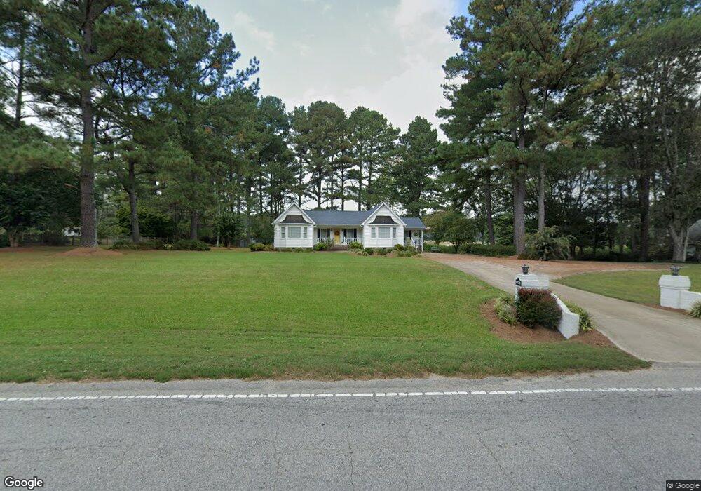
345 Nc 561 Hwy Louisburg, NC 27549
Estimated Value: $301,000 - $379,000
2
Beds
2
Baths
2,071
Sq Ft
$161/Sq Ft
Est. Value
About This Home
This home is located at 345 Nc 561 Hwy, Louisburg, NC 27549 and is currently estimated at $333,929, approximately $161 per square foot. 345 Nc 561 Hwy is a home located in Franklin County with nearby schools including Louisburg Elementary School, Terrell Lane Middle School, and Louisburg High School.
Ownership History
Date
Name
Owned For
Owner Type
Purchase Details
Closed on
Jun 22, 2018
Sold by
Willard Frances M and Willard Robert A
Bought by
Wilson Amy S and Collins Lynda S
Current Estimated Value
Purchase Details
Closed on
May 30, 2017
Sold by
Spencer Reams Susan and Reams Keith
Bought by
Spencer Willard Frances M and Willard Robert A
Purchase Details
Closed on
Mar 23, 2016
Sold by
Spencer Willard Frances M and Willard Robert A
Bought by
Spencer Reams Susan and Wilson Amy S
Purchase Details
Closed on
Jul 9, 2008
Sold by
Willard Robert A and Willard Frances M
Bought by
Willard Frances M
Purchase Details
Closed on
Aug 8, 2006
Sold by
Willard Robert A and Spencer Frances M
Bought by
Willard Robert A and Willard Frances M
Create a Home Valuation Report for This Property
The Home Valuation Report is an in-depth analysis detailing your home's value as well as a comparison with similar homes in the area
Home Values in the Area
Average Home Value in this Area
Purchase History
| Date | Buyer | Sale Price | Title Company |
|---|---|---|---|
| Wilson Amy S | -- | None Available | |
| Williard Frances M | -- | None Available | |
| Spencer Willard Frances M | -- | Attorney | |
| Spencer Reams Susan | -- | Attorney | |
| Willard Frances M | -- | None Available | |
| Willard Robert A | -- | None Available |
Source: Public Records
Tax History Compared to Growth
Tax History
| Year | Tax Paid | Tax Assessment Tax Assessment Total Assessment is a certain percentage of the fair market value that is determined by local assessors to be the total taxable value of land and additions on the property. | Land | Improvement |
|---|---|---|---|---|
| 2025 | $1,415 | $278,490 | $53,910 | $224,580 |
| 2024 | $1,415 | $278,490 | $53,910 | $224,580 |
| 2023 | $912 | $139,140 | $23,300 | $115,840 |
| 2022 | $876 | $139,140 | $23,300 | $115,840 |
| 2021 | $883 | $139,140 | $23,300 | $115,840 |
| 2020 | $886 | $139,140 | $23,300 | $115,840 |
| 2019 | $886 | $139,140 | $23,300 | $115,840 |
| 2018 | $886 | $139,140 | $23,300 | $115,840 |
| 2017 | $2,123 | $147,690 | $21,180 | $126,510 |
| 2016 | $2,207 | $147,690 | $21,180 | $126,510 |
| 2015 | $2,236 | $147,690 | $21,180 | $126,510 |
| 2014 | $2,133 | $147,670 | $21,160 | $126,510 |
Source: Public Records
Map
Nearby Homes
- 109 Drew St
- 7.69 Acres N Carolina 561
- 23.20 Acre N Carolina 561
- 10.26 Acre N Carolina 561
- 0-0 Halifax Rd
- 126 Person St
- 125 Davis St
- 612 N Main St
- 604 N Main St
- 101 Briarwood Ct
- 191 Nc 56 Hwy E
- 311 Nc 56 Hwy E
- 401 N Main St
- 205 Williamson St
- 321 W Noble St
- 55 Leisure Ln
- 70 Leisure Ln
- 45 Leisure Ln
- 491 Nc 56 Hwy E
- 121 Tanglewood Dr
- 351 Nc 561 Hwy
- 375 N Carolina 561
- 367 Nc 561 Hwy
- 340 Nc 561 Hwy
- 289 Nc 561 Hwy
- 101 Lakeside Ave
- 102 Lakeside Ave
- 375 Nc 561 Hwy
- 103 Lakeside Ave
- 298 Nc 561 Hwy
- 383 Nc 561 Hwy
- 383 Nc 561 Hwy
- 104 Drew St
- 104 Lakeside Ave
- 104 Lakeside Ave
- 0 Thornton St Unit 10031277
- 105 Lakeside Ave
- 101 Russell Blvd
- 111 Grifford Dr
- 111 Grifford Dr