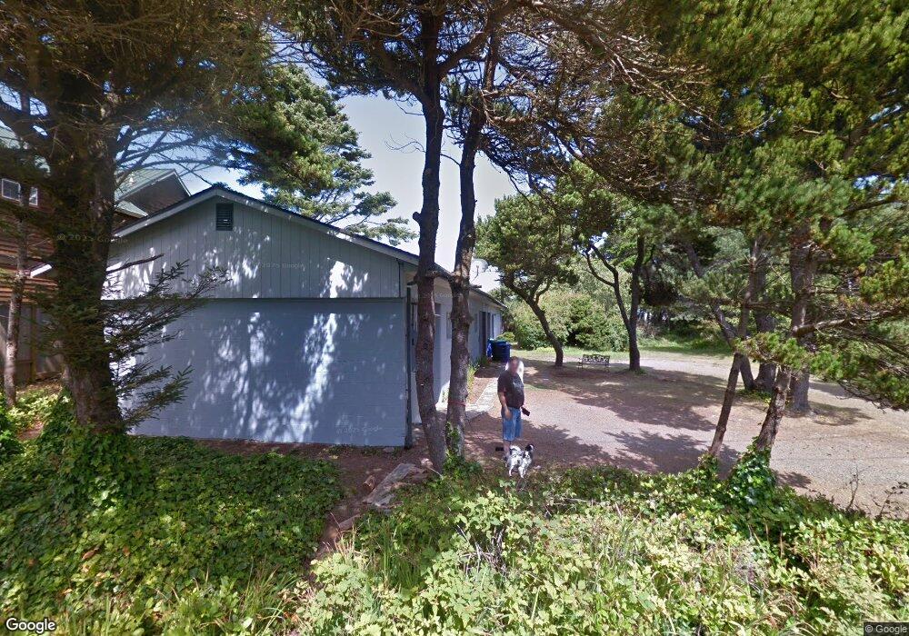
345 Ocean View Dr Depoe Bay, OR 97341
Lincoln Beach NeighborhoodEstimated Value: $517,019 - $859,000
2
Beds
2
Baths
2,229
Sq Ft
$292/Sq Ft
Est. Value
About This Home
This home is located at 345 Ocean View Dr, Depoe Bay, OR 97341 and is currently estimated at $650,505, approximately $291 per square foot. 345 Ocean View Dr is a home located in Lincoln County with nearby schools including Taft Elementary School, Oceanlake Elementary School, and Taft High School.
Ownership History
Date
Name
Owned For
Owner Type
Purchase Details
Closed on
Sep 19, 2025
Sold by
Bunn Stan
Bought by
Stanley E Bunn Trust and Bunn
Current Estimated Value
Purchase Details
Closed on
Apr 8, 2005
Sold by
Aman Barbara W
Bought by
Draper Daniel Lee and Draper Kathy A
Home Financials for this Owner
Home Financials are based on the most recent Mortgage that was taken out on this home.
Original Mortgage
$151,960
Interest Rate
5.77%
Mortgage Type
Fannie Mae Freddie Mac
Create a Home Valuation Report for This Property
The Home Valuation Report is an in-depth analysis detailing your home's value as well as a comparison with similar homes in the area
Home Values in the Area
Average Home Value in this Area
Purchase History
| Date | Buyer | Sale Price | Title Company |
|---|---|---|---|
| Stanley E Bunn Trust | -- | None Listed On Document | |
| Draper Daniel Lee | $189,950 | First American Title Ins Co |
Source: Public Records
Mortgage History
| Date | Status | Borrower | Loan Amount |
|---|---|---|---|
| Previous Owner | Draper Daniel Lee | $151,960 |
Source: Public Records
Tax History Compared to Growth
Tax History
| Year | Tax Paid | Tax Assessment Tax Assessment Total Assessment is a certain percentage of the fair market value that is determined by local assessors to be the total taxable value of land and additions on the property. | Land | Improvement |
|---|---|---|---|---|
| 2024 | $3,014 | $213,780 | -- | -- |
| 2023 | $2,114 | $159,010 | $0 | $0 |
| 2022 | $2,049 | $154,380 | $0 | $0 |
| 2021 | $1,920 | $149,890 | $0 | $0 |
| 2020 | $2,594 | $199,100 | $0 | $0 |
| 2019 | $2,400 | $193,310 | $0 | $0 |
| 2018 | $2,246 | $184,690 | $0 | $0 |
| 2017 | $2,311 | $187,680 | $0 | $0 |
| 2016 | $2,280 | $182,220 | $0 | $0 |
| 2015 | $2,124 | $174,520 | $0 | $0 |
| 2014 | $2,050 | $176,920 | $0 | $0 |
| 2013 | -- | $174,730 | $0 | $0 |
Source: Public Records
Map
Nearby Homes
- 319 Kinnikinnick Way
- 265 Bunchberry Way
- 4875 N Highway 101
- 4875 N Highway 101 Unit 20
- 4875 N Highway 101 Unit 2
- 4875 N Highway 101 Unit 93
- 4875 N Hwy 101 Unit 95
- 4875 N Hwy 101 Unit 15
- 4875 N Hwy 101 Unit 92
- 4875 N Hwy 101 Unit 45
- 4875 N Hwy 101 Unit 2
- 4875 N Hwy 101 Unit 93
- 5045 U S 101
- 5455 El Mundo Ave
- 5415 Hacienda Ave
- 5450 Hacienda Ave
- 5460 Palisades Dr
- 5460 Palisades Dr
- 0 Unit 203749614
- 6400 Division St
- 350 Ocean View Dr
- 330 Ocean View Dr
- 5120 Pelican Ln
- 335 Ocean View St
- 5110 Pelican Ln
- #8 Pelican Ln
- 3 Pelican Ln
- 8 Pelican Ln
- 1 Pelican Ln
- 2 Pelican Ln
- 330 Ocean View St
- 350 Ocean View St
- 205 Lancer St
- 5130 Pelican Ln
- 346 Oceanview St
- 5125 Pelican Ln
- 5115 Cavalier Ave
- 5125 Cavalier Ave
- 325 Lancer Unit 48
- 325 Lancer Unit 49