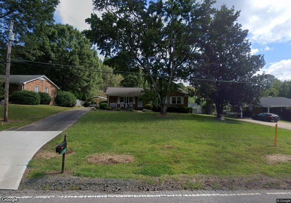
345 Olive Branch Rd Durham, NC 27703
Eastern Durham NeighborhoodEstimated Value: $311,911 - $406,000
3
Beds
2
Baths
1,409
Sq Ft
$266/Sq Ft
Est. Value
About This Home
This home is located at 345 Olive Branch Rd, Durham, NC 27703 and is currently estimated at $375,478, approximately $266 per square foot. 345 Olive Branch Rd is a home located in Durham County with nearby schools including Spring Valley Elementary School, John W Neal Middle School, and Southern School of Energy & Sustainability.
Ownership History
Date
Name
Owned For
Owner Type
Purchase Details
Closed on
Dec 7, 2022
Sold by
Vowell Barbara R
Bought by
Vowell Barbara R and Delong Donna D
Current Estimated Value
Create a Home Valuation Report for This Property
The Home Valuation Report is an in-depth analysis detailing your home's value as well as a comparison with similar homes in the area
Home Values in the Area
Average Home Value in this Area
Purchase History
| Date | Buyer | Sale Price | Title Company |
|---|---|---|---|
| Vowell Barbara R | -- | -- |
Source: Public Records
Tax History
| Year | Tax Paid | Tax Assessment Tax Assessment Total Assessment is a certain percentage of the fair market value that is determined by local assessors to be the total taxable value of land and additions on the property. | Land | Improvement |
|---|---|---|---|---|
| 2025 | $1,204 | $290,912 | $90,625 | $200,287 |
| 2024 | $1,044 | $171,018 | $36,325 | $134,693 |
| 2023 | $1,001 | $171,018 | $36,325 | $134,693 |
| 2022 | $963 | $171,018 | $36,325 | $134,693 |
| 2021 | $753 | $171,593 | $36,900 | $134,693 |
| 2020 | $735 | $171,593 | $36,900 | $134,693 |
| 2019 | $727 | $171,593 | $36,900 | $134,693 |
| 2018 | $699 | $151,523 | $44,280 | $107,243 |
| 2017 | $677 | $151,523 | $44,280 | $107,243 |
| 2016 | $656 | $151,523 | $44,280 | $107,243 |
| 2015 | $1,561 | $154,055 | $30,819 | $123,236 |
| 2014 | $1,569 | $154,055 | $30,819 | $123,236 |
Source: Public Records
Map
Nearby Homes
- 637 Conover Rd Unit B
- 639 Conover Rd Unit A
- 639 Conover Rd Unit B
- 635 Conover Rd Unit A
- 635 Conover Rd Unit B
- 2020 Rockface Way
- 2012 Sandwood Loch Dr
- 1116 Lily Loch Way
- 503 Hester Rd
- 505 Hester Rd
- 507 Hester Rd
- 511 Hester Rd
- 1417 Underbrush Dr
- 631 Ashburn Ln
- 800 Olive Branch Rd
- 1125 Arbor Edge Ln
- 3024 Bay Foal Ln
- 5923 Woodlawn Dr
- 3020 Bay Foal Ln
- 3018 Bay Foal Ln
- 401 Olive Branch Rd
- 339 Olive Branch Rd
- 333 Olive Branch Rd
- 344 Olive Branch Rd
- 404 Asbury Ct
- 327 Olive Branch Rd
- 378 Asbury Ct
- 330 Olive Branch Rd
- 353 Bandock Dr
- 321 Olive Branch Rd
- 345 Bandock Dr
- 324 Olive Branch Rd
- 341 Bandock Dr
- 320 Asbury Ct
- 328 Atwood Ct
- 320 Olive Branch Rd
- 333 Bandock Dr
- 323 Asbury Ct
- 316 Olive Branch Rd
- 319 Asbury Ct
Your Personal Tour Guide
Ask me questions while you tour the home.