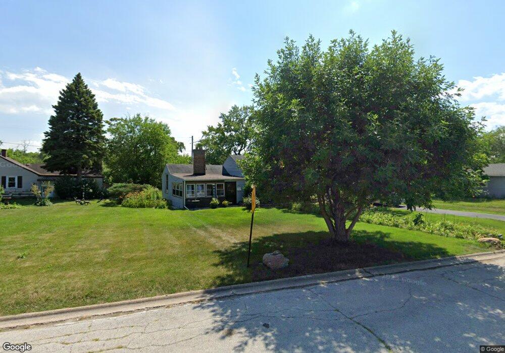
345 Riverside Dr Dolton, IL 60419
Estimated Value: $142,237 - $200,000
3
Beds
1
Bath
1,453
Sq Ft
$116/Sq Ft
Est. Value
About This Home
This home is located at 345 Riverside Dr, Dolton, IL 60419 and is currently estimated at $169,059, approximately $116 per square foot. 345 Riverside Dr is a home located in Cook County with nearby schools including Roosevelt Elementary School, Roosevelt Junior High School, and Thornton Township High School.
Ownership History
Date
Name
Owned For
Owner Type
Purchase Details
Closed on
Sep 29, 2000
Sold by
Fanning Terrence and Fanning Lauragene
Bought by
Wiley Michael Ann
Current Estimated Value
Home Financials for this Owner
Home Financials are based on the most recent Mortgage that was taken out on this home.
Original Mortgage
$84,867
Outstanding Balance
$29,428
Interest Rate
7.99%
Mortgage Type
FHA
Estimated Equity
$139,631
Create a Home Valuation Report for This Property
The Home Valuation Report is an in-depth analysis detailing your home's value as well as a comparison with similar homes in the area
Home Values in the Area
Average Home Value in this Area
Purchase History
| Date | Buyer | Sale Price | Title Company |
|---|---|---|---|
| Wiley Michael Ann | $85,000 | -- |
Source: Public Records
Mortgage History
| Date | Status | Borrower | Loan Amount |
|---|---|---|---|
| Open | Wiley Michael Ann | $84,867 |
Source: Public Records
Tax History Compared to Growth
Tax History
| Year | Tax Paid | Tax Assessment Tax Assessment Total Assessment is a certain percentage of the fair market value that is determined by local assessors to be the total taxable value of land and additions on the property. | Land | Improvement |
|---|---|---|---|---|
| 2025 | $4,462 | $9,138 | $3,543 | $5,595 |
| 2024 | $4,462 | $9,138 | $3,543 | $5,595 |
| 2023 | $805 | $10,100 | $3,543 | $6,557 |
| 2022 | $805 | $4,371 | $3,543 | $828 |
| 2021 | $871 | $4,369 | $3,542 | $827 |
| 2020 | $1,003 | $4,369 | $3,542 | $827 |
| 2019 | $2,492 | $6,272 | $3,306 | $2,966 |
| 2018 | $2,412 | $6,272 | $3,306 | $2,966 |
| 2017 | $2,318 | $6,272 | $3,306 | $2,966 |
| 2016 | $3,379 | $7,105 | $3,070 | $4,035 |
| 2015 | $3,185 | $7,105 | $3,070 | $4,035 |
| 2014 | $3,199 | $7,105 | $3,070 | $4,035 |
| 2013 | $3,434 | $7,925 | $3,070 | $4,855 |
Source: Public Records
Map
Nearby Homes
- 14359 Park Ave
- 14529 Clinton St
- 14321 Normal Ave
- 14920 Wentworth Ave
- 320 Streamside Dr
- 14506 Clinton St
- 14733 La Salle St
- 14916 La Salle St
- 14633 Parkside Dr
- 380 Calumet Blvd
- 14841 La Salle St
- 14643 La Salle St
- 14301 Parnell Ave
- 14727 Riverside Dr
- 310 W 145th Place
- 257 W 146th St
- 14533 S Parnell Ave
- 215 W 146th St
- 14455 Des Plaines St
- 345 Calumet Blvd
- 351 Riverside Dr
- 341 Riverside Dr
- 335 Riverside Dr
- 340 Riverside Dr
- 344 Riverside Dr
- 332 Riverside Dr
- 350 Riverside Dr
- 333 Riverside Dr
- 328 Riverside Dr
- 324 Riverside Dr
- 14750 Princeton Ave
- 325 Riverside Dr
- 14753 Princeton Ave
- 318 Riverside Dr
- 14746 Princeton Ave
- 14751 Princeton Ave
- 314 Riverside Dr
- 14744 Princeton Ave
- 310 N Riverside Dr
- 14749 Princeton Ave