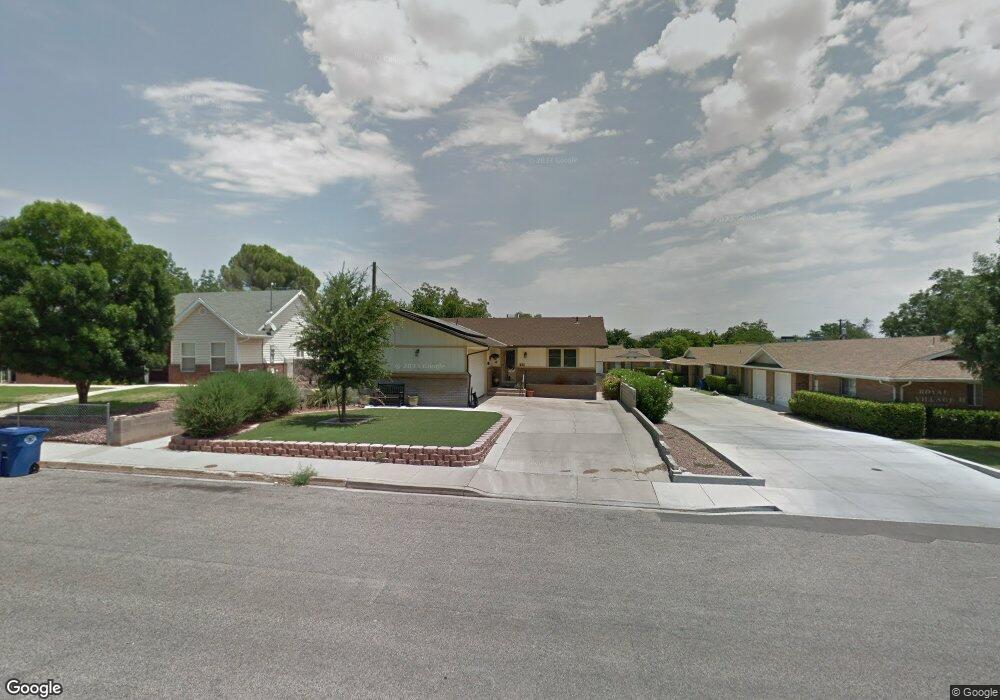
345 S 200 W Unit 12 Saint George, UT 84770
Estimated Value: $287,000 - $294,848
2
Beds
2
Baths
1,100
Sq Ft
$264/Sq Ft
Est. Value
About This Home
This home is located at 345 S 200 W Unit 12, Saint George, UT 84770 and is currently estimated at $289,962, approximately $263 per square foot. 345 S 200 W Unit 12 is a home located in Washington County with nearby schools including Heritage School, Dixie Middle School, and Dixie Intermediate School.
Ownership History
Date
Name
Owned For
Owner Type
Purchase Details
Closed on
Mar 7, 2007
Sold by
Wilson Ellene L
Bought by
Wilson Ellene L and The Ellene L Wilson Trust
Current Estimated Value
Home Financials for this Owner
Home Financials are based on the most recent Mortgage that was taken out on this home.
Original Mortgage
$90,000
Outstanding Balance
$54,386
Interest Rate
6.23%
Mortgage Type
Purchase Money Mortgage
Estimated Equity
$235,576
Create a Home Valuation Report for This Property
The Home Valuation Report is an in-depth analysis detailing your home's value as well as a comparison with similar homes in the area
Home Values in the Area
Average Home Value in this Area
Purchase History
| Date | Buyer | Sale Price | Title Company |
|---|---|---|---|
| Wilson Ellene L | -- | Meridian Title | |
| Wilson Ellene L | -- | Meridian Title |
Source: Public Records
Mortgage History
| Date | Status | Borrower | Loan Amount |
|---|---|---|---|
| Open | Wilson Ellene L | $90,000 |
Source: Public Records
Tax History Compared to Growth
Tax History
| Year | Tax Paid | Tax Assessment Tax Assessment Total Assessment is a certain percentage of the fair market value that is determined by local assessors to be the total taxable value of land and additions on the property. | Land | Improvement |
|---|---|---|---|---|
| 2025 | $1,020 | $148,720 | $33,000 | $115,720 |
| 2023 | $1,024 | $153,010 | $33,000 | $120,010 |
| 2022 | $1,104 | $155,155 | $33,000 | $122,155 |
| 2021 | $962 | $201,600 | $35,000 | $166,600 |
| 2020 | $877 | $173,000 | $35,000 | $138,000 |
| 2019 | $856 | $165,100 | $35,000 | $130,100 |
| 2018 | $805 | $77,770 | $0 | $0 |
| 2017 | $701 | $67,760 | $0 | $0 |
| 2016 | $721 | $64,405 | $0 | $0 |
| 2015 | $351 | $62,975 | $0 | $0 |
| 2014 | $627 | $54,120 | $0 | $0 |
Source: Public Records
Map
Nearby Homes
- 345 S 200 W Unit 3
- 155 W 300 S Unit 9
- 377 S 300 W
- 379 S 300 W
- 55 W 400 S Unit 15
- 295 S Main St
- 544 S 100 W Unit 3
- 135 S 100 St W
- 132 S 200 W
- 358 W 200 S
- 454 S 100 E Unit 10
- 433 S 100 E
- 55 E 700 S Unit 8
- 524 S 200 E Unit 3
- 270 S Donlee Dr Unit 5
- 96 S 200 E
- 800 W Bluff St S
- 578 S Cecita Way
- 590 S Cecita Way
- 663 W 65 S
- 345 S 200 W Unit 9
- 345 S 200 W Unit 8
- 345 S 200 W Unit 7
- 345 S 200 W Unit 6
- 345 S 200 W Unit 5
- 345 S 200 W Unit 4
- 345 S 200 W
- 345 S 200 W Unit 2
- 345 S 200 W Unit 10
- 345 S 200 W Unit 1
- 355 S 200 W
- 363 S 200 W
- 155 W 300 S Unit 8
- 155 W 300 S Unit 7
- 155 W 300 S Unit 6
- 155 W 300 S Unit 5
- 155 W 300 S Unit 4
- 155 W 300 S Unit 3
- 155 W 300 S Unit 2
- 155 W 300 S Unit 15