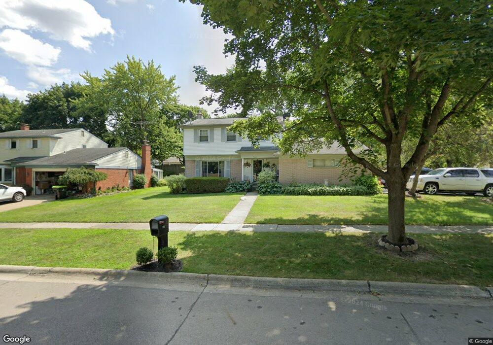
345 Sherrie Ln Northville, MI 48167
Estimated Value: $430,137 - $492,000
--
Bed
2
Baths
1,534
Sq Ft
$303/Sq Ft
Est. Value
About This Home
This home is located at 345 Sherrie Ln, Northville, MI 48167 and is currently estimated at $464,284, approximately $302 per square foot. 345 Sherrie Ln is a home located in Oakland County with nearby schools including Amerman Elementary School, Hillside Middle School, and Northville High School.
Ownership History
Date
Name
Owned For
Owner Type
Purchase Details
Closed on
Oct 10, 2003
Sold by
Tullai Karen V and Tullai Matthew R
Bought by
Tsilimingras Paraskevas E
Current Estimated Value
Purchase Details
Closed on
Apr 28, 2003
Sold by
Berlin Kristopher C and Tobin Berlin Leslie J
Bought by
Tullai Matthew R and Tullai Karen V
Purchase Details
Closed on
Jul 25, 1997
Sold by
Boyle Stephen L
Bought by
Berlin Kristopher C
Home Financials for this Owner
Home Financials are based on the most recent Mortgage that was taken out on this home.
Original Mortgage
$170,050
Interest Rate
7.68%
Mortgage Type
Purchase Money Mortgage
Create a Home Valuation Report for This Property
The Home Valuation Report is an in-depth analysis detailing your home's value as well as a comparison with similar homes in the area
Home Values in the Area
Average Home Value in this Area
Purchase History
| Date | Buyer | Sale Price | Title Company |
|---|---|---|---|
| Tsilimingras Paraskevas E | $250,000 | Metropolitan Title Company | |
| Tullai Matthew R | $250,000 | Metropolitan Title Company | |
| Berlin Kristopher C | $179,000 | -- |
Source: Public Records
Mortgage History
| Date | Status | Borrower | Loan Amount |
|---|---|---|---|
| Previous Owner | Berlin Kristopher C | $170,050 |
Source: Public Records
Tax History Compared to Growth
Tax History
| Year | Tax Paid | Tax Assessment Tax Assessment Total Assessment is a certain percentage of the fair market value that is determined by local assessors to be the total taxable value of land and additions on the property. | Land | Improvement |
|---|---|---|---|---|
| 2024 | $3,789 | $172,300 | $44,600 | $127,700 |
| 2023 | $4,150 | $162,400 | $39,300 | $123,100 |
| 2022 | $3,629 | $154,200 | $39,300 | $114,900 |
| 2021 | $3,778 | $154,100 | $39,300 | $114,800 |
| 2020 | $3,351 | $151,900 | $39,300 | $112,600 |
| 2018 | $3,497 | $127,400 | $0 | $0 |
Source: Public Records
Map
Nearby Homes
- 220 Ely Dr N
- 21082 Boulder Cir Unit 303
- 21054 Boulder Cir Unit 502
- 21856 N Center St
- 20900 Taft Rd
- 20730 Taft Rd
- 822 Springfield Dr
- 1202 Concord Ct Unit 67
- 816 Carpenter St
- 711 N Center St
- 48000 Eight Mile W
- 627 N Center St
- 621 N Center St
- 45167 9 Mile Rd
- 886 Yorktown Ct Unit N96
- 43564 Scenic Ln
- 635 N Center St
- 1002 Coldspring Dr
- 000 Horton Ave
- 744 Horton Ave
- 337 Sherrie Ln
- 344 N Ely Dr
- 344 Ely Dr N
- 336 Ely Dr N
- 331 Sherrie Ln Unit Bldg-Unit
- 331 Sherrie Ln
- 344 Sherrie Ln
- 338 Sherrie Ln
- 330 Ely Dr N
- 1131 Jeffrey Dr
- 1119 Jeffrey Dr
- 350 Sherrie Ln
- 325 Sherrie Ln
- 332 Sherrie Ln
- 1105 Jeffrey Dr
- 1139 Jeffrey Dr
- 324 Ely Dr N
- 1035 Jeffrey Dr
- 343 Ely Dr N
- 326 Sherrie Ln