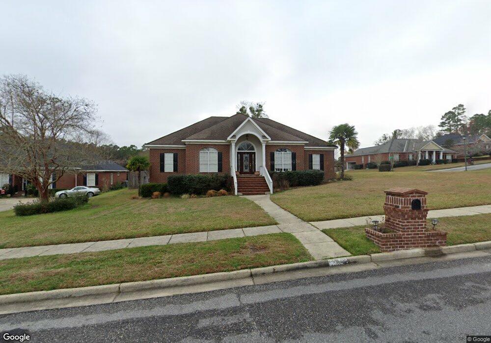
3450 Commonwealth Ct Mobile, AL 36695
Milkhouse NeighborhoodEstimated Value: $295,000 - $335,000
Studio
3
Baths
2,341
Sq Ft
$135/Sq Ft
Est. Value
About This Home
This home is located at 3450 Commonwealth Ct, Mobile, AL 36695 and is currently estimated at $315,550, approximately $134 per square foot. 3450 Commonwealth Ct is a home located in Mobile County with nearby schools including Olive J. Dodge Elementary School, Burns Middle School, and WP Davidson High School.
Ownership History
Date
Name
Owned For
Owner Type
Purchase Details
Closed on
Oct 24, 2007
Sold by
Politis Alexandra and Rouse Shawn C
Bought by
Politis Alexandra
Current Estimated Value
Home Financials for this Owner
Home Financials are based on the most recent Mortgage that was taken out on this home.
Original Mortgage
$232,500
Interest Rate
6.27%
Mortgage Type
Unknown
Purchase Details
Closed on
Sep 29, 2000
Sold by
Phenolchemie Inc
Bought by
Politis Alexandra and Rouse Shawn C
Home Financials for this Owner
Home Financials are based on the most recent Mortgage that was taken out on this home.
Original Mortgage
$164,000
Interest Rate
8.6%
Purchase Details
Closed on
Mar 19, 1998
Sold by
Forwood Mike General Contractor Inc
Bought by
Phenolchemie Inc
Create a Home Valuation Report for This Property
The Home Valuation Report is an in-depth analysis detailing your home's value as well as a comparison with similar homes in the area
Home Values in the Area
Average Home Value in this Area
Purchase History
| Date | Buyer | Sale Price | Title Company |
|---|---|---|---|
| Politis Alexandra | $307,500 | None Available | |
| Politis Alexandra | -- | -- | |
| Phenolchemie Inc | -- | -- |
Source: Public Records
Mortgage History
| Date | Status | Borrower | Loan Amount |
|---|---|---|---|
| Closed | Politis Alexandra | $232,500 | |
| Closed | Politis Alexandra | $164,000 |
Source: Public Records
Tax History
| Year | Tax Paid | Tax Assessment Tax Assessment Total Assessment is a certain percentage of the fair market value that is determined by local assessors to be the total taxable value of land and additions on the property. | Land | Improvement |
|---|---|---|---|---|
| 2025 | $1,736 | $28,230 | $4,800 | $23,430 |
| 2024 | $1,736 | $26,850 | $4,200 | $22,650 |
| 2023 | $1,649 | $24,080 | $4,200 | $19,880 |
| 2022 | $1,477 | $24,310 | $4,200 | $20,110 |
| 2021 | $1,442 | $23,750 | $4,200 | $19,550 |
| 2020 | $1,456 | $23,970 | $4,200 | $19,770 |
| 2019 | $1,418 | $23,380 | $0 | $0 |
| 2018 | $1,432 | $23,600 | $0 | $0 |
| 2017 | $1,373 | $22,680 | $0 | $0 |
| 2016 | $1,383 | $22,840 | $0 | $0 |
| 2013 | $1,335 | $21,900 | $0 | $0 |
Source: Public Records
Map
Nearby Homes
- 3312 Dundee Ct
- 6504 Heritage Trace Ct
- 6567 Addison Woods Dr
- 6409 Cherry Ridge Ct E
- 6583 Addison Woods Dr
- 0 Autumn Ridge Dr W
- 0 Stone Mill Dr Unit 7570233
- 0 Stone Mill Dr Unit 9 381415
- 0 Stone Mill Ct Unit 7715820
- 0 Stone Mill Ct Unit 1
- 6169 Foxtail Dr
- 3149 Wellborne Dr W
- 3101 Autumn Ridge Dr W
- 6709 Autumn Ridge Dr
- 3104 Autumn Ridge Ct
- 6239 Southridge Rd S
- 3140 Lloyds Ln
- 0 Sollie Rd
- 6128 Lindholm Dr S
- 2913 Steeple Chase Ct S
- 3454 Commonwealth Ct
- 3437 Windsor Place Ct
- 3413 Parliament Ct
- 3412 Parliament Ct
- 3458 Commonwealth Ct
- 3441 Windsor Place Ct
- 3451 Commonwealth Ct
- 3455 Commonwealth Ct
- 3409 Parliament Ct
- 3412 Grenadier Ct
- 3408 Parliament Ct
- 3459 Commonwealth Ct
- 3433 Windsor Place Ct
- 3445 Windsor Place Ct
- 6463 Windsor Dr
- 3408 Grenadier Ct
- 3405 Parliament Ct
- 3436 Windsor Place Ct
- 3478 Royalty Ct
- 3429 Windsor Place Ct
Your Personal Tour Guide
Ask me questions while you tour the home.