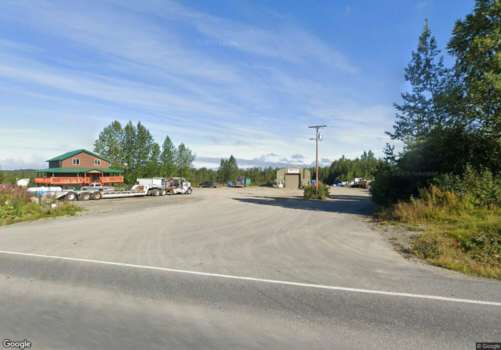
34520 North Fork Rd Anchor Point, AK 99556
Estimated Value: $93,000 - $614,203
--
Bed
1
Bath
2,317
Sq Ft
$166/Sq Ft
Est. Value
About This Home
This home is located at 34520 North Fork Rd, Anchor Point, AK 99556 and is currently estimated at $384,401, approximately $165 per square foot. 34520 North Fork Rd is a home located in Kenai Peninsula Borough with nearby schools including Chapman School and Homer High School.
Ownership History
Date
Name
Owned For
Owner Type
Purchase Details
Closed on
Nov 5, 2024
Sold by
Squires-Roderick Shanna M and Roderick Marc A
Bought by
Roderick Ethan Wolf
Current Estimated Value
Purchase Details
Closed on
May 21, 2001
Sold by
Symens Gerald Lee and Symens Jane L
Bought by
Symens Jeffery James
Purchase Details
Closed on
Jan 17, 2001
Sold by
Symens Gerald L
Bought by
Symens Jeffery James
Create a Home Valuation Report for This Property
The Home Valuation Report is an in-depth analysis detailing your home's value as well as a comparison with similar homes in the area
Home Values in the Area
Average Home Value in this Area
Purchase History
| Date | Buyer | Sale Price | Title Company |
|---|---|---|---|
| Roderick Ethan Wolf | -- | None Listed On Document | |
| Roderick Ethan Wolf | -- | None Listed On Document | |
| Symens Jeffery James | -- | -- | |
| Symens Jeffery James | -- | -- |
Source: Public Records
Tax History Compared to Growth
Tax History
| Year | Tax Paid | Tax Assessment Tax Assessment Total Assessment is a certain percentage of the fair market value that is determined by local assessors to be the total taxable value of land and additions on the property. | Land | Improvement |
|---|---|---|---|---|
| 2025 | $4,367 | $552,500 | $89,800 | $462,700 |
| 2024 | $4,367 | $423,600 | $80,700 | $342,900 |
| 2023 | $3,425 | $318,000 | $67,400 | $250,600 |
| 2022 | $2,133 | $192,300 | $58,800 | $133,500 |
| 2021 | $1,448 | $169,500 | $57,000 | $112,500 |
| 2020 | $1,561 | $139,500 | $57,000 | $82,500 |
| 2019 | $1,512 | $135,600 | $52,600 | $83,000 |
| 2018 | $1,448 | $129,900 | $52,600 | $77,300 |
| 2017 | $1,415 | $129,200 | $52,600 | $76,600 |
| 2016 | $1,378 | $125,800 | $52,600 | $73,200 |
| 2015 | $944 | $120,400 | $52,600 | $67,800 |
| 2014 | $944 | $124,600 | $52,600 | $72,000 |
Source: Public Records
Map
Nearby Homes
- 34581 N Fork Rd
- 70975 Mark Ln
- 31885 Whiskey Gulch St
- 31890 Whiskey Gulch St
- 72278 Valleyside Ave
- 71776 Cape Ninilchik Ave
- 31315 Birch Haven Rd
- 35232 N Fork Rd
- 34728 N Fork Rd
- 32425 Sterling Hwy
- 33045 Sterling Hwy
- 31435 Rorath St
- 32879 Shorebird Ln
- 32775 Shorebird Ln
- 72715 Kingair Ave
- 73340 School Ave
- 34191 Chapman St
- L3 Aquila Wings Rd
- L1 Aquila Wings Rd
- L7 Brow Tine Rd
- 32590 Dads Cir
- 34550 North Fork Rd
- 34520 N Fork Rd
- 34510 N Fork Rd
- 32595 Dads Cir
- 32725 Dads Cir
- 32725 Dad's Cir
- L8&9 N Fork Rd
- L1 Cosmic Cir
- 32670 Comic Cir
- L6&11 N Fork Rd
- L6&11 B3 N Fork Rd
- L6 B3 N Fork Rd
- 34533 North Fork Rd
- L2 N Fork Rd Mi Unit 2.2
- L2 N Fork Rd Mi
- 32770 Comic Cir
- 34525 North Fork Rd
- 71066 Greenfield Rd
- 34537 North Fork Rd
