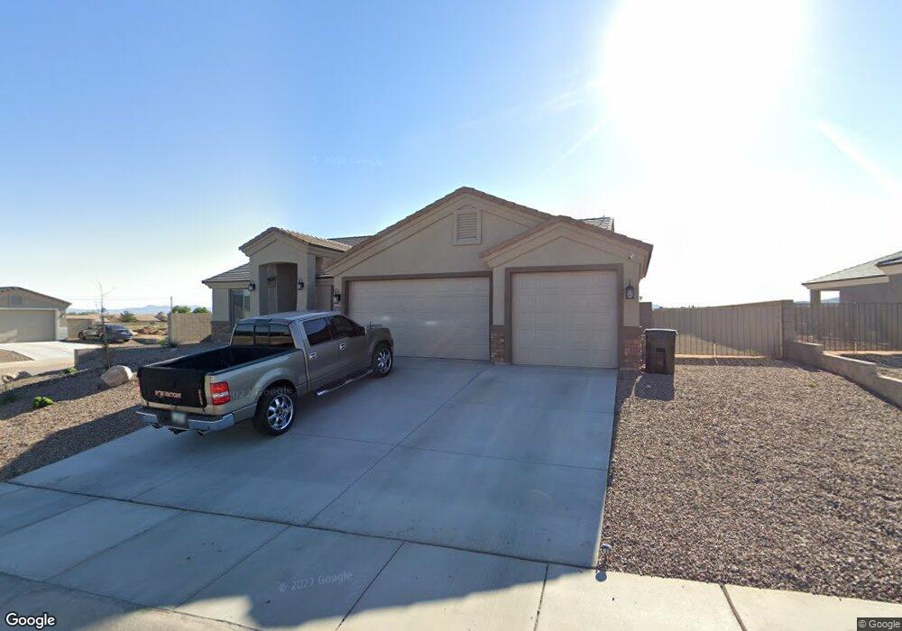
3458 Mcclintock St Kingman, AR 86401
Estimated Value: $393,000 - $410,000
--
Bed
2
Baths
1,934
Sq Ft
$208/Sq Ft
Est. Value
About This Home
This home is located at 3458 Mcclintock St, Kingman, AR 86401 and is currently estimated at $401,400, approximately $207 per square foot. 3458 Mcclintock St is a home located in Mohave County with nearby schools including Hualapai Elementary School, White Cliffs Middle School, and Kingman High School.
Ownership History
Date
Name
Owned For
Owner Type
Purchase Details
Closed on
Feb 8, 2022
Sold by
Angle Homes Inc
Bought by
Oliva Glace C and Oliva Kim I
Current Estimated Value
Home Financials for this Owner
Home Financials are based on the most recent Mortgage that was taken out on this home.
Original Mortgage
$385,575
Outstanding Balance
$358,637
Interest Rate
3.69%
Mortgage Type
New Conventional
Estimated Equity
$42,763
Purchase Details
Closed on
Nov 2, 2021
Sold by
High Desert Land Development Llc
Bought by
Angle Homes Inc
Purchase Details
Closed on
Jul 5, 2019
Sold by
Pioneer Title Agency Inc
Bought by
High Desert Land Holdings Llc
Create a Home Valuation Report for This Property
The Home Valuation Report is an in-depth analysis detailing your home's value as well as a comparison with similar homes in the area
Home Values in the Area
Average Home Value in this Area
Purchase History
| Date | Buyer | Sale Price | Title Company |
|---|---|---|---|
| Oliva Glace C | $397,500 | Pioneer Title | |
| Angle Homes Inc | $1,402,000 | None Available | |
| High Desert Land Holdings Llc | $667,500 | Pioneer Title Agency Inc |
Source: Public Records
Mortgage History
| Date | Status | Borrower | Loan Amount |
|---|---|---|---|
| Open | Oliva Glace C | $385,575 |
Source: Public Records
Tax History Compared to Growth
Tax History
| Year | Tax Paid | Tax Assessment Tax Assessment Total Assessment is a certain percentage of the fair market value that is determined by local assessors to be the total taxable value of land and additions on the property. | Land | Improvement |
|---|---|---|---|---|
| 2026 | $598 | -- | -- | -- |
| 2025 | $1,231 | $31,935 | $0 | $0 |
| 2024 | $1,231 | $30,301 | $0 | $0 |
| 2023 | $1,231 | $28,734 | $0 | $0 |
| 2022 | $348 | $569 | $0 | $0 |
| 2021 | $21 | $569 | $0 | $0 |
| 2019 | $19 | $712 | $0 | $0 |
| 2018 | $20 | $712 | $0 | $0 |
| 2017 | $18 | $535 | $0 | $0 |
| 2016 | $18 | $519 | $0 | $0 |
| 2015 | $19 | $173 | $0 | $0 |
Source: Public Records
Map
Nearby Homes
- 3616 Heather Ave
- 3398 Charleston St
- TBD Airway Ave
- 3420 Rosewood St
- 3672 Wheatland Ave
- 3668 Wheatland Ave
- 3425 Rosewood St
- 3656 Wheatland Ave
- 3660 Wheatland Ave
- 3336 Charleston St
- 3481 N Sage St
- 3325 Charleston St
- 3317 Charleston St
- 3321 Charleston St
- 000 N Airway Ave
- 3615 Charleston Loop
- 3568 Charleston Loop
- 3564 Charleston Loop
- 3607 Charleston Loop
- 3854 Heather Ave