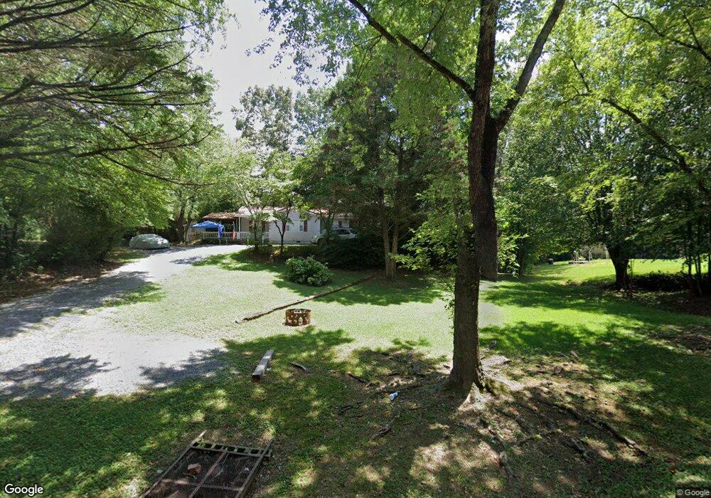
3459 Airport Rd SE Dalton, GA 30721
Estimated Value: $144,000 - $250,000
3
Beds
1
Bath
1,423
Sq Ft
$133/Sq Ft
Est. Value
About This Home
This home is located at 3459 Airport Rd SE, Dalton, GA 30721 and is currently estimated at $189,530, approximately $133 per square foot. 3459 Airport Rd SE is a home located in Whitfield County with nearby schools including Cedar Ridge Elementary School, Eastbrook Middle School, and Southeast Whitfield County High School.
Ownership History
Date
Name
Owned For
Owner Type
Purchase Details
Closed on
Jun 25, 2021
Sold by
Davis John E
Bought by
Sierra Properties Llc
Current Estimated Value
Purchase Details
Closed on
May 5, 2005
Sold by
Headrick H Ladane
Bought by
Davis John E
Purchase Details
Closed on
Aug 26, 2004
Sold by
Douglas Janelle and Sattler Lynda Chapman
Bought by
Davis John E
Purchase Details
Closed on
Dec 3, 2003
Sold by
Headrick H Ladane
Bought by
Sattler Lynda Chapman
Purchase Details
Closed on
Jan 3, 2000
Sold by
Headrick Harold
Bought by
Douglas Janelle Etal
Create a Home Valuation Report for This Property
The Home Valuation Report is an in-depth analysis detailing your home's value as well as a comparison with similar homes in the area
Home Values in the Area
Average Home Value in this Area
Purchase History
| Date | Buyer | Sale Price | Title Company |
|---|---|---|---|
| Sierra Properties Llc | -- | None Listed On Document | |
| Davis John E | $90,000 | -- | |
| Davis John E | $75,000 | -- | |
| Sattler Lynda Chapman | -- | -- | |
| Douglas Janelle Etal | -- | -- |
Source: Public Records
Tax History Compared to Growth
Tax History
| Year | Tax Paid | Tax Assessment Tax Assessment Total Assessment is a certain percentage of the fair market value that is determined by local assessors to be the total taxable value of land and additions on the property. | Land | Improvement |
|---|---|---|---|---|
| 2024 | $122 | $48,863 | $8,813 | $40,050 |
| 2023 | $122 | $31,315 | $5,640 | $25,675 |
| 2022 | $89 | $28,326 | $5,535 | $22,791 |
| 2021 | $1,542 | $52,274 | $8,557 | $43,717 |
| 2020 | $760 | $24,906 | $3,712 | $21,194 |
| 2019 | $772 | $24,906 | $3,712 | $21,194 |
| 2018 | $761 | $24,149 | $2,955 | $21,194 |
| 2017 | $761 | $24,149 | $2,955 | $21,194 |
| 2016 | $674 | $22,339 | $2,955 | $19,384 |
| 2014 | $642 | $23,856 | $4,578 | $19,277 |
| 2013 | -- | $23,855 | $4,578 | $19,277 |
Source: Public Records
Map
Nearby Homes
- 00 Tibbs Bridge Rd
- TBD Old Grade Rd
- 0 Old Grade Rd
- 01 Headrick Cir SE
- 00 Headrick Cir SE
- 3657 Airport Rd
- 118 Hill Rd
- 296 Wagner Dr
- 0 Tibbs Bridge Rd SE
- 136 Wiltshire Dr
- 00 Hill Rd
- 307 Gay St
- 00 Wooten Dr
- 1142 Ben Hill Rd SE
- 115 Wooten Dr
- 1401 Eastbrook Dr SE
- 143 Staten St
- 213 Nashville St
- 359 Pacer Ln Unit 4
- 1271 Ridge Rd SE
- 3461 Airport Rd SE
- 3130 Circleview Dr SE
- 3134 Circleview Dr SE
- 3142 Circleview Dr SE
- 3123 Headrick Cir SE
- 3114 Circleview Dr SE
- 3141 Circleview Dr SE
- 3143 Circleview Dr SE
- 3147 Circleview Dr SE
- 3123 Circleview Dr SE
- 3110 Circleview Dr SE
- 3162 Circleview Dr SE
- 3109 Headrick Cir SE
- 3159 Circleview Dr SE
- 3105 Headrick Cir SE
- 3161 Circleview Dr SE
- 120 Greenbay Dr
- 120 Greenbay Dr
- 122 Greenbay Dr
- 3463 Airport Rd