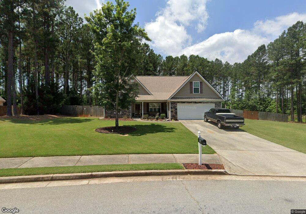
346 Laurel Ln Social Circle, GA 30025
Estimated Value: $346,808 - $380,000
--
Bed
--
Bath
1,816
Sq Ft
$201/Sq Ft
Est. Value
About This Home
This home is located at 346 Laurel Ln, Social Circle, GA 30025 and is currently estimated at $365,452, approximately $201 per square foot. 346 Laurel Ln is a home located in Walton County with nearby schools including Social Circle Primary School, Social Circle Elementary School, and Social Circle Middle School.
Ownership History
Date
Name
Owned For
Owner Type
Purchase Details
Closed on
Jul 16, 2008
Sold by
Lewis Audrey L
Bought by
Wanek John H and Wanek Peggy M
Current Estimated Value
Home Financials for this Owner
Home Financials are based on the most recent Mortgage that was taken out on this home.
Original Mortgage
$131,900
Outstanding Balance
$84,920
Interest Rate
6.03%
Mortgage Type
New Conventional
Estimated Equity
$280,532
Create a Home Valuation Report for This Property
The Home Valuation Report is an in-depth analysis detailing your home's value as well as a comparison with similar homes in the area
Home Values in the Area
Average Home Value in this Area
Purchase History
| Date | Buyer | Sale Price | Title Company |
|---|---|---|---|
| Wanek John H | $164,900 | -- |
Source: Public Records
Mortgage History
| Date | Status | Borrower | Loan Amount |
|---|---|---|---|
| Open | Wanek John H | $131,900 |
Source: Public Records
Tax History Compared to Growth
Tax History
| Year | Tax Paid | Tax Assessment Tax Assessment Total Assessment is a certain percentage of the fair market value that is determined by local assessors to be the total taxable value of land and additions on the property. | Land | Improvement |
|---|---|---|---|---|
| 2024 | $3,555 | $118,680 | $24,000 | $94,680 |
| 2023 | $3,405 | $110,160 | $22,000 | $88,160 |
| 2022 | $569 | $90,200 | $17,000 | $73,200 |
| 2021 | $569 | $78,720 | $15,200 | $63,520 |
| 2020 | $583 | $72,280 | $14,000 | $58,280 |
| 2019 | $596 | $64,880 | $12,000 | $52,880 |
| 2018 | $596 | $64,880 | $12,000 | $52,880 |
| 2017 | $2,633 | $63,000 | $12,000 | $51,000 |
| 2016 | $613 | $58,120 | $12,000 | $46,120 |
| 2015 | $497 | $48,160 | $8,000 | $40,160 |
| 2014 | $477 | $44,120 | $8,000 | $36,120 |
Source: Public Records
Map
Nearby Homes
- 1077 Riverstone Dr
- 1021 Riverstone Dr
- 318 Richmond Dr
- 433 Clover Dr
- 100 Saint Andrews Ct
- 226 Rogue Rd
- 443 Windsong Ln
- 1244 Morrow Dr
- 741 Jackson Ct
- 357 W Hightower Trail
- 246 Azalea Farms Rd
- 843 Crossroads Ct
- 960 Park Place St
- 821 Crossroads Ct
- 939 Park Place St
- 815 Crossroads Ct
- 381 Crossroads Dr
- 695 Park Place Way
- 670 Park Place Way
- 690 Park Place Way