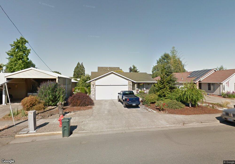
346 N Bridge St Sheridan, OR 97378
Estimated Value: $356,000 - $369,423
3
Beds
3
Baths
1,182
Sq Ft
$307/Sq Ft
Est. Value
About This Home
This home is located at 346 N Bridge St, Sheridan, OR 97378 and is currently estimated at $363,106, approximately $307 per square foot. 346 N Bridge St is a home located in Yamhill County with nearby schools including Faulconer-Chapman School, Sheridan High School, and Sheridan Allprep Academy.
Ownership History
Date
Name
Owned For
Owner Type
Purchase Details
Closed on
May 2, 2016
Bought by
Ballantyne Lloyd R
Current Estimated Value
Home Financials for this Owner
Home Financials are based on the most recent Mortgage that was taken out on this home.
Original Mortgage
$115,425
Outstanding Balance
$91,389
Interest Rate
3.66%
Estimated Equity
$271,717
Create a Home Valuation Report for This Property
The Home Valuation Report is an in-depth analysis detailing your home's value as well as a comparison with similar homes in the area
Home Values in the Area
Average Home Value in this Area
Purchase History
| Date | Buyer | Sale Price | Title Company |
|---|---|---|---|
| Ballantyne Lloyd R | -- | -- |
Source: Public Records
Mortgage History
| Date | Status | Borrower | Loan Amount |
|---|---|---|---|
| Open | Ballantyne Lloyd R | $115,425 | |
| Closed | Ballantyne Lloyd R | -- |
Source: Public Records
Tax History Compared to Growth
Tax History
| Year | Tax Paid | Tax Assessment Tax Assessment Total Assessment is a certain percentage of the fair market value that is determined by local assessors to be the total taxable value of land and additions on the property. | Land | Improvement |
|---|---|---|---|---|
| 2025 | $2,656 | $195,919 | -- | -- |
| 2024 | $2,439 | $190,213 | -- | -- |
| 2023 | $2,368 | $184,673 | $0 | $0 |
| 2022 | $2,303 | $179,294 | $0 | $0 |
| 2021 | $2,607 | $174,072 | $0 | $0 |
| 2020 | $2,518 | $169,002 | $0 | $0 |
| 2019 | $2,474 | $164,080 | $0 | $0 |
| 2018 | $2,404 | $159,301 | $0 | $0 |
| 2017 | $2,359 | $154,661 | $0 | $0 |
| 2016 | $2,273 | $150,156 | $0 | $0 |
| 2015 | $2,176 | $145,784 | $0 | $0 |
| 2014 | $2,045 | $139,627 | $0 | $0 |
Source: Public Records
Map
Nearby Homes
- 119 NW Sherman St
- 240 NW Sagan Loop
- 328 NW Sherman St
- 370 NW Yamhill St
- 1200 Blk NE Center St Unit Parcel 4
- 0 NE Center St Unit 1 491349230
- 0 NE Center St Unit 2 430429617
- 0 NE Center St Unit 3 552444847
- 0 NE Center St Unit 4 271594201
- 510 NE Hill St
- 243 SE Harney St
- 204 SW Water St
- 1200 NE Center St Unit Par 1
- 1200 NE Center St Unit Parce2
- 1200 NE Center St Unit Par3
- 347 NE Oak St
- 518 S Bridge St
- 0 NW Viola St
- 617 SW Monroe St
- 419 SE Sheridan Rd
- 348 N Bridge St
- 216 NW Sagan Loop
- 344 N Bridge St
- 350 N Bridge St Unit 1
- 350 N Bridge St
- 214 NW Sagan Loop
- 217 NW Sagan Loop
- 212 NW Sagan Loop
- 365 NW Washington St
- 352 N Bridge St
- 222 NW Sagan Loop
- 347 N Bridge St
- 351 N Bridge St
- 220 NW Sagan Loop
- 210 NW Sagan Loop
- 339 N Bridge St
- 310 N Bridge St
- 354 N Bridge St
- 353 N Bridge St
- 139 NW Sherman St