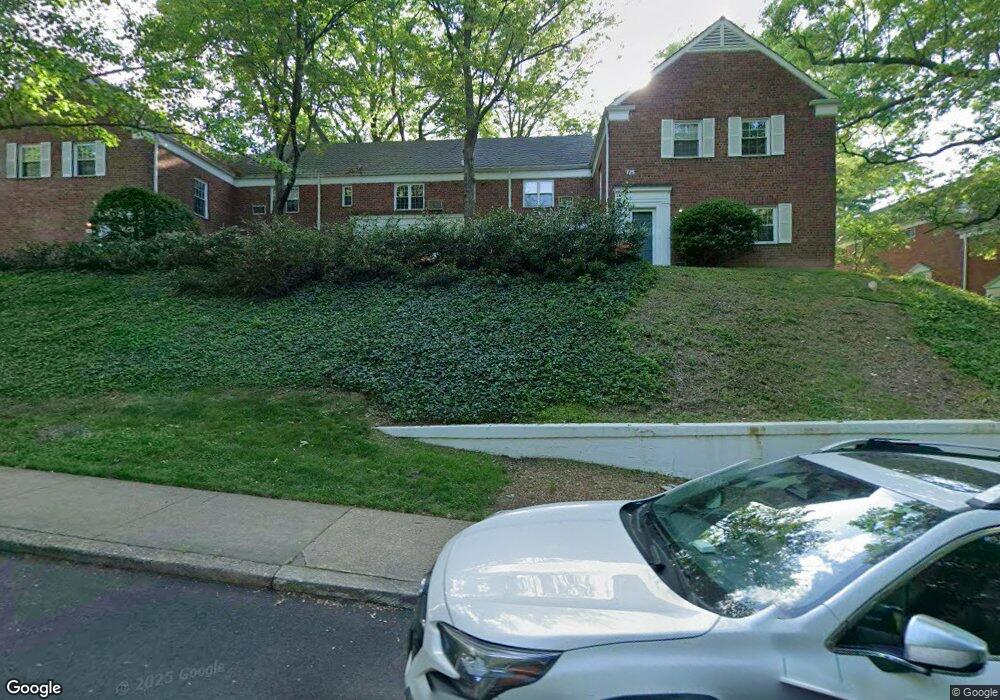
3460 Gunston Rd Alexandria, VA 22302
North Ridge NeighborhoodEstimated Value: $447,000 - $490,351
3
Beds
1
Bath
1,170
Sq Ft
$402/Sq Ft
Est. Value
About This Home
This home is located at 3460 Gunston Rd, Alexandria, VA 22302 and is currently estimated at $469,784, approximately $401 per square foot. 3460 Gunston Rd is a home located in Alexandria City with nearby schools including Charles Barrett Elementary School, George Washington Middle School, and Alexandria City High School.
Ownership History
Date
Name
Owned For
Owner Type
Purchase Details
Closed on
Mar 12, 1999
Sold by
Dewree Mary R
Bought by
Larsen William L
Current Estimated Value
Home Financials for this Owner
Home Financials are based on the most recent Mortgage that was taken out on this home.
Original Mortgage
$96,800
Outstanding Balance
$23,388
Interest Rate
6.73%
Estimated Equity
$446,396
Purchase Details
Closed on
Feb 25, 1998
Sold by
Kurtz + Stephen G
Bought by
Dewree Mary R
Home Financials for this Owner
Home Financials are based on the most recent Mortgage that was taken out on this home.
Original Mortgage
$103,500
Interest Rate
6.85%
Mortgage Type
New Conventional
Create a Home Valuation Report for This Property
The Home Valuation Report is an in-depth analysis detailing your home's value as well as a comparison with similar homes in the area
Home Values in the Area
Average Home Value in this Area
Purchase History
| Date | Buyer | Sale Price | Title Company |
|---|---|---|---|
| Larsen William L | $121,000 | -- | |
| Dewree Mary R | $115,000 | Island Title Corp |
Source: Public Records
Mortgage History
| Date | Status | Borrower | Loan Amount |
|---|---|---|---|
| Open | Larsen William L | $96,800 | |
| Previous Owner | Dewree Mary R | $103,500 |
Source: Public Records
Tax History Compared to Growth
Tax History
| Year | Tax Paid | Tax Assessment Tax Assessment Total Assessment is a certain percentage of the fair market value that is determined by local assessors to be the total taxable value of land and additions on the property. | Land | Improvement |
|---|---|---|---|---|
| 2025 | $5,113 | $495,562 | $165,015 | $330,547 |
| 2024 | $5,113 | $442,696 | $157,157 | $285,539 |
| 2023 | $4,865 | $438,313 | $155,601 | $282,712 |
| 2022 | $4,770 | $429,719 | $152,550 | $277,169 |
| 2021 | $4,676 | $421,257 | $149,523 | $271,734 |
| 2020 | $4,244 | $382,961 | $135,930 | $247,031 |
| 2019 | $4,083 | $361,283 | $128,235 | $233,048 |
| 2018 | $3,964 | $350,761 | $124,500 | $226,261 |
| 2017 | $3,851 | $340,795 | $121,125 | $219,670 |
| 2016 | $3,730 | $347,589 | $121,125 | $226,464 |
| 2015 | $3,625 | $347,589 | $121,125 | $226,464 |
| 2014 | $3,535 | $338,879 | $121,125 | $217,754 |
Source: Public Records
Map
Nearby Homes
- 3325 Valley Dr
- 3519 Valley Dr
- 1609 Preston Rd
- 3508 Valley Dr
- 1649 Preston Rd
- 1650 Preston Rd
- 1603 Mount Eagle Place
- 3614 Valley Dr
- 1615 Mount Eagle Place
- 1119 Beverley Dr
- 1640 Fitzgerald Ln
- 3513 Martha Custis Dr
- 3606 Greenway Place
- 1002 Beverley Dr
- 3476 Martha Custis Dr
- 3249 Martha Custis Dr Unit 847
- 3721 Gunston Rd
- 1121 Allison St
- 3492 Martha Custis Dr
- 3460 Martha Custis Dr
- 3458 Gunston Rd
- 3462 Gunston Rd
- 3462 Gunston Rd Unit 725-34
- 3464 Gunston Rd
- 3466 Gunston Rd
- 3466 Gunston Rd Unit 725
- 3450 Gunston Rd Unit 727-34
- 3450 Gunston Rd
- 3450 Gunston Rd Unit 3450
- 3450 Gunston Rd Unit NONE
- 3454 Gunston Rd
- 3446 Gunston Rd
- 3452 Gunston Rd
- 3452 Gunston Rd Unit 727
- 3446 Gunston Rd Unit 727
- 3446 Gunston Rd Unit 727-34
- 3446 Gunston Rd Unit 726
- 3452 Gunston Rd Unit 727-34
- 3448 Gunston Rd
- 3488 Gunston Rd