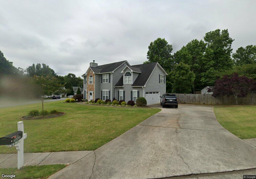
3465 Duncan Bridge Dr Buford, GA 30519
Estimated Value: $399,000 - $421,545
3
Beds
2
Baths
2,007
Sq Ft
$204/Sq Ft
Est. Value
About This Home
This home is located at 3465 Duncan Bridge Dr, Buford, GA 30519 and is currently estimated at $408,886, approximately $203 per square foot. 3465 Duncan Bridge Dr is a home located in Gwinnett County with nearby schools including Ivy Creek Elementary School, Glenn C. Jones Middle School, and Celebration Academy.
Ownership History
Date
Name
Owned For
Owner Type
Purchase Details
Closed on
Mar 20, 2017
Sold by
Hayward Daniel A
Bought by
Roe Christopher F and Roe Kimberly H
Current Estimated Value
Home Financials for this Owner
Home Financials are based on the most recent Mortgage that was taken out on this home.
Original Mortgage
$192,000
Outstanding Balance
$158,745
Interest Rate
4.15%
Mortgage Type
New Conventional
Estimated Equity
$250,141
Purchase Details
Closed on
Mar 7, 2014
Sold by
Tomaino Patrick
Bought by
Hayward Daniel A
Home Financials for this Owner
Home Financials are based on the most recent Mortgage that was taken out on this home.
Original Mortgage
$114,880
Interest Rate
4.25%
Mortgage Type
FHA
Purchase Details
Closed on
Dec 31, 1998
Sold by
Parker Built Homes Inc
Bought by
Tomaino Patrick and Tuffe Pame
Create a Home Valuation Report for This Property
The Home Valuation Report is an in-depth analysis detailing your home's value as well as a comparison with similar homes in the area
Home Values in the Area
Average Home Value in this Area
Purchase History
| Date | Buyer | Sale Price | Title Company |
|---|---|---|---|
| Roe Christopher F | $205,000 | -- | |
| Roe Christopher F | $205,000 | -- | |
| Hayward Daniel A | $117,000 | -- | |
| Hayward Daniel A | $117,000 | -- | |
| Tomaino Patrick | $135,700 | -- | |
| Tomaino Patrick | $135,700 | -- |
Source: Public Records
Mortgage History
| Date | Status | Borrower | Loan Amount |
|---|---|---|---|
| Open | Roe Christopher F | $192,000 | |
| Previous Owner | Hayward Daniel A | $114,880 |
Source: Public Records
Tax History Compared to Growth
Tax History
| Year | Tax Paid | Tax Assessment Tax Assessment Total Assessment is a certain percentage of the fair market value that is determined by local assessors to be the total taxable value of land and additions on the property. | Land | Improvement |
|---|---|---|---|---|
| 2025 | $5,650 | $149,640 | $32,800 | $116,840 |
| 2024 | $6,047 | $157,960 | $34,000 | $123,960 |
| 2023 | $6,047 | $139,520 | $30,400 | $109,120 |
| 2022 | $5,074 | $131,480 | $27,200 | $104,280 |
| 2021 | $4,022 | $100,560 | $22,360 | $78,200 |
| 2020 | $3,902 | $96,640 | $20,720 | $75,920 |
| 2019 | $3,461 | $88,200 | $17,920 | $70,280 |
| 2018 | $2,692 | $66,240 | $14,400 | $51,840 |
| 2016 | $2,710 | $66,240 | $14,400 | $51,840 |
| 2015 | $2,044 | $46,800 | $12,000 | $34,800 |
| 2014 | $2,132 | $54,944 | $10,200 | $44,744 |
Source: Public Records
Map
Nearby Homes
- 3475 Duncan Bridge Dr Unit 2
- 2415 Hamilton Parc Ln
- 2485 Hamilton Parc Ln
- 4162 Wyndham Ridge Ct Unit 3
- 4602 Shay Terrace
- 2590 Hamilton Parc Ln
- 4082 Adler Cir Unit 35
- 4082 Adler Cir
- 2200 Spring Sound Ln
- 2171 Spring Sound Ln
- 3941 Adler Cir
- Tucker II Plan at The Paddocks at Doc Hughes
- Canton II Plan at The Paddocks at Doc Hughes
- Riverside Plan at The Paddocks at Doc Hughes
- Shelby Plan at The Paddocks at Doc Hughes
- Emerson Plan at The Paddocks at Doc Hughes
- 2206 Spring Stone Ct
- 4012 Adler Cir
- 2726 Talley Ln
- 2740 Talley Ln
- 2831 Sardis Mill Trail
- 2831 Sardis Mill Trail Unit 2
- 3460 Duncan Bridge Dr Unit 2
- 3470 Duncan Bridge Dr
- 2838 Sardis Mill Trail
- 2821 Sardis Mill Trail
- 2848 Sardis Mill Trail Unit 2
- 2828 Sardis Mill Trail
- 3480 Duncan Bridge Dr
- 2818 Sardis Mill Trail
- 3445 Duncan Bridge Dr
- 3445 Duncan Bridge Dr Unit II
- 3490 Duncan Bridge Dr Unit 2
- 3515 Duncan Bridge Dr
- 2808 Sardis Mill Trail Unit 2
- 0 Sardis Mill Trail Unit 7292800
- 0 Sardis Mill Trail Unit 7184435
- 0 Sardis Mill Trail Unit 3179513
- 0 Sardis Mill Trail Unit 8823983
- 0 Sardis Mill Trail Unit 8209140