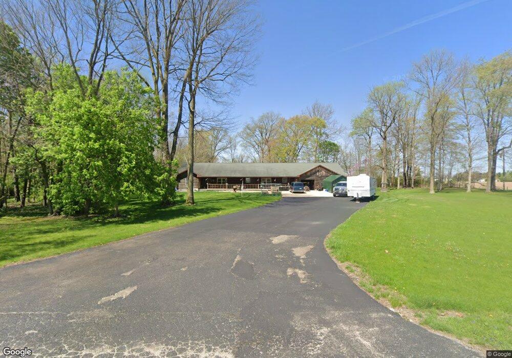
3465 N 300 W Marion, IN 46952
Estimated Value: $295,000 - $390,881
4
Beds
3
Baths
2,553
Sq Ft
$134/Sq Ft
Est. Value
About This Home
This home is located at 3465 N 300 W, Marion, IN 46952 and is currently estimated at $342,941, approximately $134 per square foot. 3465 N 300 W is a home located in Grant County with nearby schools including Converse Elementary School, Sweetser Elementary School, and Oak Hill Junior High School.
Ownership History
Date
Name
Owned For
Owner Type
Purchase Details
Closed on
Sep 12, 2000
Sold by
Not Provided
Bought by
Not Provided
Current Estimated Value
Create a Home Valuation Report for This Property
The Home Valuation Report is an in-depth analysis detailing your home's value as well as a comparison with similar homes in the area
Home Values in the Area
Average Home Value in this Area
Purchase History
| Date | Buyer | Sale Price | Title Company |
|---|---|---|---|
| Not Provided | $25,000 | -- |
Source: Public Records
Tax History Compared to Growth
Tax History
| Year | Tax Paid | Tax Assessment Tax Assessment Total Assessment is a certain percentage of the fair market value that is determined by local assessors to be the total taxable value of land and additions on the property. | Land | Improvement |
|---|---|---|---|---|
| 2024 | $2,289 | $302,700 | $35,600 | $267,100 |
| 2023 | $1,888 | $251,900 | $35,600 | $216,300 |
| 2022 | $2,191 | $238,900 | $34,900 | $204,000 |
| 2021 | $1,873 | $213,500 | $34,900 | $178,600 |
| 2020 | $1,673 | $203,900 | $32,400 | $171,500 |
| 2019 | $1,520 | $195,400 | $32,400 | $163,000 |
| 2018 | $1,320 | $180,900 | $32,400 | $148,500 |
| 2017 | $1,200 | $183,400 | $32,400 | $151,000 |
| 2016 | $1,251 | $192,100 | $34,400 | $157,700 |
| 2014 | $1,200 | $195,400 | $34,400 | $161,000 |
| 2013 | $1,200 | $193,000 | $34,400 | $158,600 |
Source: Public Records
Map
Nearby Homes
- 5066 Sunset Ct
- 3576 W 505 N
- 5085 County Road 525 W
- 3930 N Avalon Dr
- 3920 N Avalon Dr
- 4493 N Wabash Rd
- 5055 N Wabash Rd
- 4616 W 505 N
- 516 Nancy Dr
- 3598 W Delphi Pike
- 1920 W Westholme Dr
- 2376 W Kem Rd
- 2214 N Wabash Rd
- 2010 W Wilno Dr
- 4141 N River Rd
- 105 Peterson Dr
- 1406 N Marlin Dr
- 5292 W Delphi Pike
- 1431 Fox Trail Unit 49
- 1032 W Brandon Ave
- 3397 N 300 W
- 3111 W 350 N
- 3372 N 300 W
- 3644 N 325 W
- 3595 N 325 W
- 3826 N 325 W
- 3070 N 300 W
- 3332 W 325 N
- 3075 W 400 N
- 2512 W 350 N
- 3995 Frances Slocum Trail
- 2397 W 350 N
- 4009 Frances Slocum Trail
- 2341 W 350 N
- 3953 Frances Slocum Trail
- 4197 Frances Slocum Trail
- 3959 Frances Slocum Trail
- 4225 Frances Slocum Trail
- 4241 Frances Slocum Trail
- 4292 N 325 W