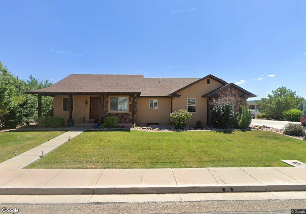
3467 W 1375 N Unit 9 Cedar City, UT 84721
Estimated Value: $197,000 - $706,000
--
Bed
--
Bath
--
Sq Ft
0.53
Acres
About This Home
This home is located at 3467 W 1375 N Unit 9, Cedar City, UT 84721 and is currently estimated at $524,122. 3467 W 1375 N Unit 9 is a home located in Iron County with nearby schools including Iron Springs School, Cedar Middle School, and Cedar City High School.
Ownership History
Date
Name
Owned For
Owner Type
Purchase Details
Closed on
Feb 18, 2022
Sold by
Reid Christopher M
Bought by
Christopher And Karen Reid Family Trust and Fam Karen
Current Estimated Value
Purchase Details
Closed on
Mar 9, 2012
Sold by
Judd Mark Alan and Judd Deborah K
Bought by
Reid Christopher M
Purchase Details
Closed on
Jan 31, 2011
Sold by
2020 Properties Llc
Bought by
Judd Mark Alan and Judd Deborah K
Purchase Details
Closed on
Sep 14, 2010
Sold by
Federal Deposit Insurance Corporation
Bought by
2020 Properties Llc
Purchase Details
Closed on
Jun 8, 2010
Sold by
Equestrian Pointe Land Co Llc
Bought by
Centennial Bank Inc
Purchase Details
Closed on
Jan 13, 2009
Sold by
Title West Title Company
Bought by
Centennial Bank Inc
Purchase Details
Closed on
Oct 21, 2005
Sold by
Equestrian Pointe Llc
Bought by
Wimber Byran L and Wimber Stephanie
Home Financials for this Owner
Home Financials are based on the most recent Mortgage that was taken out on this home.
Original Mortgage
$67,600
Interest Rate
5.68%
Mortgage Type
Purchase Money Mortgage
Create a Home Valuation Report for This Property
The Home Valuation Report is an in-depth analysis detailing your home's value as well as a comparison with similar homes in the area
Home Values in the Area
Average Home Value in this Area
Purchase History
| Date | Buyer | Sale Price | Title Company |
|---|---|---|---|
| Christopher And Karen Reid Family Trust | -- | Westwood Law Pc | |
| Reid Christopher M | -- | Security Escrow & Title Insu | |
| Judd Mark Alan | -- | Southern Utah Title | |
| 2020 Properties Llc | -- | None Available | |
| Centennial Bank Inc | -- | Cedar Land Title Inc | |
| Centennial Bank Inc | -- | -- | |
| Wimber Byran L | -- | -- |
Source: Public Records
Mortgage History
| Date | Status | Borrower | Loan Amount |
|---|---|---|---|
| Previous Owner | Wimber Byran L | $67,600 |
Source: Public Records
Tax History Compared to Growth
Tax History
| Year | Tax Paid | Tax Assessment Tax Assessment Total Assessment is a certain percentage of the fair market value that is determined by local assessors to be the total taxable value of land and additions on the property. | Land | Improvement |
|---|---|---|---|---|
| 2025 | $2,689 | $345,770 | $54,049 | $291,721 |
| 2023 | $2,691 | $354,360 | $83,980 | $270,380 |
| 2022 | $3,251 | $353,610 | $69,985 | $283,625 |
| 2021 | $2,537 | $275,950 | $39,595 | $236,355 |
| 2020 | $2,532 | $244,245 | $39,595 | $204,650 |
| 2019 | $2,358 | $217,550 | $39,595 | $177,955 |
| 2018 | $2,202 | $196,475 | $34,690 | $161,785 |
| 2017 | $1,936 | $170,095 | $34,690 | $135,405 |
| 2016 | $1,949 | $159,475 | $29,200 | $130,275 |
| 2015 | $1,970 | $152,825 | $0 | $0 |
| 2014 | $1,822 | $132,185 | $0 | $0 |
Source: Public Records
Map
Nearby Homes
- 5695 N 3525 Cir W
- 5513 N 3575 W
- 5513 N 3575 W Unit Lot. 3 Block CF, Ced
- 1148 Yucca St
- 1 ac ft 73-4733 Unit 6.33 ac ft avaliable
- 1170 N Yucca St
- 7374 N 3625 West Cir
- 6903 N 3625 Cir W Unit 3
- 6903 N 3625 Cir W
- 1148 N Yucca St
- 3437 W 1600 N
- 3336 Pointe Way W
- Bella Plan at Pointe West
- 3293 W Indigo St
- 3263 W Indigo St Unit 1089
- 3257 W Indigo St Unit 1190
- 3257 W Indigo St Unit 1090
- 6800 N 3700 W
- 1130 Indigo St Unit 1093
- 3253 W Indigo St Unit 1091
- 3467 W 1375 N
- 3489 W 1375 N
- 1326 N 3525 West Cir
- 3446 W 1375 N
- 3509 W 1375 N
- 3468 W 1375 N
- 3421 W 1375 N Unit 9
- 3492 W 1375 N Unit 9
- 3492 W 1375 N
- 1308 N 3525 West Cir Unit 11
- 1308 N 3525 West Cir
- 1308 N 3525 West Cir Unit 14
- 1308 N 3525 Cir W
- 1307 N 3525 Cir W
- 6704 N 3525 Cir W
- 1307 N 3525 Cir W Unit Phase 11
- 1327 N 3525 Cir W Unit 11
- 1327 N 3525 Cir W
- 6834 N 3525 Cir W
- 3516 W 1375 N