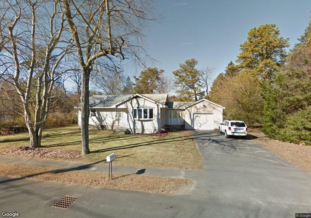
347 Apremont Hwy Holyoke, MA 01040
Estimated Value: $299,513 - $338,000
3
Beds
1
Bath
1,293
Sq Ft
$244/Sq Ft
Est. Value
About This Home
This home is located at 347 Apremont Hwy, Holyoke, MA 01040 and is currently estimated at $315,878, approximately $244 per square foot. 347 Apremont Hwy is a home located in Hampden County with nearby schools including Lt. Elmer J. McMahon Elementary School, Holyoke High School, and Blessed Sacrament School.
Ownership History
Date
Name
Owned For
Owner Type
Purchase Details
Closed on
Nov 10, 2015
Sold by
Levitre Virginia
Bought by
Rivers Roy D
Current Estimated Value
Create a Home Valuation Report for This Property
The Home Valuation Report is an in-depth analysis detailing your home's value as well as a comparison with similar homes in the area
Home Values in the Area
Average Home Value in this Area
Purchase History
| Date | Buyer | Sale Price | Title Company |
|---|---|---|---|
| Rivers Roy D | $62,500 | -- |
Source: Public Records
Tax History Compared to Growth
Tax History
| Year | Tax Paid | Tax Assessment Tax Assessment Total Assessment is a certain percentage of the fair market value that is determined by local assessors to be the total taxable value of land and additions on the property. | Land | Improvement |
|---|---|---|---|---|
| 2025 | $4,075 | $233,400 | $66,500 | $166,900 |
| 2024 | $3,934 | $207,600 | $63,400 | $144,200 |
| 2023 | $3,778 | $201,400 | $63,400 | $138,000 |
| 2022 | $3,654 | $189,700 | $63,400 | $126,300 |
| 2021 | $3,523 | $182,800 | $60,600 | $122,200 |
| 2020 | $3,356 | $175,900 | $60,600 | $115,300 |
| 2019 | $3,314 | $171,800 | $60,600 | $111,200 |
| 2018 | $3,176 | $166,000 | $60,600 | $105,400 |
| 2017 | $3,182 | $166,000 | $60,600 | $105,400 |
| 2016 | $3,185 | $166,600 | $62,600 | $104,000 |
| 2015 | $3,172 | $166,600 | $62,600 | $104,000 |
Source: Public Records
Map
Nearby Homes
- 351 Apremont Hsy
- 397 Apremont Hwy
- 16 Davis St
- 94 Pequot Rd (Rear)
- 150 Middle Rd
- 64 Old Stage Rd
- 21 Old County Rd
- 128 Middle Rd
- 0 Char Dr
- Lot 57 White Loaf Rd
- 178 County Rd
- 695 Homestead Ave
- Lot A Homestead Ave
- 794 Homestead Ave
- lot b Homestead Ave
- 36 County Rd
- 36 Susan Dr
- 7 Vermont St
- 86 Lynch Dr
- 286 Westfield Rd
- 351 Apremont Hwy
- 341 Apremont Hwy
- 38 Coronet Rd
- 346 Apremont Hwy
- 11 Maginnis Ave
- 352 Apremont Hwy
- 32 Coronet Rd
- 360 Apremont Hwy
- 357 Apremont Hwy
- 335 Apremont Hwy
- 10 Maginnis Ave
- 362 Apremont Hwy
- 26 Coronet Rd
- 336 Apremont Hwy
- 711 Westfield Rd
- 37 Coronet Rd
- 715 Westfield Rd
- 43 Coronet Rd
- 22 Maginnis Ave
- 717 Westfield Rd