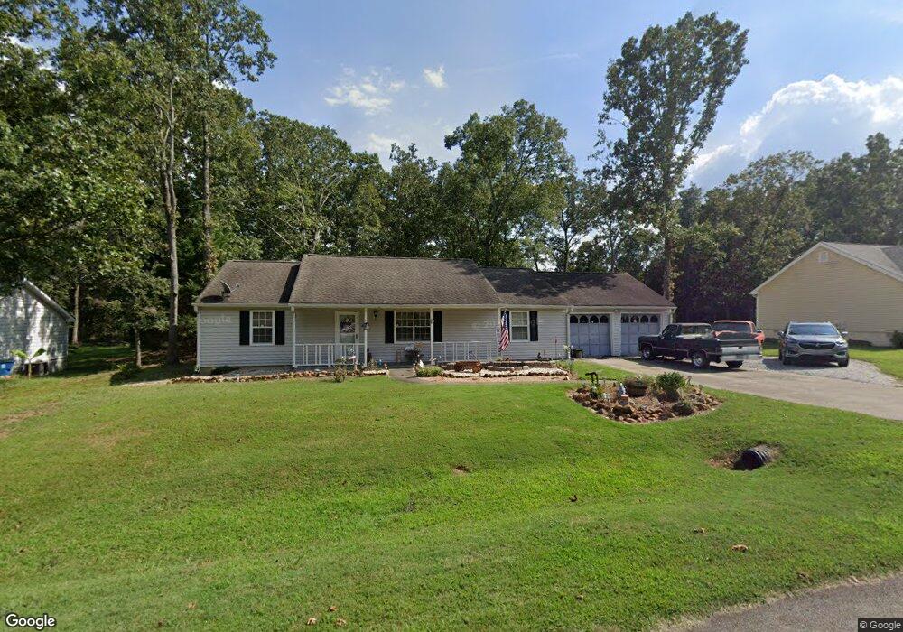
347 Austin Way Unit 2 Auburn, GA 30011
Estimated Value: $314,000 - $329,882
3
Beds
2
Baths
1,479
Sq Ft
$219/Sq Ft
Est. Value
About This Home
This home is located at 347 Austin Way Unit 2, Auburn, GA 30011 and is currently estimated at $324,221, approximately $219 per square foot. 347 Austin Way Unit 2 is a home located in Barrow County with nearby schools including Auburn Elementary School, Westside Middle School, and Apalachee High School.
Ownership History
Date
Name
Owned For
Owner Type
Purchase Details
Closed on
Jul 30, 1999
Sold by
Brown Robby J and Brown Judith A
Bought by
Squires Rodney P and Squires Charlotte A
Current Estimated Value
Home Financials for this Owner
Home Financials are based on the most recent Mortgage that was taken out on this home.
Original Mortgage
$99,050
Outstanding Balance
$28,486
Interest Rate
7.66%
Mortgage Type
FHA
Estimated Equity
$295,735
Purchase Details
Closed on
Oct 9, 1992
Bought by
Brown Robby Jay & Ju
Create a Home Valuation Report for This Property
The Home Valuation Report is an in-depth analysis detailing your home's value as well as a comparison with similar homes in the area
Home Values in the Area
Average Home Value in this Area
Purchase History
| Date | Buyer | Sale Price | Title Company |
|---|---|---|---|
| Squires Rodney P | $99,900 | -- | |
| Brown Robby Jay & Ju | $11,500 | -- |
Source: Public Records
Mortgage History
| Date | Status | Borrower | Loan Amount |
|---|---|---|---|
| Open | Squires Rodney P | $99,050 |
Source: Public Records
Tax History Compared to Growth
Tax History
| Year | Tax Paid | Tax Assessment Tax Assessment Total Assessment is a certain percentage of the fair market value that is determined by local assessors to be the total taxable value of land and additions on the property. | Land | Improvement |
|---|---|---|---|---|
| 2024 | $2,698 | $101,758 | $24,000 | $77,758 |
| 2023 | $1,752 | $101,758 | $24,000 | $77,758 |
| 2022 | $1,557 | $59,003 | $12,000 | $47,003 |
| 2021 | $1,653 | $59,003 | $12,000 | $47,003 |
| 2020 | $1,655 | $59,003 | $12,000 | $47,003 |
| 2019 | $1,591 | $55,280 | $10,000 | $45,280 |
| 2018 | $1,427 | $48,558 | $8,800 | $39,758 |
| 2017 | $223 | $41,138 | $8,800 | $32,338 |
| 2016 | $1,072 | $37,880 | $12,800 | $25,080 |
| 2015 | $1,084 | $38,208 | $12,800 | $25,408 |
| 2014 | $849 | $32,336 | $6,272 | $26,064 |
| 2013 | -- | $31,155 | $6,272 | $24,883 |
Source: Public Records
Map
Nearby Homes
- 335 Wages Rd
- 2063 Blackberry Ln
- 331 Wages Rd
- 2057 Blackberry Ln
- 270 E Union Grove Cir
- 1466 Maston Rd
- 491 Glen Terrace Rd
- 1778 Wynfield Ln
- 60 Wood Chuck Ct
- 70 Wood Chuck Ct
- 1923 Westfall Landing
- 280 Etheridge Rd
- 1587 Cronic Town Rd Unit 1
- 81 Hills Shop Rd
- 315 Rodeo Dr
- 345 Etheridge Rd
- 370 Ridgeview Dr
- 395 Rodeo Dr
- 433 Mount Moriah Rd
- 405 Rodeo Dr
- 345 Austin Way
- 349 Austin Way Unit 2
- 351 Austin Way
- 343 Austin Way
- 350 Austin Way
- 348 Austin Way
- 345 Rowan Ct
- 341 Austin Way Unit 2
- 338 Wages Rd
- 353 Austin Way
- 344 Austin Way
- 339 Austin Way Unit 1
- 355 Austin Way Unit 2
- 346 Rowan Ct
- 354 Austin Way
- 330 Wages Rd
- 338 Austin Way
- 347 Rowan Ct
- 348 Rowan Ct
- 355 Ardell Ct