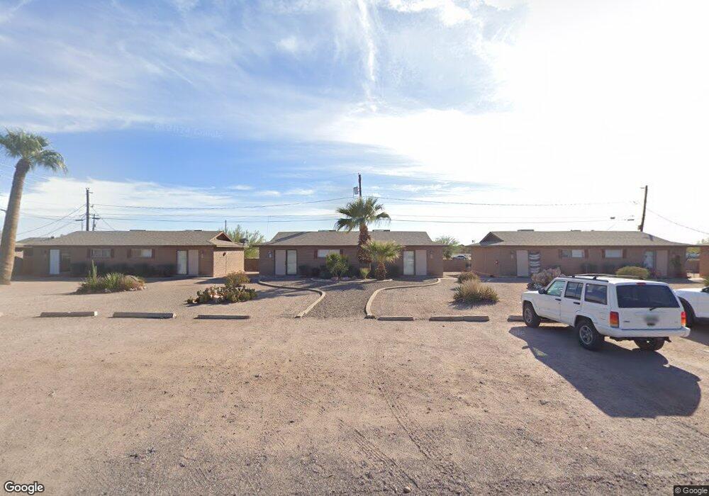
347 E 2nd Ave Apache Junction, AZ 85119
Estimated Value: $239,000 - $839,000
Studio
--
Bath
5,760
Sq Ft
$111/Sq Ft
Est. Value
About This Home
This home is located at 347 E 2nd Ave, Apache Junction, AZ 85119 and is currently estimated at $638,948, approximately $110 per square foot. 347 E 2nd Ave is a home located in Pinal County with nearby schools including Desert Vista Elementary School, Cactus Canyon Junior High School, and Apache Junction High School.
Ownership History
Date
Name
Owned For
Owner Type
Purchase Details
Closed on
Apr 28, 2014
Sold by
Hauser Mary C
Bought by
Arnett Robert and Arnett Lanie D
Current Estimated Value
Home Financials for this Owner
Home Financials are based on the most recent Mortgage that was taken out on this home.
Original Mortgage
$204,500
Interest Rate
4.32%
Mortgage Type
Seller Take Back
Purchase Details
Closed on
Jun 21, 2007
Sold by
Hauser Mary C
Bought by
Hauser Mary C
Purchase Details
Closed on
May 14, 2007
Sold by
Hauser Mary
Bought by
Hauser Mary C
Purchase Details
Closed on
Jan 12, 1999
Sold by
Reber Daniel P
Bought by
Hauser Mary
Home Financials for this Owner
Home Financials are based on the most recent Mortgage that was taken out on this home.
Original Mortgage
$162,000
Interest Rate
6.73%
Mortgage Type
New Conventional
Create a Home Valuation Report for This Property
The Home Valuation Report is an in-depth analysis detailing your home's value as well as a comparison with similar homes in the area
Home Values in the Area
Average Home Value in this Area
Purchase History
| Date | Buyer | Sale Price | Title Company |
|---|---|---|---|
| Arnett Robert | $404,500 | Stewart Title & Trust Of Pho | |
| Hauser Mary C | -- | Stewart Title & Trust Of Pho | |
| Hauser Mary C | -- | None Available | |
| Hauser Mary | $202,500 | Ati Title Agency |
Source: Public Records
Mortgage History
| Date | Status | Borrower | Loan Amount |
|---|---|---|---|
| Previous Owner | Arnett Robert | $204,500 | |
| Previous Owner | Hauser Mary | $162,000 |
Source: Public Records
Tax History
| Year | Tax Paid | Tax Assessment Tax Assessment Total Assessment is a certain percentage of the fair market value that is determined by local assessors to be the total taxable value of land and additions on the property. | Land | Improvement |
|---|---|---|---|---|
| 2025 | $3,195 | $59,660 | -- | -- |
| 2024 | $3,016 | $54,920 | -- | -- |
| 2023 | $3,145 | $38,681 | $11,980 | $26,701 |
| 2022 | $3,016 | $25,792 | $4,156 | $21,636 |
| 2021 | $3,072 | $24,706 | $0 | $0 |
| 2020 | $2,993 | $24,669 | $0 | $0 |
| 2019 | $2,871 | $22,383 | $0 | $0 |
| 2018 | $2,813 | $19,911 | $0 | $0 |
| 2017 | $2,738 | $19,563 | $0 | $0 |
| 2016 | $2,671 | $18,930 | $2,656 | $16,274 |
| 2014 | $2,529 | $14,793 | $2,657 | $12,137 |
Source: Public Records
Map
Nearby Homes
- 111 S Outpost Rd
- 269 N Winchester Rd Unit 2
- 269 N Winchester Rd Unit 7
- 269 N Winchester Rd Unit 66
- 851 E Junction St
- 600 S Idaho Rd Unit 946
- 600 S Idaho Rd Unit 325
- 600 S Idaho Rd Unit 439
- 600 S Idaho Rd Unit 317
- 600 S Idaho Rd Unit 252
- 600 S Idaho Rd Unit 1063
- 600 S Idaho Rd Unit 413
- 600 S Idaho Rd Unit 920
- 600 S Idaho Rd Unit 505
- 600 S Idaho Rd Unit 341
- 600 S Idaho Rd Unit 847
- 600 S Idaho Rd Unit 1047
- 600 S Idaho Rd Unit 411
- 600 S Idaho Rd Unit 713
- 600 S Idaho Rd Unit 957
- 143 S Outpost Rd Unit 2
- 143 S Outpost Rd
- 348 E 2nd Ave
- 348 E 2nd Ave
- 127 S Outpost Rd Unit Outpost
- 127 S Outpost Rd Unit 2
- 127 S Outpost Rd Unit 4
- 127 S Outpost Rd
- 127 S Outpost Rd Unit 3
- 127 S Outpost Rd Unit 1
- 343 S Outpost Rd
- 420 E 2nd Ave
- 111 S Outpost Rd
- 111 S Outpost Rd Unit 3
- 111 S Outpost Rd Unit 4
- 111 S Outpost Rd Unit 1
- 110 S Winchester Rd Unit A & B
- 110 S Winchester Rd Unit B
- 110 S Winchester Rd
- 325 S Winchester Rd
Your Personal Tour Guide
Ask me questions while you tour the home.